

FJORDSTROEM
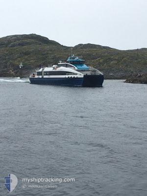
High speed craft

Current Trip
NO SOR>
| Time Travelled | 11 days |
|---|---|
| Remaining Time | --- |
| Distance Travelled | 188.15 nm |
| Remaining Distance | --- |
| AVG Speed | 16 Knots |
| MAX Speed | 16 Knots |
| AVG Wind | 8.9 knots |
| MAX Wind | 27 knots |
| MIN Temp | -12°C / 10.4°F |
| MAX Temp | 6.4°C / 43.52°F |
| Draught | 0 m |
| Position Received | 1 h, 4 m ago |
Current Position
| Longitude | --- |
|---|---|
| Latitude | --- |
| Status | Under way using engine |
| Speed | |
| Course | 359° |
| Area | Norwegian Sea |
| Station | T-AIS |
| Position Received | 1 h, 4 m ago |
Information
The current position of FJORDSTROEM is in Norwegian Sea with coordinates 61.73517° / 5.92243° as reported on 2025-03-27 18:48 by AIS to our vessel tracker app. The vessel's current speed is 0 Knots
The vessel FJORDSTROEM (IMO: 9982328, MMSI: 259026700) is a High speed craft It's sailing under the flag of [NO] Norway.
In this page you can find informations about the vessels current position, last detected port calls, and current voyage information. If the vessels is not in coverage by AIS you will find the latest position.
The current position of FJORDSTROEM is detected by our AIS receivers and we are not responsible for the reliability of the data. The last position was recorded while the vessel was in Coverage by the Ais receivers of our vessel tracking app.
Weather
| Temperature | --- |
|---|---|
| Wind Speed | 8 knots |
| Direction | 171° S |
| Pressure | 1003.8 hPa |
| Humidity | 99 % |
| Cloud Coverage | 100 % |


Featured Company
Last Port Calls
| Port | Arrival | Departure | Time In Port |
|---|---|---|---|
| 2025-03-16 17:34 | 2025-03-16 18:23 | 48 m | |
| 2025-03-15 22:23 | 2025-03-16 10:26 | 12 h | |
| 2025-03-14 22:42 | 2025-03-15 15:46 | 17 h | |
| 2025-03-14 19:22 | 2025-03-14 20:00 | 37 m | |
| 2025-03-14 07:36 | 2025-03-14 09:40 | 2 h | |
| 2025-03-14 07:01 | 2025-03-14 07:07 | 6 m | |
| 2025-03-14 06:49 | 2025-03-14 06:57 | 8 m | |
| 2025-03-13 21:22 | 2025-03-14 06:18 | 8 h | |
| 2025-03-13 20:47 | 2025-03-13 20:49 | 2 m | |
| 2025-03-13 20:35 | 2025-03-13 20:41 | 6 m |
Last Trips
| Origin | Departure | Destination | Arrival | Distance | |
|---|---|---|---|---|---|
| 2025-03-16 10:26 | 2025-03-16 17:34 | 115.23 nm | |||
| 2025-03-15 15:46 | 2025-03-15 22:23 | 110.53 nm | |||
| 2025-03-14 20:00 | 2025-03-14 22:42 | 41.42 nm | |||
| 2025-03-14 09:40 | 2025-03-14 19:22 | 173.67 nm | |||
| 2025-03-14 07:07 | 2025-03-14 07:36 | 13.23 nm | |||
| 2025-03-14 06:57 | 2025-03-14 07:01 | 1.27 nm | |||
| 2025-03-14 06:18 | 2025-03-14 06:49 | 12.99 nm | |||
| 2025-03-13 20:49 | 2025-03-13 21:22 | 13.23 nm | |||
| 2025-03-13 20:41 | 2025-03-13 20:47 | 1.66 nm | |||
| 2025-03-13 19:34 | 2025-03-13 20:35 | 23.02 nm |
Events
| Time | Event | Details | Position / Dest | Info |
|---|---|---|---|---|
| 2025-03-27 18:48 | OUT of Coverage |
61.73517 / 5.92243
Norwegian Sea
|
Speed: Course: 271.2° |
|
| 2025-03-27 18:13 | STOP Moving | 8.35 nm, West of SANDANE |
61.73521 / 5.92245
NO SOR> |
Speed: 0.1 kn Course: 359° |
| 2025-03-27 14:44 | START Moving | 0.4 nm, West of DEKNEPOLLEN |
61.92778 / 5.12318
NO SOR> |
Speed: 12.5 kn Course: 202° |
| 2025-03-27 13:38 | STOP Moving | 0.28 nm, South East of MALOY |
61.93106 / 5.12648
NO SOR> |
Speed: Course: 180° |
| 2025-03-27 09:52 | Status Changed | Under way using engine Moored |
61.74118 / 5.92138
NO SOR> |
Speed: 4.8 kn Course: 336° |
| 2025-03-27 09:52 | START Moving | 8.28 nm, West of SANDANE |
61.74118 / 5.92138
NO SOR> |
Speed: 15.2 kn Course: 4° |
| 2025-03-27 09:17 | IN Coverage |
61.73518 / 5.92243
Norwegian Sea
|
Speed: Course: 328.2° |
|
| 2025-03-27 02:26 | OUT of Coverage |
61.73516 / 5.92237
Norwegian Sea
|
Speed: Course: 256.5° |
|
| 2025-03-27 02:26 | IN Coverage |
61.73516 / 5.92237
Norwegian Sea
|
Speed: Course: 256.5° |
|
| 2025-03-26 20:11 | OUT of Coverage |
61.73516 / 5.92246
Norwegian Sea
|
Speed: Course: 36.7° |