

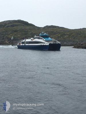
FJORDSTROEM
High speed craft

Current Trip
CH.16 SEA TRAILS
| Time Travelled | 13 days |
|---|---|
| Remaining Time | --- |
| Distance Travelled | 267.15 nm |
| Remaining Distance | --- |
| AVG Speed | 16.8 Knots |
| MAX Speed | 16.8 Knots |
| AVG Wind | 8.5 knots |
| MAX Wind | 27 knots |
| MIN Temp | -12°C / 10.4°F |
| MAX Temp | 6.4°C / 43.52°F |
| Dybgang | 0 m |
| Position Modtaget | 3 m siden |
Current Position
| Longitude | --- |
|---|---|
| Latitude | --- |
| Status | Moored |
| Fart | |
| Kurs | 357° |
| Område | Norwegian Sea |
| Station | T-AIS |
| Position Modtaget | 3 m siden |
Information
The current position of FJORDSTROEM is in Norwegian Sea with coordinates 61.73516° / 5.92249° as reported on 2025-03-29 20:21 by AIS to our vessel tracker app. The vessel's current speed is 0 Knots
The vessel FJORDSTROEM (IMO: 9982328, MMSI: 259026700) is a High speed craft It's sailing under the flag of [NO] Norway.
In this page you can find informations about the vessels current position, last detected port calls, and current voyage information. If the vessels is not in coverage by AIS you will find the latest position.
The current position of FJORDSTROEM is detected by our AIS receivers and we are not responsible for the reliability of the data. The last position was recorded while the vessel was in Coverage by the Ais receivers of our vessel tracking app.
Weather
| Temperature | -1.6°C / 29.12°F |
|---|---|
| Wind Speed | 5 knots |
| Direction | 172° S |
| Pressure | 1004.1 hPa |
| Humidity | 97.5 % |
| Cloud Coverage | 100 % |


Featured Company
Last Port Calls
| Port | Arrival | Departure | Time In Port |
|---|---|---|---|
| 2025-03-16 17:34 | 2025-03-16 18:23 | 48 m | |
| 2025-03-15 22:23 | 2025-03-16 10:26 | 12 h | |
| 2025-03-14 22:42 | 2025-03-15 15:46 | 17 h | |
| 2025-03-14 19:22 | 2025-03-14 20:00 | 37 m | |
| 2025-03-14 07:36 | 2025-03-14 09:40 | 2 h | |
| 2025-03-14 07:01 | 2025-03-14 07:07 | 6 m | |
| 2025-03-14 06:49 | 2025-03-14 06:57 | 8 m | |
| 2025-03-13 21:22 | 2025-03-14 06:18 | 8 h | |
| 2025-03-13 20:47 | 2025-03-13 20:49 | 2 m | |
| 2025-03-13 20:35 | 2025-03-13 20:41 | 6 m |
Last Trips
| Origin | Departure | Destination | Arrival | Distance | |
|---|---|---|---|---|---|
| 2025-03-16 10:26 | 2025-03-16 17:34 | 115.23 nm | |||
| 2025-03-15 15:46 | 2025-03-15 22:23 | 110.53 nm | |||
| 2025-03-14 20:00 | 2025-03-14 22:42 | 41.42 nm | |||
| 2025-03-14 09:40 | 2025-03-14 19:22 | 173.67 nm | |||
| 2025-03-14 07:07 | 2025-03-14 07:36 | 13.23 nm | |||
| 2025-03-14 06:57 | 2025-03-14 07:01 | 1.27 nm | |||
| 2025-03-14 06:18 | 2025-03-14 06:49 | 12.99 nm | |||
| 2025-03-13 20:49 | 2025-03-13 21:22 | 13.23 nm | |||
| 2025-03-13 20:41 | 2025-03-13 20:47 | 1.66 nm | |||
| 2025-03-13 19:34 | 2025-03-13 20:35 | 23.02 nm |
Events
| Tid | Hændelsen | Detaljer | Position / Dest | Info |
|---|---|---|---|---|
| 2025-03-29 20:21 | Status er ændret | Moored Default |
61.73516 / 5.92249
CH.16 SEA TRAILS
|
Fart: 0.1 kn Kurs: 359° |
| 2025-03-29 20:00 | Status er ændret | Default Moored |
61.73517 / 5.92249
CH.16 SEA TRAILS
|
Fart: Kurs: 358° |
| 2025-03-29 17:57 | Status er ændret | Moored Default |
61.73516 / 5.92244
CH.16 SEA TRAILS
|
Fart: Kurs: 358° |
| 2025-03-29 17:45 | Status er ændret | Default Moored |
61.73517 / 5.92243
CH.16 SEA TRAILS
|
Fart: Kurs: 358° |
| 2025-03-29 17:21 | Status er ændret | Moored Default |
61.73518 / 5.92244
CH.16 SEA TRAILS
|
Fart: Kurs: 358° |
| 2025-03-29 17:00 | Status er ændret | Default Moored |
61.73517 / 5.92243
CH.16 SEA TRAILS
|
Fart: Kurs: 358° |
| 2025-03-29 16:45 | Status er ændret | Moored Default |
61.73517 / 5.92246
CH.16 SEA TRAILS
|
Fart: Kurs: 358° |
| 2025-03-29 16:15 | Status er ændret | Default Moored |
61.73518 / 5.92244
CH.16 SEA TRAILS
|
Fart: Kurs: 359° |
| 2025-03-29 15:57 | Status er ændret | Moored Default |
61.73518 / 5.92245
CH.16 SEA TRAILS
|
Fart: Kurs: 358° |
| 2025-03-29 15:30 | Status er ændret | Default Moored |
61.73517 / 5.92248
CH.16 SEA TRAILS
|
Fart: Kurs: 359° |