
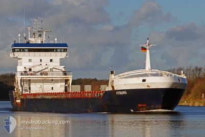
FITBURG
General Cargo
Current Trip
| Time Travelled | 18 days |
|---|---|
| Remaining Time | --- |
| Distance Travelled | 2863.42 nm |
| Remaining Distance | --- |
| AVG Speed | 10.2 Knots |
| MAX Speed | 14.1 Knots |
| AVG Wind | 20.8 knots |
| MAX Wind | 40.5 knots |
| MIN Temp | -11.1°C / 12.02°F |
| MAX Temp | 8.5°C / 47.3°F |
| Draught | 7.8 m |
| Position Received | 2 m ago |
Current Position
| Longitude | --- |
|---|---|
| Latitude | --- |
| Status | Under way using engine |
| Speed | 11.1 Knots |
| Course | 254.3° |
| Area | Norwegian Sea |
| Station | T-AIS |
| Position Received | 2 m ago |
Info
Information
The current position of FITBURG is in Norwegian Sea with coordinates 71.53788° / 22.51818° as reported on 2025-02-16 23:39 by AIS to our vessel tracker app. The vessel's current speed is 11.1 Knots and is heading at the port of ASHDOD. The estimated time of arrival as calculated by MyShipTracking vessel tracking app is 2025-03-09 08:00 LT
The vessel FITBURG (IMO: 9250397, MMSI: 341438000) is a General Cargo that was built in 2001 ( 24 years old ). It's sailing under the flag of [KN] St Kitts Nevis.
In this page you can find informations about the vessels current position, last detected port calls, and current voyage information. If the vessels is not in coverage by AIS you will find the latest position.
The current position of FITBURG is detected by our AIS receivers and we are not responsible for the reliability of the data. The last position was recorded while the vessel was in Coverage by the Ais receivers of our vessel tracking app.
The current draught of FITBURG as reported by AIS is 7.8 meters
Weather
| Temperature | 1.1°C / 33.98°F |
|---|---|
| Wind Speed | 13 knots |
| Direction | 33° NNE |
| Pressure | 1016.1 hPa |
| Humidity | 67.2 % |
| Cloud Coverage | 100 % |
Featured Company
Events
| Time | Event | Details | Position / Dest | Info |
|---|---|---|---|---|
| 2025-02-16 20:00 | Change Sea Area | Norwegian part of the Norwegian Sea Norwegian part of the Barentsz Sea |
71.67705 / 24.66465
Norwegian Sea
IL ASH
|
Speed: 11.5 kn Course: 267.6° |
| 2025-02-16 06:11 | Draught Changed | 7.8 7.7 |
70.90009 / 31.44628
IL ASH
|
Speed: 8.9 kn Course: 313.3° |
| 2025-02-16 03:07 | Detected in Sea | Norwegian part of the Barentsz Sea |
70.61120 / 32.55138
Barentsz Sea
IL ASH
|
Speed: 10.2 kn Course: 303.4° |
| 2025-02-16 00:11 | Draught Changed | 7.7 5.5 |
70.28624 / 33.70218
IL ASH
|
Speed: 10.8 kn Course: 308.7° |
| 2025-02-16 00:11 | Destination Changed | IL ASH TO ORDER |
70.28624 / 33.70218
IL ASH
|
Speed: 10.8 kn Course: 308.7° |
| 2025-02-16 00:11 | ETA Changed | 2025/03/09 08:00 2025/02/08 01:00 |
70.28624 / 33.70218
IL ASH
|
Speed: 10.8 kn Course: 308.7° |
| 2025-02-16 00:04 | Status Changed | Under way using engine Default |
70.27441 / 33.74392
TO ORDER
|
Speed: 10.7 kn Course: 311° |
| 2025-02-16 00:04 | IN Coverage |
70.27441 / 33.74392
Barentsz Sea
|
Speed: 10.8 kn Course: 313° |