

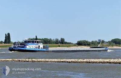
FINN-LUCAS DEYMANN
Cargo

Current Trip
| Time Travelled | 7 h, 43 mins |
|---|---|
| Remaining Time | 2 h, 9 mins |
| Distance Travelled | 35.03 nm |
| Remaining Distance | 12.13 nm |
| AVG Speed | 5.4 Knots |
| MAX Speed | 6.6 Knots |
| AVG Wind | 5.5 knots |
| MAX Wind | 7 knots |
| MIN Temp | 4.1°C / 39.38°F |
| MAX Temp | 5.5°C / 41.9°F |
| Draught | 0.3 m |
| Position Received | Now |
Current Position
| Longitude | --- |
|---|---|
| Latitude | --- |
| Status | Under way using engine |
| Speed | 4.6 Knots |
| Course | 240° |
| Area | North Sea |
| Station | T-AIS |
| Position Received | Now |
Information
The current position of FINN-LUCAS DEYMANN is in North Sea with coordinates 51.49124° / 6.69053° as reported on 2025-02-28 02:23 by AIS to our vessel tracker app. The vessel's current speed is 4.6 Knots and is heading at the port of BOTTROP. The estimated time of arrival as calculated by MyShipTracking vessel tracking app is 2025-02-28 04:33 LT
The vessel FINN-LUCAS DEYMANN (MMSI: 211417530) is a Cargo It's sailing under the flag of [DE] Germany.
In this page you can find informations about the vessels current position, last detected port calls, and current voyage information. If the vessels is not in coverage by AIS you will find the latest position.
The current position of FINN-LUCAS DEYMANN is detected by our AIS receivers and we are not responsible for the reliability of the data. The last position was recorded while the vessel was in Coverage by the Ais receivers of our vessel tracking app.
The current draught of FINN-LUCAS DEYMANN as reported by AIS is 0.3 meters
Weather
| Temperature | 4.1°C / 39.38°F |
|---|---|
| Wind Speed | 4 knots |
| Direction | 9° N |
| Pressure | 1019.6 hPa |
| Humidity | 92 % |
| Cloud Coverage | 100 % |


Featured Company
Last Port Calls
| Port | Arrival | Departure | Time In Port |
|---|---|---|---|
| 2025-02-27 17:58 | 2025-02-27 18:41 | 43 m | |
| 2025-02-26 17:28 | 2025-02-27 05:11 | 11 h | |
| 2025-02-26 04:33 | 2025-02-26 16:51 | 12 h | |
| 2025-02-25 09:59 | 2025-02-26 04:18 | 18 h | |
| 2025-02-25 09:22 | 2025-02-25 09:35 | 12 m | |
| 2025-02-24 10:23 | 2025-02-24 11:56 | 1 h | |
| 2025-02-23 18:20 | 2025-02-24 06:05 | 11 h | |
| 2025-02-23 07:30 | 2025-02-23 07:56 | 25 m | |
| 2025-02-22 17:03 | 2025-02-23 05:04 | 12 h | |
| 2025-02-22 15:36 | 2025-02-22 16:01 | 24 m |
Last Trips
| Origin | Departure | Destination | Arrival | Distance | |
|---|---|---|---|---|---|
| 2025-02-27 06:11 | 2025-02-27 18:58 | 83.73 nm | |||
| 2025-02-26 17:51 | 2025-02-26 18:28 | 7.26 nm | |||
| 2025-02-26 05:18 | 2025-02-26 05:33 | 2.27 nm | |||
| 2025-02-25 10:35 | 2025-02-25 10:59 | 2.36 nm | |||
| 2025-02-24 12:56 | 2025-02-25 10:22 | 105.78 nm | |||
| 2025-02-24 07:05 | 2025-02-24 11:23 | 46.22 nm | |||
| 2025-02-23 08:56 | 2025-02-23 19:20 | 92.98 nm | |||
| 2025-02-23 06:04 | 2025-02-23 08:30 | 8.97 nm | |||
| 2025-02-22 17:01 | 2025-02-22 18:03 | 6.77 nm | |||
| 2025-02-17 12:05 | 2025-02-22 16:36 | 4.27 nm |
Events
| Time | Event | Details | Position / Dest | Info |
|---|---|---|---|---|
| 2025-02-28 01:13 | IN Coverage |
51.56322 / 6.68664
North Sea
|
Speed: 5.6 kn Course: 179° |
|
| 2025-02-28 00:08 | OUT of Coverage |
51.59605 / 6.59680
North Sea
|
Speed: 6 kn Course: 172° |
|
| 2025-02-28 00:07 | IN Coverage |
51.59875 / 6.59603
North Sea
|
Speed: 5.8 kn Course: 171° |
|
| 2025-02-27 19:07 | OUT of Coverage |
51.84734 / 6.12971
North Sea
|
Speed: 6.1 kn Course: 93° |
|
| 2025-02-27 18:41 | PORT DEPARTURE |
|
51.86412 / 6.06613
BOTTROP
|
Speed: 6.5 kn Course: 129° |
| 2025-02-27 18:33 | START Moving |
51.86985 / 6.04612
[NL] MILLINGEN AAN DE RIJN
|
Speed: 5 kn Course: 99° |
|
| 2025-02-27 17:58 | STOP Moving |
51.87032 / 6.04228
[NL] MILLINGEN AAN DE RIJN
|
Speed: Course: 511° |
|
| 2025-02-27 17:58 | PORT ARRIVAL |
|
51.87032 / 6.04228
[NL] MILLINGEN AAN DE RIJN
|
Speed: 0.7 kn Course: 511° |
| 2025-02-27 09:31 | Status Changed | Under way using engine Default |
51.81717 / 4.79884
BOTTROP
|
Speed: 7.2 kn Course: 89° |
| 2025-02-27 09:26 | Status Changed | Default Under way using engine |
51.81481 / 4.78333
BOTTROP
|
Speed: 7.3 kn Course: 118° |