
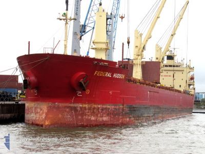
FEDERAL HUDSON
Bulk Carrier
Current Trip
VARNA
| Time Travelled | 5 h, 47 mins |
|---|---|
| Remaining Time | --- |
| Distance Travelled | 33.60 nm |
| Remaining Distance | --- |
| AVG Speed | 10.6 Knots |
| MAX Speed | 11 Knots |
| AVG Wind | 8.9 knots |
| MAX Wind | 13 knots |
| MIN Temp | 7.4°C / 45.32°F |
| MAX Temp | 10.9°C / 51.62°F |
| Draught | 5.8 m |
| Position Received | 28 d ago |
Current Position
| Longitude | --- |
|---|---|
| Latitude | --- |
| Status | Under way using engine |
| Speed | 12.2 Knots |
| Course | 354° |
| Area | Black Sea |
| Station | T-AIS |
| Position Received | 28 d ago |
Info
Information
The current position of FEDERAL HUDSON is in Black Sea with coordinates 41.49815° / 29.19837° as reported on 2024-10-30 16:48 by AIS to our vessel tracker app. The vessel's current speed is 12.2 Knots
The vessel FEDERAL HUDSON (IMO: 9205902, MMSI: 538006779) is a Bulk Carrier that was built in 2000 ( 24 years old ). It's sailing under the flag of [MH] Marshall Is.
In this page you can find informations about the vessels current position, last detected port calls, and current voyage information. If the vessels is not in coverage by AIS you will find the latest position.
The current position of FEDERAL HUDSON is detected by our AIS receivers and we are not responsible for the reliability of the data. The last position was recorded while the vessel was in Coverage by the Ais receivers of our vessel tracking app.
The current draught of FEDERAL HUDSON as reported by AIS is 5.8 meters
Weather
| Temperature | 10.9°C / 51.62°F |
|---|---|
| Wind Speed | 14 knots |
| Direction | 352° N |
| Pressure | 1027.4 hPa |
| Humidity | 77.4 % |
| Cloud Coverage | 100 % |
Featured Company
Last Port Calls
| Port | Arrival | Departure | Time In Port |
|---|---|---|---|
| 2024-11-25 07:12 | 2024-11-27 17:12 | 2 d | |
| 2024-10-31 11:04 | 2024-11-24 12:40 | 24 d | |
| 2024-10-14 11:56 | 2024-10-25 06:55 | 10 d | |
| 2024-09-26 12:04 | 2024-09-28 22:35 | 2 d | |
| 2024-09-25 03:26 | 2024-09-25 04:04 | 38 m | |
| 2024-09-22 19:59 | 2024-09-22 20:58 | 59 m | |
| 2024-09-19 19:56 | 2024-09-21 23:47 | 2 d |
Most Visited Ports (Last year)
| Port | Arrivals | |
|---|---|---|
| 4 | ||
| 4 | ||
| 3 | ||
| 3 | ||
| 2 | ||
| 2 |
Last Trips
| Origin | Departure | Destination | Arrival | Distance | |
|---|---|---|---|---|---|
| 2024-11-24 14:40 | 2024-11-25 09:12 | 69.42 nm | |||
| 2024-10-25 08:55 | 2024-10-31 13:04 | 1483.39 nm | |||
| 2024-09-28 18:35 | 2024-10-14 13:56 | 4015.19 nm | |||
| 2024-09-25 00:04 | 2024-09-26 08:04 | 295.52 nm | |||
| 2024-09-22 16:58 | 2024-09-24 23:26 | 524.44 nm | |||
| 2024-09-21 19:47 | 2024-09-22 15:59 | 237.56 nm | |||
| 2024-08-26 08:01 | 2024-09-19 15:56 | 258.28 nm |
Events
| Time | Event | Details | Position / Dest | Info |
|---|---|---|---|---|
| 2024-11-27 17:12 | PORT DEPARTURE |
|
42.47142 / 27.53293
VARNA
|
Speed: 8.1 kn Course: 91° |
| 2024-11-27 16:32 | START Moving |
42.48020 / 27.45831
[BG] BURGAS
|
Speed: 3.3 kn Course: 128° |
|
| 2024-11-25 08:12 | STOP Moving |
42.48323 / 27.45715
[BG] BURGAS
|
Speed: Course: 21° |
|
| 2024-11-25 07:12 | PORT ARRIVAL |
|
42.47533 / 27.50942
[BG] BURGAS
|
Speed: 5.6 kn Course: 254° |
| 2024-11-25 02:37 | START Moving | 8.75 nm, South of ST CONSTANTIN HELENA |
43.08855 / 28.08813
VARNA
|
Speed: 4.4 kn Course: 255° |
| 2024-11-24 14:16 | STOP Moving | 8.63 nm, South East of ST CONSTANTIN HELENA |
43.15910 / 28.18815
VARNA
|
Speed: 0.1 kn Course: 12° |
| 2024-11-24 12:40 | PORT DEPARTURE |
|
43.18552 / 27.92685
VARNA
|
Speed: 6.6 kn Course: 81° |
| 2024-11-24 11:40 | START Moving |
43.19337 / 27.78633
[BG] VARNA
|
Speed: 3.8 kn Course: 122° |