
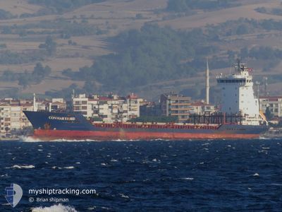
FATMA
Container Ship
Current Trip
| Time Travelled | 13 days |
|---|---|
| Remaining Time | 1 h, 0 mins |
| Distance Travelled | 907.99 nm |
| Remaining Distance | 426.79 nm |
| AVG Speed | 10.4 Knots |
| MAX Speed | 12.7 Knots |
| AVG Wind | 12.3 knots |
| MAX Wind | 31 knots |
| MIN Temp | 4.8°C / 40.64°F |
| MAX Temp | 19.4°C / 66.92°F |
| Draught | 5.4 m |
| Position Received | 1 d ago |
Current Position
| Longitude | --- |
|---|---|
| Latitude | --- |
| Status | Under way using engine |
| Speed | 10.1 Knots |
| Course | 18.9° |
| Area | Black Sea |
| Station | T-AIS |
| Position Received | 1 d ago |
Info
Information
The current position of FATMA is in Black Sea with coordinates 41.49436° / 29.32207° as reported on 2024-12-16 15:40 by AIS to our vessel tracker app. The vessel's current speed is 10.1 Knots and is heading at the port of NOVOROSSIYSK. The estimated time of arrival as calculated by MyShipTracking vessel tracking app is 2024-12-18 06:01 LT
The vessel FATMA (IMO: 9244192, MMSI: 672000030) is a Container Ship that was built in 2002 ( 22 years old ). It's sailing under the flag of [TN] Tunisia.
In this page you can find informations about the vessels current position, last detected port calls, and current voyage information. If the vessels is not in coverage by AIS you will find the latest position.
The current position of FATMA is detected by our AIS receivers and we are not responsible for the reliability of the data. The last position was recorded while the vessel was in Coverage by the Ais receivers of our vessel tracking app.
The current draught of FATMA as reported by AIS is 5.4 meters
Weather
| Temperature | 10.7°C / 51.26°F |
|---|---|
| Wind Speed | 24 knots |
| Direction | 299° WNW |
| Pressure | 1017.7 hPa |
| Humidity | 71.1 % |
| Cloud Coverage | 48 % |
Featured Company
Last Port Calls
| Port | Arrival | Departure | Time In Port |
|---|---|---|---|
| 2024-12-04 14:52 | 2024-12-04 20:30 | 5 h | |
| 2024-12-01 10:51 | 2024-12-01 16:57 | 6 h | |
| 2024-11-28 10:40 | 2024-11-28 19:31 | 8 h | |
| 2024-11-23 14:18 | 2024-11-24 08:46 | 18 h | |
| 2024-11-17 07:09 | 2024-11-17 17:47 | 10 h | |
| 2024-11-17 04:10 | 2024-11-17 05:27 | 1 h | |
| 2024-11-08 12:48 | 2024-11-08 23:05 | 10 h | |
| 2024-10-29 18:43 | 2024-10-30 06:41 | 11 h | |
| 2024-10-24 13:48 | 2024-10-25 02:01 | 12 h | |
| 2024-10-16 06:24 | 2024-10-16 13:35 | 7 h |
Last Trips
| Origin | Departure | Destination | Arrival | Distance | |
|---|---|---|---|---|---|
| 2024-12-01 19:57 | 2024-12-04 16:52 | 768.99 nm | |||
| 2024-11-28 22:31 | 2024-12-01 13:51 | 524.89 nm | |||
| 2024-11-24 11:46 | 2024-11-28 13:40 | 509.05 nm | |||
| 2024-11-17 20:47 | 2024-11-23 17:18 | 548.06 nm | |||
| 2024-11-17 08:27 | 2024-11-17 10:09 | 33.08 nm | |||
| 2024-11-09 01:05 | 2024-11-17 07:10 | 1300.34 nm | |||
| 2024-10-30 08:41 | 2024-11-08 14:48 | 1667.43 nm | |||
| 2024-10-25 05:01 | 2024-10-29 20:43 | 1222.88 nm | |||
| 2024-10-16 15:35 | 2024-10-24 16:48 | 1387.66 nm | |||
| 2024-10-10 14:45 | 2024-10-16 08:24 | 1296.42 nm |
Events
| Time | Event | Details | Position / Dest | Info |
|---|---|---|---|---|
| 2024-12-16 15:47 | Status Changed | Default Under way using engine |
41.51294 / 29.33077
RU NVS
|
Speed: 10.1 kn Course: 18.9° |
| 2024-12-16 15:40 | OUT of Coverage |
41.49436 / 29.32207
Black Sea
RU NVS
|
Speed: 10.1 kn Course: 18.9° |
|
| 2024-12-16 15:33 | Status Changed | Under way using engine Default |
41.47761 / 29.31406
RU NVS
|
Speed: 9.8 kn Course: 8° |
| 2024-12-16 15:22 | Status Changed | Default Under way using engine |
41.44881 / 29.30466
RU NVS
|
Speed: 10.3 kn Course: 7.2° |
| 2024-12-16 14:01 | Change Sea Area | Turkish part of the Black Sea Turkish part of the Sea of Marmara |
41.23566 / 29.14969
Black Sea
RU NVS
|
Speed: 11.2 kn Course: 38.7° |
| 2024-12-16 08:41 | ETA Changed | 2024/12/18 12:00 2024/12/18 18:00 |
40.80619 / 28.88769
RU NVS
|
Speed: 1.1 kn Course: 277° |
| 2024-12-16 06:25 | START Moving | 1.15 nm, South East of ZEYTINBURNU |
40.96209 / 28.90471
RU NVS
|
Speed: 5.7 kn Course: 93.4° |
| 2024-12-16 06:23 | ETA Changed | 2024/12/18 18:00 2024/12/14 06:00 |
40.96190 / 28.90097
RU NVS
|
Speed: 1.1 kn Course: 80° |
| 2024-12-16 06:22 | Status Changed | Under way using engine At anchor |
40.96191 / 28.90077
RU NVS
|
Speed: 1 kn Course: 54° |
| 2024-12-13 20:34 | Status Changed | At anchor Default |
40.96086 / 28.90107
RU NVS
|
Speed: Course: 51° |