
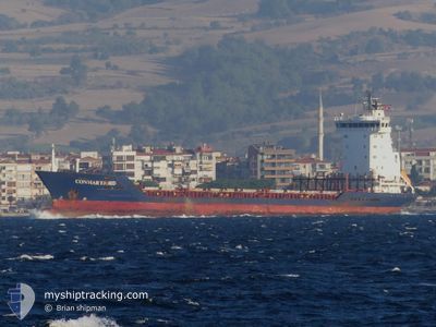
FATMA
Container Ship
Current Trip
| Time Travelled | --- |
|---|---|
| Remaining Time | --- |
| Distance Travelled | --- |
| Remaining Distance | --- |
| AVG Speed | --- |
| MAX Speed | --- |
| AVG Wind | --- |
| MAX Wind | --- |
| MIN Temp | --- |
| MAX Temp | --- |
| Diepgang | 7.4 M |
| Positie ontvangen | 3 m geleden |
Current Position
| Lengtegraad | --- |
|---|---|
| Breedtegraat | --- |
| Status | At anchor |
| Snelheid | |
| Koers | 46° |
| Gebied | Sea of Marmara |
| Station | T-AIS |
| Positie ontvangen | 3 m geleden |
Info
Information
The current position of FATMA is in Sea of Marmara with coordinates 40.98195° / 28.93579° as reported on 2025-03-07 02:33 by AIS to our vessel tracker app. The vessel's current speed is 0 Knopen and is heading at the port of DAMIETTA. The estimated time of arrival as calculated by MyShipTracking vessel tracking app is 2025-03-05 06:00 LT
The vessel FATMA (IMO: 9244192, MMSI: 672000030) is a Container Ship that was built in 2002 ( 23 Jaar oud ). It's sailing under the flag of [TN] Tunisia.
In this page you can find informations about the vessels current position, last detected port calls, and current voyage information. If the vessels is not in coverage by AIS you will find the latest position.
The current position of FATMA is detected by our AIS receivers and we are not responsible for the reliability of the data. The last position was recorded while the vessel was in Coverage by the Ais receivers of our vessel tracking app.
The current draught of FATMA as reported by AIS is 7.4 meters
Weather
| Temperature | 6.8°C / 44.24°F |
|---|---|
| Wind Speed | 6 knots |
| Direction | 36° NE |
| Pressure | 1025.3 hPa |
| Humidity | 53.2 % |
| Cloud Coverage | 3 % |
Featured Company
Last Port Calls
| Port | Arrival | Departure | Time In Port |
|---|---|---|---|
| 2025-03-01 15:37 | |||
| 2025-02-28 13:17 | 2025-03-01 13:37 | 1 d | |
| 2025-02-27 14:11 | 2025-02-27 23:55 | 9 h | |
| 2025-02-11 05:05 | 2025-02-11 12:51 | 7 h | |
| 2025-02-01 21:28 | |||
| 2025-02-01 21:18 | |||
| 2025-02-01 18:19 | 2025-02-01 21:09 | 2 h | |
| 2025-02-01 06:45 | 2025-02-01 15:02 | 8 h | |
| 2025-01-22 05:50 | 2025-01-22 12:09 | 6 h | |
| 2025-01-05 15:28 | 2025-01-05 16:20 | 51 m |
Last Trips
| Origin | Departure | Destination | Arrival | Distance | |
|---|---|---|---|---|---|
| 2025-03-01 16:37 | 2025-03-01 18:37 | 25.83 nm | |||
| 2025-02-28 02:55 | 2025-02-28 16:17 | 8.30 nm | |||
| 2025-02-11 14:51 | 2025-02-27 17:11 | 1956.55 nm | |||
| 2025-02-02 00:18 | 2025-02-11 07:05 | 1282.35 nm | |||
| 2025-02-02 00:09 | 2025-02-02 00:28 | --- | |||
| 2025-02-01 18:02 | 2025-02-01 21:19 | 16.03 nm | |||
| 2025-01-22 14:09 | 2025-02-01 09:45 | 1776.56 nm | |||
| 2025-01-05 19:20 | 2025-01-22 07:50 | 1525.33 nm | |||
| 2025-01-05 17:42 | 2025-01-05 18:28 | 4.16 nm | |||
| 2024-12-31 13:43 | 2025-01-05 17:36 | 1287.97 nm |
Events
| Tijd | Evenement | Details | Positie / Bestemming | Info |
|---|---|---|---|---|
| 2025-03-06 04:26 | Status Changed | At anchor Default |
40.98345 / 28.93820
EG DAM
|
Snelheid: Koers: 261° |
| 2025-03-06 04:23 | Status Changed | Default At anchor |
40.98344 / 28.93819
EG DAM
|
Snelheid: Koers: 264° |
| 2025-03-03 13:44 | Status Changed | At anchor Default |
40.98167 / 28.93642
EG DAM
|
Snelheid: 0.1 kn Koers: 4° |
| 2025-03-03 13:38 | Status Changed | Default At anchor |
40.98165 / 28.93684
EG DAM
|
Snelheid: 0.3 kn Koers: 7° |
| 2025-03-03 12:06 | Status Changed | At anchor Under way using engine |
40.98181 / 28.93613
EG DAM
|
Snelheid: 0.3 kn Koers: 44° |
| 2025-03-03 11:48 | Stop beweging | 2.07 nm, East of ZEYTINBURNU |
40.98220 / 28.93833
EG DAM
|
Snelheid: 0.3 kn Koers: 315° |
| 2025-03-03 11:32 | Start beweging | 2.05 nm, East of ZEYTINBURNU |
40.96957 / 28.93618
EG DAM
|
Snelheid: 3.7 kn Koers: 22° |
| 2025-03-03 11:26 | Stop beweging | 2.08 nm, East of ZEYTINBURNU |
40.96769 / 28.93614
EG DAM
|
Snelheid: 0.2 kn Koers: 344° |
| 2025-03-03 09:25 | Wijzig zee gebeid | Turkish part of the Sea of Marmara Turkish part of the Black Sea |
41.23311 / 29.13182
Sea of Marmara
EG DAM
|
Snelheid: 11.9 kn Koers: 196.7° |
| 2025-03-03 07:57 | Start beweging | 7.5 nm, North West of RUMELI FENERI |
41.31826 / 28.99381
EG DAM
|
Snelheid: 3.5 kn Koers: 305° |