
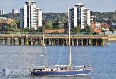
FARAMIR
Sailing
Current Trip
FARAMIR is out of coverage. Learn how you can join the community and extend the coverage to your area by clicking here!
Unknown
Destination Port
ETA*
---
| Time Travelled | 2 days |
|---|---|
| Remaining Time | --- |
| Distance Travelled | 138.62 nm |
| Remaining Distance | --- |
| AVG Speed | 6.7 Knots |
| MAX Speed | 10.4 Knots |
| AVG Wind | 10.2 knots |
| MAX Wind | 14 knots |
| MIN Temp | 9.8°C / 49.64°F |
| MAX Temp | 14.1°C / 57.38°F |
| Draught | --- |
| Position Received | 3 h, 23 m ago |
Current Position
| Longitude | --- |
|---|---|
| Latitude | --- |
| Status | Default |
| Speed | |
| Course | --- |
| Area | English Channel |
| Station | T-AIS |
| Position Received | 3 h, 23 m ago |
Information
The current position of FARAMIR is in English Channel with coordinates 50.35983° / -4.12089° as reported on 2025-04-24 10:02 by AIS to our vessel tracker app. The vessel's current speed is 0 Knots
The vessel FARAMIR (MMSI: 235005645) is a Sailing It's sailing under the flag of [GB] United Kingdom.
In this page you can find informations about the vessels current position, last detected port calls, and current voyage information. If the vessels is not in coverage by AIS you will find the latest position.
The current position of FARAMIR is detected by our AIS receivers and we are not responsible for the reliability of the data. The last position was recorded while the vessel was in Coverage by the Ais receivers of our vessel tracking app.
Weather
| Temperature | 11.8°C / 53.24°F |
|---|---|
| Wind Speed | 8 knots |
| Direction | 112° ESE |
| Pressure | 1022 hPa |
| Humidity | 75.9 % |
| Cloud Coverage | 76 % |
Featured Company
Limited time offer - Install a base station receiver to your area and list your company on MyShipTracking Free forever!
Last Port Calls
| Port | Arrival | Departure | Time In Port |
|---|---|---|---|
| 2025-04-20 18:20 | 2025-04-21 17:04 | 22 h | |
| 2025-04-18 09:13 | 2025-04-20 07:27 | 1 d | |
| 2025-04-16 13:06 | 2025-04-17 08:49 | 19 h | |
| 2025-04-15 05:40 | 2025-04-16 10:06 | 1 d | |
| 2025-04-11 10:07 | 2025-04-13 15:45 | 2 d | |
| 2025-03-08 19:13 | 2025-04-07 13:24 | 29 d | |
| 2025-02-20 15:34 | 2025-03-08 09:37 | 15 d | |
| 2025-02-19 22:35 | 2025-02-20 14:41 | 16 h | |
| 2025-02-06 10:01 | 2025-02-17 15:27 | 11 d | |
| 2025-02-05 17:50 | 2025-02-06 09:18 | 15 h |
Most Visited Ports (Last year)
| Port | Arrivals | |
|---|---|---|
| 7 | ||
| 6 | ||
| 6 | ||
| 4 | ||
| 4 | ||
| 3 |
Last Trips
| Origin | Departure | Destination | Arrival | Distance | |
|---|---|---|---|---|---|
| 2025-04-20 08:27 | 2025-04-20 19:20 | 51.62 nm | |||
| 2025-04-17 09:49 | 2025-04-18 10:13 | 23.68 nm | |||
| 2025-04-16 11:06 | 2025-04-16 14:06 | 15.88 nm | |||
| 2025-04-13 16:45 | 2025-04-15 06:40 | 209.23 nm | |||
| 2025-04-07 14:24 | 2025-04-11 11:07 | 101.95 nm | |||
| 2025-03-08 09:37 | 2025-03-08 19:13 | 51.59 nm | |||
| 2025-02-20 14:41 | 2025-02-20 15:34 | 5.08 nm | |||
| 2025-02-17 15:27 | 2025-02-19 22:35 | 97.95 nm | |||
| 2025-02-06 09:18 | 2025-02-06 10:01 | 1.11 nm | |||
| 2025-02-04 09:24 | 2025-02-05 17:50 | 74.65 nm |
Events
| Time | Event | Details | Position / Dest | Info |
|---|---|---|---|---|
| 2025-04-24 10:02 | OUT of Coverage |
50.35983 / -4.12089
English Channel
|
Speed: Course: 281.2° |
|
| 2025-04-24 09:12 | STOP Moving | 1.29 nm, East of PLYMOUTH |
50.35982 / -4.12088
|
Speed: 0.2 kn Course: 511° |
| 2025-04-24 08:52 | START Moving | 0.71 nm, South East of PLYMOUTH |
50.35591 / -4.13959
|
Speed: 3.3 kn Course: 27.9° |
| 2025-04-24 08:34 | STOP Moving | 0.81 nm, South East of PLYMOUTH |
50.35301 / -4.14044
|
Speed: 0.2 kn Course: 511° |
| 2025-04-24 07:51 | START Moving | 1.89 nm, South West of PLYMOUTH |
50.33482 / -4.17535
|
Speed: 3.1 kn Course: 84.1° |
| 2025-04-24 07:33 | STOP Moving | 2.17 nm, South West of PLYMOUTH |
50.33201 / -4.18273
|
Speed: 0.2 kn Course: 511° |
| 2025-04-24 07:14 | START Moving | 2.44 nm, South West of PLYMOUTH |
50.33071 / -4.19219
|
Speed: 4.5 kn Course: 66.7° |
| 2025-04-23 16:47 | STOP Moving | 2.57 nm, South West of PLYMOUTH |
50.32935 / -4.19501
|
Speed: 0.3 kn Course: 511° |
| 2025-04-23 08:33 | IN Coverage |
50.24525 / -3.57665
English Channel
|
Speed: 6 kn Course: 178.9° |
|
| 2025-04-22 01:29 | OUT of Coverage |
50.23700 / -2.97194
English Channel
|
Speed: 5.2 kn Course: 208.2° |