
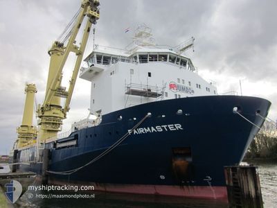
FAIRMASTER
Reserved for future use
Current Trip
| Time Travelled | 11 days |
|---|---|
| Remaining Time | 4 days |
| Distance Travelled | 743.31 nm |
| Remaining Distance | 1751.03 nm |
| AVG Speed | 15 Knots |
| MAX Speed | 16.3 Knots |
| AVG Wind | 8.5 knots |
| MAX Wind | 18.8 knots |
| MIN Temp | 27.3°C / 81.14°F |
| MAX Temp | 35.3°C / 95.54°F |
| Draught | 7.3 m |
| Position Received | 8 m ago |
Current Position
| Longitude | 76.63124° |
|---|---|
| Latitude | 7.87470° |
| Status | Under way using engine |
| Speed | 15.1 Knots |
| Course | 133.7° |
| Area | Laccadive Sea |
| Station | T-AIS |
| Position Received | 8 m ago |
Info
Information
The current position of FAIRMASTER is in Laccadive Sea with coordinates 7.87470° / 76.63124° as reported on 2024-04-29 08:32 by AIS to our vessel tracker app. The vessel's current speed is 15.1 Knots and is heading at the port of SINGAPORE. The estimated time of arrival as calculated by MyShipTracking vessel tracking app is 2024-05-04 01:19 LT
The vessel FAIRMASTER (IMO: 9650585, MMSI: 244820422) is a Reserved for future use It's sailing under the flag of [NL] Netherlands.
In this page you can find informations about the vessels current position, last detected port calls, and current voyage information. If the vessels is not in coverage by AIS you will find the latest position.
The current position of FAIRMASTER is detected by our AIS receivers and we are not responsible for the reliability of the data. The last position was recorded while the vessel was in Coverage by the Ais receivers of our vessel tracking app.
The current draught of FAIRMASTER as reported by AIS is 7.3 meters
Weather
| Temperature | 30.5°C / 86.9°F |
|---|---|
| Wind Speed | 5 knots |
| Direction | 222° SW |
| Pressure | 1008.7 hPa |
| Humidity | 67.6 % |
| Cloud Coverage | 100 % |
Featured Company
Last Port Calls
| Port | Arrival | Departure | Time In Port |
|---|---|---|---|
| 2024-04-14 10:42 | 2024-04-17 10:52 | 3 d | |
| 2024-04-04 04:21 | 2024-04-09 08:49 | 5 d | |
| 2024-02-26 23:32 | 2024-02-29 12:58 | 2 d | |
| 2024-02-20 01:12 | 2024-02-22 01:52 | 2 d | |
| 2024-02-04 08:10 | 2024-02-05 09:39 | 1 d | |
| 2024-02-02 09:14 | 2024-02-04 00:16 | 1 d | |
| 2024-02-02 00:27 |
Last Trips
| Origin | Departure | Destination | Arrival | Distance | |
|---|---|---|---|---|---|
| 2024-04-09 11:49 | 2024-04-14 16:12 | 1340.57 nm | |||
| 2024-02-29 20:58 | 2024-04-04 07:21 | 7233.19 nm | |||
| 2024-02-22 10:52 | 2024-02-27 07:32 | 1178.59 nm | |||
| 2024-02-05 17:39 | 2024-02-20 10:12 | 1147.10 nm | |||
| 2024-02-04 08:16 | 2024-02-04 16:10 | 104.31 nm | |||
| 2024-02-02 08:27 | 2024-02-02 17:14 | 101.68 nm |
Events
| Time | Event | Details | Position / Dest | Info |
|---|---|---|---|---|
| 2024-04-29 08:10 | Draught Changed | 7.3 7.2 |
7.96219 / 76.53942
SGSIN
|
Speed: 15.1 kn Course: 133.3° |
| 2024-04-29 08:10 | Destination Changed | SGSIN INBOM |
7.96219 / 76.53942
SGSIN
|
Speed: 15.1 kn Course: 133.3° |
| 2024-04-29 08:10 | ETA Changed | 2024/05/04 04:00 2024/04/14 03:00 |
7.96219 / 76.53942
SGSIN
|
Speed: 15.1 kn Course: 133.3° |
| 2024-04-29 08:02 | Detected in Sea | Indian part of the Laccadive Sea |
7.96219 / 76.53942
Laccadive Sea
|
Speed: 15.1 kn Course: 133.3° |
| 2024-04-29 08:02 | Status Changed | Under way using engine Default |
7.96219 / 76.53942
INBOM
|
Speed: 15.3 kn Course: 130° |
| 2024-04-29 08:02 | IN Coverage |
7.96219 / 76.53942
Laccadive Sea
|
Speed: 15.1 kn Course: 133.3° |
|
| 2024-04-27 08:40 | START Moving | 3.31 nm, South of MUMBAI |
18.93035 / 72.88159
INBOM
|
Speed: 6.3 kn Course: 232° |