
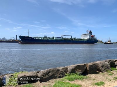
FAIRCHEM CUTLASS
Tanker
Current Trip
| Time Travelled | 6 h, 18 mins |
|---|---|
| Remaining Time | --- |
| Distance Travelled | 80.55 nm |
| Remaining Distance | --- |
| AVG Speed | 13.3 Knots |
| MAX Speed | 13.9 Knots |
| AVG Wind | 10.2 knots |
| MAX Wind | 12.5 knots |
| MIN Temp | 17.4°C / 63.32°F |
| MAX Temp | 19.3°C / 66.74°F |
| Draught | 8.7 m |
| Position Received | 26 m ago |
Current Position
| Longitude | -10.10318° |
|---|---|
| Latitude | 32.81685° |
| Status | Under way using engine |
| Speed | 13.2 Knots |
| Course | 267.6° |
| Area | North Atlantic Ocean |
| Station | T-AIS |
| Position Received | 26 m ago |
Info
Information
The current position of FAIRCHEM CUTLASS is in North Atlantic Ocean with coordinates 32.81685° / -10.10318° as reported on 2024-05-08 12:03 by AIS to our vessel tracker app. The vessel's current speed is 13.2 Knots and is heading at the port of BARRANQUILLA. The estimated time of arrival as calculated by MyShipTracking vessel tracking app is 2024-05-20 08:00 LT
The vessel FAIRCHEM CUTLASS (IMO: 9746164, MMSI: 538006625) is a Tanker It's sailing under the flag of [MH] Marshall Is.
In this page you can find informations about the vessels current position, last detected port calls, and current voyage information. If the vessels is not in coverage by AIS you will find the latest position.
The current position of FAIRCHEM CUTLASS is detected by our AIS receivers and we are not responsible for the reliability of the data. The last position was recorded while the vessel was in Coverage by the Ais receivers of our vessel tracking app.
The current draught of FAIRCHEM CUTLASS as reported by AIS is 8.7 meters
Weather
| Temperature | 19.3°C / 66.74°F |
|---|---|
| Wind Speed | 12 knots |
| Direction | 11° N |
| Pressure | 1014.4 hPa |
| Humidity | 83.8 % |
| Cloud Coverage | 83 % |
Featured Company
Last Port Calls
| Port | Arrival | Departure | Time In Port |
|---|---|---|---|
| 2024-05-07 05:38 | 2024-05-08 06:11 | 1 d | |
| 2024-05-05 06:47 | 2024-05-05 21:43 | 14 h | |
| 2024-04-28 05:12 | 2024-04-28 21:53 | 16 h | |
| 2024-04-21 21:40 | 2024-04-25 03:40 | 3 d | |
| 2024-04-18 03:43 | 2024-04-19 11:49 | 1 d | |
| 2024-04-15 05:52 | 2024-04-15 15:43 | 9 h | |
| 2024-04-11 14:44 | 2024-04-13 02:44 | 1 d | |
| 2024-04-09 06:45 | 2024-04-10 03:34 | 20 h | |
| 2024-04-07 04:13 | 2024-04-07 13:28 | 9 h | |
| 2024-04-06 14:21 | 2024-04-07 04:05 | 13 h |
Last Trips
| Origin | Departure | Destination | Arrival | Distance | |
|---|---|---|---|---|---|
| 2024-05-05 23:43 | 2024-05-07 06:38 | 271.69 nm | |||
| 2024-04-29 00:53 | 2024-05-05 08:47 | 1897.59 nm | |||
| 2024-04-25 06:40 | 2024-04-28 08:12 | 870.83 nm | |||
| 2024-04-19 14:49 | 2024-04-22 00:40 | 79.38 nm | |||
| 2024-04-13 05:44 | 2024-04-18 06:43 | 1060.76 nm | |||
| 2024-04-13 05:44 | 2024-04-15 07:52 | 507.02 nm | |||
| 2024-04-10 06:34 | 2024-04-11 17:44 | 5.53 nm | |||
| 2024-04-07 06:05 | 2024-04-09 09:45 | 598.45 nm | |||
| 2024-04-07 06:05 | 2024-04-07 06:13 | 1.33 nm | |||
| 2024-03-30 23:34 | 2024-04-06 16:21 | 1706.62 nm |
Events
| Time | Event | Details | Position / Dest | Info |
|---|---|---|---|---|
| 2024-05-08 12:05 | Status Changed | Default Under way using engine |
32.81642 / -10.11485
BARRANQUILLA
|
Speed: 13.2 kn Course: 267.6° |
| 2024-05-08 12:02 | Status Changed | Under way using engine Default |
32.81690 / -10.10173
BARRANQUILLA
|
Speed: 12.3 kn Course: 267° |
| 2024-05-08 11:55 | Status Changed | Default Under way using engine |
32.81797 / -10.07115
BARRANQUILLA
|
Speed: 11.2 kn Course: 266.6° |
| 2024-05-08 10:53 | Status Changed | Under way using engine Default |
32.83096 / -9.80487
BARRANQUILLA
|
Speed: 13.6 kn Course: 257° |
| 2024-05-08 10:42 | Status Changed | Default Under way using engine |
32.83751 / -9.75618
BARRANQUILLA
|
Speed: 13.6 kn Course: 248.8° |
| 2024-05-08 10:32 | Status Changed | Under way using engine Default |
32.84987 / -9.71302
BARRANQUILLA
|
Speed: 13.4 kn Course: 249° |
| 2024-05-08 10:32 | IN Coverage |
32.84987 / -9.71302
North Atlantic Ocean
BARRANQUILLA
|
Speed: 13.6 kn Course: 248.9° |
|
| 2024-05-08 07:46 | Status Changed | Default Under way using engine |
33.07648 / -9.03179
BARRANQUILLA
|
Speed: 13.9 kn Course: 249° |
| 2024-05-08 07:43 | OUT of Coverage |
33.08082 / -9.01809
North Atlantic Ocean
BARRANQUILLA
|
Speed: 13.9 kn Course: 249° |
|
| 2024-05-08 06:11 | Status Changed | Under way using engine Default |
33.11959 / -8.65329
BARRANQUILLA
|
Speed: 6 kn Course: 227° |