
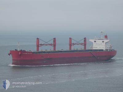
F CHARM
Bulker
Current Trip
ZONA COMMON
| Time Travelled | 2 days |
|---|---|
| Remaining Time | --- |
| Distance Travelled | 720.89 nm |
| Remaining Distance | --- |
| AVG Speed | 11.9 Knots |
| MAX Speed | 13.5 Knots |
| AVG Wind | 19 knots |
| MAX Wind | 30 knots |
| MIN Temp | 16.1°C / 60.98°F |
| MAX Temp | 26.7°C / 80.06°F |
| Draught | 10.2 m |
| Position Received | 9 d ago |
Current Position
| Longitude | --- |
|---|---|
| Latitude | --- |
| Status | Under way using engine |
| Speed | 7.5 Knots |
| Course | 161.2° |
| Area | Rio de La Plata |
| Station | T-AIS |
| Position Received | 9 d ago |
Info
Information
The current position of F CHARM is in Rio de La Plata with coordinates -34.32571° / -58.48913° as reported on 2025-12-24 06:54 by AIS to our vessel tracker app. The vessel's current speed is 7.5 Knots
The vessel F CHARM (IMO: 9642203, MMSI: 355142000) is a Bulker that was built in 2013 ( 13 years old ). It's sailing under the flag of [PA] Panama.
In this page you can find informations about the vessels current position, last detected port calls, and current voyage information. If the vessels is not in coverage by AIS you will find the latest position.
The current position of F CHARM is detected by our AIS receivers and we are not responsible for the reliability of the data. The last position was recorded while the vessel was in Coverage by the Ais receivers of our vessel tracking app.
The current draught of F CHARM as reported by AIS is 10.2 meters
Weather
| Temperature | 18.3°C / 64.94°F |
|---|---|
| Wind Speed | 24 knots |
| Direction | 269° W |
| Pressure | 997.5 hPa |
| Humidity | 54.6 % |
| Cloud Coverage | 64 % |
Featured Company
Last Port Calls
| Port | Arrival | Departure | Time In Port |
|---|---|---|---|
| 2025-12-28 02:52 | 2025-12-31 07:33 | 3 d | |
| 2025-12-20 01:11 | 2025-12-23 11:30 | 3 d |
Most Visited Ports (Last year)
| Port | Arrivals | |
|---|---|---|
| 3 | ||
| 1 | ||
| 1 | ||
| 1 | ||
| 1 | ||
| 1 |
Last Trips
| Origin | Departure | Destination | Arrival | Distance | |
|---|---|---|---|---|---|
| 2025-12-23 11:30 | 2025-12-28 02:52 | 672.01 nm | |||
| 2025-10-01 15:24 | 2025-12-20 01:11 | 9040.97 nm |
Events
| Time | Event | Details | Position / Dest | Info |
|---|---|---|---|---|
| 2025-12-31 10:33 | START Moving | 0.82 nm, South East of NECOCHEA |
-38.58247 / -58.69737
ZONA COMMON
|
Speed: 3.6 kn Course: 111° |
| 2025-12-31 10:33 | PORT DEPARTURE |
|
-38.58247 / -58.69737
ZONA COMMON
|
Speed: 0.3 kn Course: 132° |
| 2025-12-28 05:52 | STOP Moving |
-38.57620 / -58.70548
[AR] NECOCHEA
|
Speed: 0.1 kn Course: 124° |
|
| 2025-12-28 05:52 | PORT ARRIVAL |
|
-38.57620 / -58.70548
[AR] NECOCHEA
|
Speed: 0.6 kn Course: 124° |
| 2025-12-28 01:41 | START Moving | 9.01 nm, South East of NECOCHEA |
-38.66067 / -58.55447
ZONA COMMON
|
Speed: 3.1 kn Course: 295° |
| 2025-12-27 00:43 | STOP Moving | 9.22 nm, South East of NECOCHEA |
-38.66319 / -58.55127
ZONA COMMON
|
Speed: 0.1 kn Course: 16° |
| 2025-12-25 11:55 | START Moving | 8.47 nm, North East of LA PLATA |
-34.72918 / -57.79658
ZONA COMMON
|
Speed: 3.6 kn Course: 81° |
| 2025-12-24 12:10 | STOP Moving | 8.34 nm, North East of LA PLATA |
-34.73176 / -57.79660
ZONA COMMON
|
Speed: 0.1 kn Course: 345° |
| 2025-12-24 06:59 | Status Changed | Default Under way using engine |
-34.33517 / -58.48406
ZONA COMMON
|
Speed: 7.5 kn Course: 161.2° |
| 2025-12-24 06:54 | OUT of Coverage |
-34.32571 / -58.48913
Rio de La Plata
ZONA COMMON
|
Speed: 7.5 kn Course: 161.2° |