
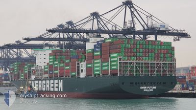
EVER FUTURE
Cargo D
Current Trip
| Time Travelled | 1 day |
|---|---|
| Remaining Time | 2 days |
| Distance Travelled | 490.65 nm |
| Remaining Distance | 949.55 nm |
| AVG Speed | 15.6 Knots |
| MAX Speed | 19.3 Knots |
| AVG Wind | 16 knots |
| MAX Wind | 22 knots |
| MIN Temp | 25.5°C / 77.9°F |
| MAX Temp | 26.9°C / 80.42°F |
| Draught | 12 m |
| Position Received | 1 d ago |
Current Position
| Longitude | --- |
|---|---|
| Latitude | --- |
| Status | Under way using engine |
| Speed | 16.5 Knots |
| Course | 78.7° |
| Area | Singapore Strait |
| Station | T-AIS |
| Position Received | 1 d ago |
Info
Information
The current position of EVER FUTURE is in Singapore Strait with coordinates 1.27686° / 104.29658° as reported on 2026-02-18 06:40 by AIS to our vessel tracker app. The vessel's current speed is 16.5 Knots and is heading at the port of HONG KONG. The estimated time of arrival as calculated by MyShipTracking vessel tracking app is 2026-02-22 02:03 LT
The vessel EVER FUTURE (IMO: 9850599, MMSI: 563160200) is a Cargo D It's sailing under the flag of [SG] Singapore.
In this page you can find informations about the vessels current position, last detected port calls, and current voyage information. If the vessels is not in coverage by AIS you will find the latest position.
The current position of EVER FUTURE is detected by our AIS receivers and we are not responsible for the reliability of the data. The last position was recorded while the vessel was in Coverage by the Ais receivers of our vessel tracking app.
The current draught of EVER FUTURE as reported by AIS is 12 meters
Weather
| Temperature | 25.6°C / 78.08°F |
|---|---|
| Wind Speed | 22 knots |
| Direction | 40° NE |
| Pressure | 1010.5 hPa |
| Humidity | 87.6 % |
| Cloud Coverage | 100 % |
Featured Company
Last Port Calls
| Port | Arrival | Departure | Time In Port |
|---|---|---|---|
| 2026-02-17 12:02 | 2026-02-18 12:04 | 1 d | |
| 2026-01-21 04:22 | 2026-01-22 09:58 | 1 d | |
| 2026-01-18 04:53 | 2026-01-20 04:26 | 1 d | |
| 2026-01-14 01:12 | 2026-01-15 18:14 | 1 d | |
| 2026-01-11 22:54 | 2026-01-13 10:53 | 1 d | |
| 2026-01-09 07:50 | 2026-01-09 23:05 | 15 h | |
| 2026-01-01 08:31 | 2026-01-01 08:38 | 6 m | |
| 2025-12-27 23:33 | 2025-12-29 05:41 | 1 d | |
| 2025-12-08 01:18 | 2025-12-09 02:21 | 1 d | |
| 2025-12-03 11:51 | 2025-12-04 05:54 | 18 h |
Most Visited Ports (Last year)
| Port | Arrivals | |
|---|---|---|
| 9 | ||
| 8 | ||
| 6 | ||
| 5 | ||
| 5 | ||
| 4 |
Last Trips
| Origin | Departure | Destination | Arrival | Distance | |
|---|---|---|---|---|---|
| 2026-01-22 09:58 | 2026-02-17 12:02 | 9187.91 nm | |||
| 2026-01-20 04:26 | 2026-01-21 04:22 | 182.15 nm | |||
| 2026-01-15 18:14 | 2026-01-18 04:53 | 935.51 nm | |||
| 2026-01-13 10:53 | 2026-01-14 01:12 | 145.91 nm | |||
| 2026-01-09 23:05 | 2026-01-11 22:54 | 707.48 nm | |||
| 2026-01-01 08:38 | 2026-01-09 07:50 | 410.79 nm | |||
| 2025-12-29 05:41 | 2026-01-01 08:31 | 244.29 nm | |||
| 2025-12-09 02:21 | 2025-12-27 23:33 | 9006.13 nm | |||
| 2025-12-04 05:54 | 2025-12-08 01:18 | 1451.01 nm | |||
| 2025-12-03 06:29 | 2025-12-03 11:51 | 53.97 nm |
Events
| Time | Event | Details | Position / Dest | Info |
|---|---|---|---|---|
| 2026-02-18 06:45 | Status Changed | Default Under way using engine |
1.28098 / 104.31877
SG SIN>HK HKG
|
Speed: 16.5 kn Course: 78.7° |
| 2026-02-18 06:40 | OUT of Coverage |
1.27686 / 104.29658
Singapore Strait
SG SIN>HK HKG
|
Speed: 16.5 kn Course: 78.7° |
|
| 2026-02-18 06:39 | Status Changed | Under way using engine Default |
1.27594 / 104.29213
SG SIN>HK HKG
|
Speed: 16.1 kn Course: 80° |
| 2026-02-18 06:29 | Status Changed | Default Under way using engine |
1.26985 / 104.24760
SG SIN>HK HKG
|
Speed: 15 kn Course: 83.1° |
| 2026-02-18 06:11 | Change Sea Area | Malaysian part of the Singapore Strait Indonesian part of the Singapore Strait |
1.25978 / 104.17342
Singapore Strait
SG SIN>HK HKG
|
Speed: 14.6 kn Course: 76.7° |
| 2026-02-18 04:47 | Change Sea Area | Indonesian part of the Singapore Strait Singaporean part of the Singapore Strait |
1.18821 / 103.84454
Singapore Strait
SG SIN>HK HKG
|
Speed: 11.8 kn Course: 80.9° |
| 2026-02-18 04:04 | PORT DEPARTURE |
|
1.25738 / 103.77570
SG SIN>HK HKG
|
Speed: 8.4 kn Course: 182° |
| 2026-02-18 03:58 | START Moving |
1.26859 / 103.77652
[SG] SINGAPORE
|
Speed: 3.2 kn Course: 186° |
|
| 2026-02-18 03:33 | Status Changed | Under way using engine Moored |
1.27326 / 103.77385
[SG] SINGAPORE
|
Speed: Course: 30° |
| 2026-02-18 02:42 | Draught Changed | 12 13.5 |
1.27324 / 103.77378
[SG] SINGAPORE
|
Speed: Course: 30° |