
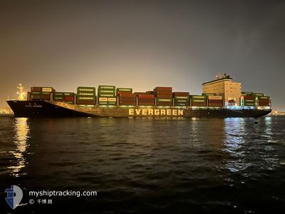
EVER BOARD
Cargo D
Current Trip
| Time Travelled | 1 h, 0 mins |
|---|---|
| Remaining Time | 15 h, 23 mins |
| Distance Travelled | 9.74 nm |
| Remaining Distance | 182.59 nm |
| AVG Speed | 12.3 Knots |
| MAX Speed | 13.6 Knots |
| AVG Wind | 9.5 knots |
| MAX Wind | 10 knots |
| MIN Temp | 25.9°C / 78.62°F |
| MAX Temp | 26.2°C / 79.16°F |
| Draught | 10.6 m |
| Position Received | 1 m ago |
Current Position
| Longitude | --- |
|---|---|
| Latitude | --- |
| Status | Under way using engine |
| Speed | 14.5 Knots |
| Course | 278.5° |
| Area | Singapore Strait |
| Station | T-AIS |
| Position Received | 1 m ago |
Info
Information
The current position of EVER BOARD is in Singapore Strait with coordinates 1.20283° / 103.59508° as reported on 2024-12-20 17:02 by AIS to our vessel tracker app. The vessel's current speed is 14.5 Knots and is heading at the port of PORT KLANG. The estimated time of arrival as calculated by MyShipTracking vessel tracking app is 2024-12-21 08:26 LT
The vessel EVER BOARD (IMO: 9790050, MMSI: 416038000) is a Cargo D It's sailing under the flag of [TW] Taiwan.
In this page you can find informations about the vessels current position, last detected port calls, and current voyage information. If the vessels is not in coverage by AIS you will find the latest position.
The current position of EVER BOARD is detected by our AIS receivers and we are not responsible for the reliability of the data. The last position was recorded while the vessel was in Coverage by the Ais receivers of our vessel tracking app.
The current draught of EVER BOARD as reported by AIS is 10.6 meters
Weather
| Temperature | 26°C / 78.8°F |
|---|---|
| Wind Speed | 9 knots |
| Direction | 26° NNE |
| Pressure | 1010.9 hPa |
| Humidity | 84.3 % |
| Cloud Coverage | 100 % |
Featured Company
Last Port Calls
| Port | Arrival | Departure | Time In Port |
|---|---|---|---|
| 2024-12-19 22:38 | 2024-12-20 16:03 | 17 h | |
| 2024-12-15 06:42 | 2024-12-16 07:45 | 1 d | |
| 2024-12-14 07:48 | 2024-12-14 23:04 | 15 h | |
| 2024-12-13 16:06 | 2024-12-14 02:32 | 10 h | |
| 2024-12-10 22:28 | 2024-12-11 08:00 | 9 h | |
| 2024-12-09 22:00 | 2024-12-10 21:42 | 23 h | |
| 2024-12-08 09:44 | 2024-12-09 07:31 | 21 h | |
| 2024-12-07 22:27 | 2024-12-08 07:47 | 9 h | |
| 2024-12-04 15:44 | 2024-12-05 00:04 | 8 h | |
| 2024-12-03 18:23 | 2024-12-04 10:02 | 15 h |
Last Trips
| Origin | Departure | Destination | Arrival | Distance | |
|---|---|---|---|---|---|
| 2024-12-16 15:45 | 2024-12-20 06:38 | 1623.65 nm | |||
| 2024-12-15 07:04 | 2024-12-15 14:42 | 134.93 nm | |||
| 2024-12-14 10:32 | 2024-12-14 15:48 | 83.62 nm | |||
| 2024-12-11 17:00 | 2024-12-14 00:06 | 1041.74 nm | |||
| 2024-12-11 06:42 | 2024-12-11 07:28 | 4.76 nm | |||
| 2024-12-09 16:31 | 2024-12-10 07:00 | 212.62 nm | |||
| 2024-12-08 16:47 | 2024-12-08 18:44 | 19.79 nm | |||
| 2024-12-05 08:04 | 2024-12-08 07:27 | 1157.20 nm | |||
| 2024-12-04 18:02 | 2024-12-04 23:44 | 79.59 nm | |||
| 2024-12-03 14:24 | 2024-12-04 02:23 | 131.90 nm |
Events
| Time | Event | Details | Position / Dest | Info |
|---|---|---|---|---|
| 2024-12-20 17:02 | Change Sea Area | Malaysian part of the Singapore Strait Indonesian part of the Singapore Strait |
1.20283 / 103.59508
Singapore Strait
SGSIN>MY PKG
|
Speed: 14.5 kn Course: 278.5° |
| 2024-12-20 16:48 | Change Sea Area | Indonesian part of the Singapore Strait Singaporean part of the Singapore Strait |
1.19972 / 103.64307
Singapore Strait
SGSIN>MY PKG
|
Speed: 10.8 kn Course: 267.7° |
| 2024-12-20 16:45 | ETA Changed | 2024/12/21 04:00 2024/12/19 21:15 |
1.20187 / 103.65140
SGSIN>MY PKG
|
Speed: 9.7 kn Course: 241.9° |
| 2024-12-20 16:03 | PORT DEPARTURE |
|
1.26563 / 103.76524
SGSIN>MY PKG
|
Speed: 10.7 kn Course: 281° |
| 2024-12-20 15:45 | START Moving |
1.27509 / 103.77833
[SG] SINGAPORE
|
Speed: 3.1 kn Course: 342° |
|
| 2024-12-20 15:37 | Status Changed | Under way using engine Moored |
1.27724 / 103.77865
[SG] SINGAPORE
|
Speed: Course: 301° |
| 2024-12-20 15:16 | Draught Changed | 10.6 11.2 |
1.27731 / 103.77859
[SG] SINGAPORE
|
Speed: Course: 301° |
| 2024-12-20 15:16 | Destination Changed | SGSIN>MY PKG TWKHH > SGSIN PEBGA |
1.27731 / 103.77859
[SG] SINGAPORE
|
Speed: Course: 301° |
| 2024-12-20 08:26 | Status Changed | Moored Default |
1.27735 / 103.77867
[SG] SINGAPORE
|
Speed: 0.1 kn Course: 301° |
| 2024-12-20 08:23 | Status Changed | Default Moored |
1.27737 / 103.77858
[SG] SINGAPORE
|
Speed: Course: 301° |