
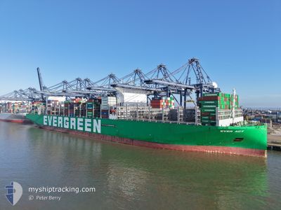
EVER ACT
Cargo D
Current Trip
| Time Travelled | 20 days |
|---|---|
| Remaining Time | 6 days |
| Distance Travelled | 8120.59 nm |
| Remaining Distance | 2768.23 nm |
| AVG Speed | 16.7 Knots |
| MAX Speed | 21.6 Knots |
| AVG Wind | 15.1 knots |
| MAX Wind | 33.7 knots |
| MIN Temp | 3.2°C / 37.76°F |
| MAX Temp | 28.3°C / 82.94°F |
| Draught | 12.2 m |
| Position Received | 3 d ago |
Current Position
| Longitude | --- |
|---|---|
| Latitude | --- |
| Status | Under way using engine |
| Speed | 18.4 Knots |
| Course | 75.2° |
| Area | Indian Ocean |
| Station | T-AIS |
| Position Received | 3 d ago |
Info
Information
The current position of EVER ACT is in Indian Ocean with coordinates -34.26592° / 25.85870° as reported on 2025-12-05 04:40 by AIS to our vessel tracker app. The vessel's current speed is 18.4 Knots and is heading at the port of COLOMBO. The estimated time of arrival as calculated by MyShipTracking vessel tracking app is 2025-12-15 09:34 LT
The vessel EVER ACT (IMO: 9893905, MMSI: 352978199) is a Cargo D It's sailing under the flag of [PA] Panama.
In this page you can find informations about the vessels current position, last detected port calls, and current voyage information. If the vessels is not in coverage by AIS you will find the latest position.
The current position of EVER ACT is detected by our AIS receivers and we are not responsible for the reliability of the data. The last position was recorded while the vessel was in Coverage by the Ais receivers of our vessel tracking app.
The current draught of EVER ACT as reported by AIS is 12.2 meters
Weather
| Temperature | 25.1°C / 77.18°F |
|---|---|
| Wind Speed | 15 knots |
| Direction | 69° ENE |
| Pressure | 1014.6 hPa |
| Humidity | 89.5 % |
| Cloud Coverage | 8 % |
Featured Company
Last Port Calls
| Port | Arrival | Departure | Time In Port |
|---|---|---|---|
| 2025-11-13 23:32 | 2025-11-18 05:31 | 4 d | |
| 2025-11-01 22:15 | 2025-11-06 02:31 | 4 d | |
| 2025-10-02 12:09 | 2025-10-03 23:45 | 1 d |
Last Trips
| Origin | Departure | Destination | Arrival | Distance | |
|---|---|---|---|---|---|
| 2025-11-06 02:31 | 2025-11-13 23:32 | 562.25 nm | |||
| 2025-10-03 23:45 | 2025-11-01 22:15 | 11928.83 nm | |||
| 2025-09-28 14:00 | 2025-10-02 12:09 | 1470.59 nm |
Events
| Time | Event | Details | Position / Dest | Info |
|---|---|---|---|---|
| 2025-12-05 04:48 | Status Changed | Default Under way using engine |
-34.25560 / 25.90508
DEHAM>LKCMB
|
Speed: 18.4 kn Course: 75.2° |
| 2025-12-05 04:40 | OUT of Coverage |
-34.26592 / 25.85870
Indian Ocean
DEHAM>LKCMB
|
Speed: 18.4 kn Course: 75.2° |
|
| 2025-12-05 04:37 | Status Changed | Under way using engine Default |
-34.27082 / 25.83655
DEHAM>LKCMB
|
Speed: 18.4 kn Course: 75° |
| 2025-12-05 04:35 | Status Changed | Default Under way using engine |
-34.27242 / 25.82921
DEHAM>LKCMB
|
Speed: 18.4 kn Course: 75° |
| 2025-12-05 03:23 | Status Changed | Under way using engine Default |
-34.38127 / 25.39653
DEHAM>LKCMB
|
Speed: 18.5 kn Course: 74° |
| 2025-12-05 03:20 | Status Changed | Default Under way using engine |
-34.38566 / 25.37842
DEHAM>LKCMB
|
Speed: 18.5 kn Course: 73.6° |
| 2025-12-05 03:03 | Status Changed | Under way using engine Default |
-34.41028 / 25.27582
DEHAM>LKCMB
|
Speed: 18.4 kn Course: 74° |
| 2025-12-05 02:55 | Status Changed | Default Under way using engine |
-34.42139 / 25.22933
DEHAM>LKCMB
|
Speed: 18.4 kn Course: 73.2° |
| 2025-12-05 02:48 | Status Changed | Under way using engine Default |
-34.43194 / 25.18556
DEHAM>LKCMB
|
Speed: 18.4 kn Course: 74° |
| 2025-12-05 02:43 | Status Changed | Default Under way using engine |
-34.43882 / 25.15679
DEHAM>LKCMB
|
Speed: 18.4 kn Course: 74° |