
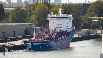
ERRIA SWAN
Oil/Chemical Tanker
Current Trip
| Time Travelled | 1 day |
|---|---|
| Remaining Time | --- |
| Distance Travelled | 131.61 nm |
| Remaining Distance | --- |
| AVG Speed | 9.1 Knots |
| MAX Speed | 11.8 Knots |
| AVG Wind | 9.4 knots |
| MAX Wind | 15.3 knots |
| MIN Temp | 24.4°C / 75.92°F |
| MAX Temp | 27.2°C / 80.96°F |
| Draught | 7.1 m |
| Position Received | 1 d ago |
Current Position
| Longitude | --- |
|---|---|
| Latitude | --- |
| Status | Under way using engine |
| Speed | 11.7 Knots |
| Course | 104.1° |
| Area | Caribbean Sea |
| Station | T-AIS |
| Position Received | 1 d ago |
Info
Information
The current position of ERRIA SWAN is in Caribbean Sea with coordinates 13.11680° / -59.67491° as reported on 2025-03-14 17:10 by AIS to our vessel tracker app. The vessel's current speed is 11.7 Knots
The vessel ERRIA SWAN (IMO: 9347748, MMSI: 220644000) is a Oil/Chemical Tanker that was built in 2006 ( 19 years old ). It's sailing under the flag of [DK] Denmark.
In this page you can find informations about the vessels current position, last detected port calls, and current voyage information. If the vessels is not in coverage by AIS you will find the latest position.
The current position of ERRIA SWAN is detected by our AIS receivers and we are not responsible for the reliability of the data. The last position was recorded while the vessel was in Coverage by the Ais receivers of our vessel tracking app.
The current draught of ERRIA SWAN as reported by AIS is 7.1 meters
Weather
| Temperature | 26.9°C / 80.42°F |
|---|---|
| Wind Speed | 9 knots |
| Direction | 112° ESE |
| Pressure | 1011.7 hPa |
| Humidity | 75.7 % |
| Cloud Coverage | 98 % |
Featured Company
Last Port Calls
| Port | Arrival | Departure | Time In Port |
|---|---|---|---|
| 2025-03-12 19:47 | 2025-03-13 23:24 | 1 d | |
| 2025-03-11 10:27 | 2025-03-12 13:41 | 1 d | |
| 2025-03-09 11:49 | 2025-03-11 00:42 | 1 d | |
| 2025-03-05 02:03 | 2025-03-06 16:25 | 1 d | |
| 2025-03-04 09:23 | 2025-03-04 16:35 | 7 h | |
| 2025-02-27 08:25 | 2025-03-02 18:09 | 3 d | |
| 2025-02-25 06:03 | 2025-02-26 14:16 | 1 d | |
| 2025-02-22 10:31 | 2025-02-23 17:15 | 1 d | |
| 2025-02-16 22:02 | 2025-02-17 18:31 | 20 h | |
| 2025-02-11 09:58 | 2025-02-12 12:37 | 1 d |
Most Visited Ports (Last year)
| Port | Arrivals | |
|---|---|---|
| 7 | ||
| 7 | ||
| 4 | ||
| 3 | ||
| 3 | ||
| 2 |
Last Trips
| Origin | Departure | Destination | Arrival | Distance | |
|---|---|---|---|---|---|
| 2025-03-12 13:41 | 2025-03-12 19:47 | 43.08 nm | |||
| 2025-03-11 00:42 | 2025-03-11 10:27 | 112.74 nm | |||
| 2025-03-06 16:25 | 2025-03-09 11:49 | 250.98 nm | |||
| 2025-03-04 16:35 | 2025-03-05 02:03 | 32.26 nm | |||
| 2025-03-02 18:09 | 2025-03-04 09:23 | 384.32 nm | |||
| 2025-02-26 14:16 | 2025-02-27 08:25 | 122.57 nm | |||
| 2025-02-23 17:15 | 2025-02-25 06:03 | 329.26 nm | |||
| 2025-02-17 18:31 | 2025-02-22 10:31 | 608.12 nm | |||
| 2025-02-12 12:37 | 2025-02-16 22:02 | 153.14 nm | |||
| 2025-02-10 18:47 | 2025-02-11 09:58 | 124.70 nm |
Events
| Time | Event | Details | Position / Dest | Info |
|---|---|---|---|---|
| 2025-03-14 18:46 | STOP Moving | 6.06 nm, South East of BRIDGETOWN |
13.05477 / -59.54318
LCCDS>BBBGI
|
Speed: 0.3 kn Course: 62° |
| 2025-03-14 17:11 | Status Changed | Default Under way using engine |
13.11619 / -59.67211
LCCDS>BBBGI
|
Speed: 11.7 kn Course: 104.1° |
| 2025-03-14 17:10 | OUT of Coverage |
13.11680 / -59.67491
Caribbean Sea
|
Speed: 11.7 kn Course: 104.1° |
|
| 2025-03-14 16:50 | Change Sea Area | Barbados part of the Caribbean Sea Saint Lucia part of the Caribbean Sea |
13.14527 / -59.73735
Caribbean Sea
LCCDS>BBBGI
|
Speed: 11.5 kn Course: 113.7° |
| 2025-03-14 16:49 | Status Changed | Under way using engine Default |
13.14610 / -59.73930
LCCDS>BBBGI
|
Speed: 11.5 kn Course: 113° |
| 2025-03-14 16:40 | IN Coverage |
13.14527 / -59.73735
Caribbean Sea
LCCDS>BBBGI
|
Speed: 11.5 kn Course: 113.7° |
|
| 2025-03-14 07:28 | Status Changed | Default Under way using engine |
13.85097 / -61.19844
LCCDS>BBBGI
|
Speed: 10.9 kn Course: 182.5° |
| 2025-03-14 07:22 | OUT of Coverage |
13.86859 / -61.19743
Caribbean Sea
LCCDS>BBBGI
|
Speed: 10.9 kn Course: 182.5° |
|
| 2025-03-14 07:20 | Status Changed | Under way using engine Default |
13.87575 / -61.19709
LCCDS>BBBGI
|
Speed: 11 kn Course: 182° |
| 2025-03-14 07:16 | Status Changed | Default Under way using engine |
13.88792 / -61.19660
LCCDS>BBBGI
|
Speed: 10.7 kn Course: 180.6° |