

ENERGY GLORY
Tanker
Current Trip
US FREEPORT
| Time Travelled | 2 days |
|---|---|
| Remaining Time | --- |
| Distance Travelled | 832.00 nm |
| Remaining Distance | --- |
| AVG Speed | 13.1 Knots |
| MAX Speed | 21.1 Knots |
| AVG Wind | 9.9 knots |
| MAX Wind | 25.2 knots |
| MIN Temp | 3.6°C / 38.48°F |
| MAX Temp | 13.8°C / 56.84°F |
| Draught | 9.7 m |
| Position Received | 12 h, 18 m ago |
Current Position
| Longitude | --- |
|---|---|
| Latitude | --- |
| Status | Under way using engine |
| Speed | 20.3 Knots |
| Course | 212.4° |
| Area | Celtic Sea |
| Station | T-AIS |
| Position Received | 12 h, 18 m ago |
Information
The current position of ENERGY GLORY is in Celtic Sea with coordinates 48.39356° / -6.26635° as reported on 2025-02-13 10:37 by AIS to our vessel tracker app. The vessel's current speed is 20.3 Knots
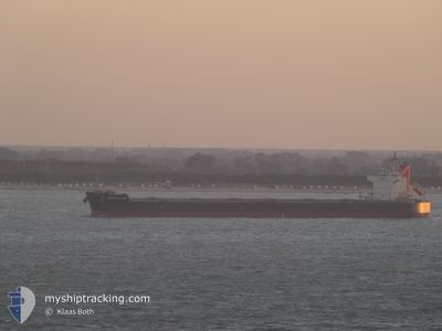
The vessel ENERGY GLORY (IMO: 9752565, MMSI: 431776000) is a Tanker It's sailing under the flag of [JP] Japan.
In this page you can find informations about the vessels current position, last detected port calls, and current voyage information. If the vessels is not in coverage by AIS you will find the latest position.
The current position of ENERGY GLORY is detected by our AIS receivers and we are not responsible for the reliability of the data. The last position was recorded while the vessel was in Coverage by the Ais receivers of our vessel tracking app.
The current draught of ENERGY GLORY as reported by AIS is 9.7 meters
Weather
| Temperature | 13.4°C / 56.12°F |
|---|---|
| Wind Speed | 25 knots |
| Direction | 197° SSW |
| Pressure | 1013.8 hPa |
| Humidity | 90.2 % |
| Cloud Coverage | 100 % |
Featured Company
Last Port Calls
| Port | Arrival | Departure | Time In Port |
|---|---|---|---|
| 2025-02-10 08:42 | 2025-02-11 10:56 | 1 d | |
| 2025-01-27 12:13 | 2025-01-28 13:11 | 1 d | |
| 2024-12-13 04:58 | 2024-12-14 10:21 | 1 d |
Most Visited Ports (Last year)
| Port | Arrivals | |
|---|---|---|
| 4 | ||
| 1 | ||
| 1 | ||
| 1 |
Last Trips
| Origin | Departure | Destination | Arrival | Distance | |
|---|---|---|---|---|---|
| 2025-01-28 08:11 | 2025-02-10 08:42 | 4768.04 nm | |||
| 2024-12-14 19:21 | 2025-01-27 07:13 | 16136.64 nm | |||
| 2024-11-05 11:18 | 2024-12-13 13:58 | 16120.52 nm |
Events
| Time | Event | Details | Position / Dest | Info |
|---|---|---|---|---|
| 2025-02-13 10:40 | Status Changed | Default Under way using engine |
48.37660 / -6.28277
US FREEPORT
|
Speed: 20.3 kn Course: 212.4° |
| 2025-02-13 10:37 | OUT of Coverage |
48.39356 / -6.26635
Celtic Sea
US FREEPORT
|
Speed: 20.3 kn Course: 212.4° |
|
| 2025-02-13 10:35 | Status Changed | Under way using engine Default |
48.40379 / -6.25657
US FREEPORT
|
Speed: 20.3 kn Course: 213° |
| 2025-02-13 10:26 | Status Changed | Default Under way using engine |
48.44740 / -6.21458
US FREEPORT
|
Speed: 20.4 kn Course: 212.9° |
| 2025-02-13 10:08 | Status Changed | Under way using engine Default |
48.53174 / -6.13344
US FREEPORT
|
Speed: 20.4 kn Course: 213° |
| 2025-02-13 09:58 | IN Coverage |
48.52930 / -6.13588
Celtic Sea
US FREEPORT
|
Speed: 20.4 kn Course: 213.1° |
|
| 2025-02-13 08:15 | Status Changed | Default Under way using engine |
49.03129 / -5.54286
US FREEPORT
|
Speed: 20.2 kn Course: 231° |
| 2025-02-13 08:06 | OUT of Coverage |
49.06302 / -5.48302
Celtic Sea
US FREEPORT
|
Speed: 20.2 kn Course: 231° |
|
| 2025-02-13 07:56 | Change Sea Area | French part of the Celtic Sea United Kingdom part of the English Channel |
49.09886 / -5.41463
Celtic Sea
US FREEPORT
|
Speed: 19.6 kn Course: 231.7° |
| 2025-02-13 07:56 | Status Changed | Under way using engine Default |
49.09886 / -5.41463
US FREEPORT
|
Speed: 19.5 kn Course: 232° |