

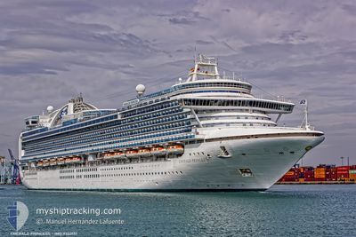
EMERALD PRINCESS
Passengers Ship

Current Trip
AUA
| Time Travelled | 3 days |
|---|---|
| Remaining Time | --- |
| Distance Travelled | 1092.42 nm |
| Remaining Distance | --- |
| AVG Speed | 16.7 Knots |
| MAX Speed | 20.9 Knots |
| AVG Wind | 13.7 knots |
| MAX Wind | 21 knots |
| MIN Temp | 24.3°C / 75.74°F |
| MAX Temp | 26.8°C / 80.24°F |
| Draught | 8.8 m |
| Position Received | 3 d ago |
Current Position
| Longitude | --- |
|---|---|
| Latitude | --- |
| Status | Under way using engine |
| Speed | 19.2 Knots |
| Course | 167.1° |
| Area | North Atlantic Ocean |
| Station | T-AIS |
| Position Received | 3 d ago |
Information
The current position of EMERALD PRINCESS is in North Atlantic Ocean with coordinates 24.24954° / -79.34333° as reported on 2025-02-17 04:19 by AIS to our vessel tracker app. The vessel's current speed is 19.2 Knots
The vessel EMERALD PRINCESS (IMO: 9333151, MMSI: 310531000) is a Passengers Ship that was built in 2007 ( 18 years old ). It's sailing under the flag of [BM] Bermuda.
In this page you can find informations about the vessels current position, last detected port calls, and current voyage information. If the vessels is not in coverage by AIS you will find the latest position.
The current position of EMERALD PRINCESS is detected by our AIS receivers and we are not responsible for the reliability of the data. The last position was recorded while the vessel was in Coverage by the Ais receivers of our vessel tracking app.
The current draught of EMERALD PRINCESS as reported by AIS is 8.8 meters
Weather
| Temperature | 25.6°C / 78.08°F |
|---|---|
| Wind Speed | 21 knots |
| Direction | 95° E |
| Pressure | 1011.9 hPa |
| Humidity | 85.1 % |
| Cloud Coverage | 83 % |


Featured Company
Last Port Calls
| Port | Arrival | Departure | Time In Port |
|---|---|---|---|
| 2025-02-16 11:15 | 2025-02-16 21:30 | 10 h | |
| 2025-02-12 13:11 | 2025-02-12 23:54 | 10 h | |
| 2025-02-11 22:49 | 2025-02-12 02:19 | 3 h | |
| 2025-02-10 11:22 | 2025-02-10 20:06 | 8 h | |
| 2025-02-08 11:39 | 2025-02-08 21:55 | 10 h | |
| 2025-02-04 11:12 | 2025-02-04 22:03 | 10 h | |
| 2025-01-31 12:49 | 2025-02-01 00:19 | 11 h | |
| 2025-01-30 22:37 | 2025-01-31 00:59 | 2 h | |
| 2025-01-29 11:23 | 2025-01-29 20:11 | 8 h | |
| 2025-01-23 11:18 | 2025-01-23 21:13 | 9 h |
Most Visited Ports (Last year)
| Port | Arrivals | |
|---|---|---|
| 19 | ||
| 11 | ||
| 10 | ||
| 10 | ||
| 9 | ||
| 9 |
Last Trips
| Origin | Departure | Destination | Arrival | Distance | |
|---|---|---|---|---|---|
| 2025-02-12 17:54 | 2025-02-16 06:15 | 1306.02 nm | |||
| 2025-02-11 21:19 | 2025-02-12 07:11 | 196.28 nm | |||
| 2025-02-10 15:06 | 2025-02-11 17:49 | 302.94 nm | |||
| 2025-02-08 17:55 | 2025-02-10 06:22 | 489.05 nm | |||
| 2025-02-04 17:03 | 2025-02-08 07:39 | 1184.01 nm | |||
| 2025-01-31 18:19 | 2025-02-04 06:12 | 1303.99 nm | |||
| 2025-01-30 19:59 | 2025-01-31 06:49 | 196.60 nm | |||
| 2025-01-29 15:11 | 2025-01-30 17:37 | 302.05 nm | |||
| 2025-01-23 16:13 | 2025-01-29 06:23 | 1748.97 nm | |||
| 2025-01-19 17:57 | 2025-01-23 06:18 | 1267.52 nm |
Events
| Time | Event | Details | Position / Dest | Info |
|---|---|---|---|---|
| 2025-02-19 11:45 | STOP Moving |
12.51882 / -70.04230
AUA
|
Speed: Course: 130° |
|
| 2025-02-17 04:23 | Status Changed | Default Under way using engine |
24.22547 / -79.33725
AUA
|
Speed: 19.2 kn Course: 167.1° |
| 2025-02-17 04:19 | OUT of Coverage |
24.24954 / -79.34333
North Atlantic Ocean
AUA
|
Speed: 19.2 kn Course: 167.1° |
|
| 2025-02-17 03:05 | Status Changed | Under way using engine Default |
24.65122 / -79.45302
AUA
|
Speed: 20.4 kn Course: 167° |
| 2025-02-17 03:05 | IN Coverage |
24.65122 / -79.45302
North Atlantic Ocean
AUA
|
Speed: 20.3 kn Course: 165.3° |
|
| 2025-02-17 00:29 | Status Changed | Default Under way using engine |
25.47691 / -79.66248
AUA
|
Speed: 18.3 kn Course: 160.6° |
| 2025-02-17 00:24 | OUT of Coverage |
25.50393 / -79.67271
North Atlantic Ocean
AUA
|
Speed: 18.3 kn Course: 160.6° |
|
| 2025-02-17 00:15 | Change Sea Area | Bahamas part of the North Atlantic Ocean United States part of the North Atlantic Ocean |
25.54489 / -79.68914
North Atlantic Ocean
AUA
|
Speed: 18.2 kn Course: 157.3° |
| 2025-02-16 21:30 | PORT DEPARTURE |
|
26.09342 / -80.10884
AUA
|
Speed: 8 kn Course: 92° |
| 2025-02-16 21:25 | START Moving |
26.09024 / -80.11672
[US] PORT EVERGLADES
|
Speed: 3.1 kn Course: 358° |