
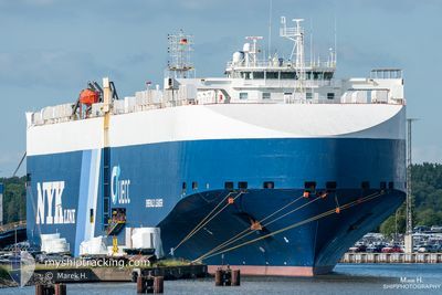
EMERALD LEADER
Vehicles Carrier
Current Trip
| Time Travelled | 8 days |
|---|---|
| Remaining Time | 2 days |
| Distance Travelled | 2436.01 nm |
| Remaining Distance | 928.20 nm |
| AVG Speed | 14.8 Knots |
| MAX Speed | 18 Knots |
| AVG Wind | 9.8 knots |
| MAX Wind | 28 knots |
| MIN Temp | 9°C / 48.2°F |
| MAX Temp | 19.7°C / 67.46°F |
| Draught | 8.4 m |
| Position Received | 3 h, 36 m ago |
Current Position
| Longitude | --- |
|---|---|
| Latitude | --- |
| Status | Under way using engine |
| Speed | 16.4 Knots |
| Course | 0.7° |
| Area | North Atlantic Ocean |
| Station | T-AIS |
| Position Received | 3 h, 36 m ago |
Info
Information
The current position of EMERALD LEADER is in North Atlantic Ocean with coordinates 41.34924° / -9.79188° as reported on 2025-12-11 04:08 by AIS to our vessel tracker app. The vessel's current speed is 16.4 Knots and is heading at the port of VLISSINGEN. The estimated time of arrival as calculated by MyShipTracking vessel tracking app is 2025-12-13 12:24 LT
The vessel EMERALD LEADER (IMO: 9361811, MMSI: 308688000) is a Vehicles Carrier that was built in 2007 ( 18 years old ). It's sailing under the flag of [BS] Bahamas.
In this page you can find informations about the vessels current position, last detected port calls, and current voyage information. If the vessels is not in coverage by AIS you will find the latest position.
The current position of EMERALD LEADER is detected by our AIS receivers and we are not responsible for the reliability of the data. The last position was recorded while the vessel was in Coverage by the Ais receivers of our vessel tracking app.
The current draught of EMERALD LEADER as reported by AIS is 8.4 meters
Weather
| Temperature | 14.3°C / 57.74°F |
|---|---|
| Wind Speed | 15 knots |
| Direction | 212° SSW |
| Pressure | 1020.2 hPa |
| Humidity | 72.5 % |
| Cloud Coverage | 100 % |
Featured Company
Last Port Calls
| Port | Arrival | Departure | Time In Port |
|---|---|---|---|
| 2025-12-02 10:07 | 2025-12-03 00:50 | 14 h | |
| 2025-11-30 15:28 | 2025-12-01 06:52 | 15 h | |
| 2025-11-27 12:21 | 2025-11-28 02:35 | 14 h | |
| 2025-11-22 03:00 | 2025-11-22 13:29 | 10 h | |
| 2025-11-20 04:53 | 2025-11-20 18:45 | 13 h | |
| 2025-11-18 01:41 | 2025-11-18 12:58 | 11 h | |
| 2025-11-15 03:54 | 2025-11-16 01:48 | 21 h | |
| 2025-11-10 16:40 | 2025-11-13 16:02 | 2 d | |
| 2025-11-08 07:14 | 2025-11-08 17:57 | 10 h | |
| 2025-11-06 19:53 | 2025-11-08 00:47 | 1 d |
Last Trips
| Origin | Departure | Destination | Arrival | Distance | |
|---|---|---|---|---|---|
| 2025-12-01 06:52 | 2025-12-02 10:07 | 402.65 nm | |||
| 2025-11-28 02:35 | 2025-11-30 15:28 | 945.97 nm | |||
| 2025-11-22 13:29 | 2025-11-27 12:21 | 750.22 nm | |||
| 2025-11-20 18:45 | 2025-11-22 03:00 | 435.68 nm | |||
| 2025-11-18 12:58 | 2025-11-20 04:53 | 557.56 nm | |||
| 2025-11-16 01:48 | 2025-11-18 01:41 | 708.15 nm | |||
| 2025-11-13 16:02 | 2025-11-15 03:54 | 548.58 nm | |||
| 2025-11-08 17:57 | 2025-11-10 16:40 | 441.17 nm | |||
| 2025-11-08 00:47 | 2025-11-08 07:14 | 70.40 nm | |||
| 2025-10-26 20:49 | 2025-11-06 19:53 | 3620.99 nm |
Events
| Time | Event | Details | Position / Dest | Info |
|---|---|---|---|---|
| 2025-12-11 04:16 | Status Changed | Default Under way using engine |
41.38633 / -9.79094
NLVLI
|
Speed: 16.4 kn Course: 0.7° |
| 2025-12-11 04:08 | Status Changed | Under way using engine Default |
41.34924 / -9.79188
NLVLI
|
Speed: 16.4 kn Course: 360° |
| 2025-12-11 04:08 | OUT of Coverage |
41.34924 / -9.79188
North Atlantic Ocean
NLVLI
|
Speed: 16.4 kn Course: 0.7° |
|
| 2025-12-11 03:29 | Status Changed | Default Under way using engine |
41.17574 / -9.78945
NLVLI
|
Speed: 16 kn Course: 358.3° |
| 2025-12-11 03:00 | Status Changed | Under way using engine Default |
41.04965 / -9.78579
NLVLI
|
Speed: 16 kn Course: 355° |
| 2025-12-11 03:00 | IN Coverage |
41.05268 / -9.78605
North Atlantic Ocean
NLVLI
|
Speed: 16 kn Course: 356.7° |
|
| 2025-12-11 01:36 | Status Changed | Default Under way using engine |
40.67507 / -9.76418
NLVLI
|
Speed: 16.9 kn Course: 4° |
| 2025-12-11 01:30 | OUT of Coverage |
40.64961 / -9.76576
North Atlantic Ocean
NLVLI
|
Speed: 16.9 kn Course: 4° |
|
| 2025-12-11 01:05 | Status Changed | Under way using engine Default |
40.53609 / -9.77357
NLVLI
|
Speed: 16.3 kn Course: 4° |
| 2025-12-11 01:05 | IN Coverage |
40.54656 / -9.77281
North Atlantic Ocean
NLVLI
|
Speed: 16.5 kn Course: 1.9° |