

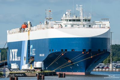
EMERALD LEADER
Vehicles Carrier

Current Trip
| Time Travelled | 4 days |
|---|---|
| Remaining Time | -17 mins |
| Distance Travelled | 1060.01 nm |
| Remaining Distance | 26.20 nm |
| AVG Speed | 13.1 Knots |
| MAX Speed | 16.6 Knots |
| AVG Wind | 17.4 knots |
| MAX Wind | 28.3 knots |
| MIN Temp | 12.1°C / 53.78°F |
| MAX Temp | 16.3°C / 61.34°F |
| Dybgang | 8.7 m |
| Position Modtaget | 3 h, 3 m siden |
Current Position
| Longitude | --- |
|---|---|
| Latitude | --- |
| Status | Under way using engine |
| Fart | 13.3 Knots |
| Kurs | 73.1° |
| Område | Balearic Sea |
| Station | T-AIS |
| Position Modtaget | 3 h, 3 m siden |
Information
The current position of EMERALD LEADER is in Balearic Sea with coordinates 39.59450° / 0.12740° as reported on 2025-03-05 15:28 by AIS to our vessel tracker app. The vessel's current speed is 13.3 Knots and is heading at the port of SAGUNTO. The estimated time of arrival as calculated by MyShipTracking vessel tracking app is 2025-03-05 18:14 LT
The vessel EMERALD LEADER (IMO: 9361811, MMSI: 308688000) is a Vehicles Carrier that was built in 2007 ( 18 år gamle ). It's sailing under the flag of [BS] Bahamas.
In this page you can find informations about the vessels current position, last detected port calls, and current voyage information. If the vessels is not in coverage by AIS you will find the latest position.
The current position of EMERALD LEADER is detected by our AIS receivers and we are not responsible for the reliability of the data. The last position was recorded while the vessel was in Coverage by the Ais receivers of our vessel tracking app.
The current draught of EMERALD LEADER as reported by AIS is 8.7 meters
Weather
| Temperature | 14.1°C / 57.38°F |
|---|---|
| Wind Speed | 19 knots |
| Direction | 75° ENE |
| Pressure | 1017.9 hPa |
| Humidity | 86.9 % |
| Cloud Coverage | 100 % |


Featured Company
Last Port Calls
| Port | Arrival | Departure | Time In Port |
|---|---|---|---|
| 2025-02-28 14:21 | 2025-03-01 11:11 | 20 h | |
| 2025-02-25 05:12 | 2025-02-26 17:12 | 1 d | |
| 2025-02-17 12:21 | 2025-02-20 15:01 | 3 d | |
| 2025-02-12 15:44 | 2025-02-13 12:22 | 20 h | |
| 2025-02-08 05:16 | 2025-02-08 12:19 | 7 h | |
| 2025-01-31 08:20 | 2025-02-01 14:15 | 1 d | |
| 2025-01-28 19:32 | 2025-01-29 04:40 | 9 h | |
| 2025-01-24 22:36 | 2025-01-26 01:19 | 1 d | |
| 2025-01-22 11:05 | 2025-01-22 23:57 | 12 h | |
| 2025-01-19 11:14 | 2025-01-19 19:22 | 8 h |
Last Trips
| Origin | Departure | Destination | Arrival | Distance | |
|---|---|---|---|---|---|
| 2025-02-26 17:12 | 2025-02-28 15:21 | 714.08 nm | |||
| 2025-02-20 16:01 | 2025-02-25 05:12 | 662.75 nm | |||
| 2025-02-13 13:22 | 2025-02-17 13:21 | 511.54 nm | |||
| 2025-02-08 13:19 | 2025-02-12 16:44 | 1110.66 nm | |||
| 2025-02-01 17:15 | 2025-02-08 06:16 | 2406.01 nm | |||
| 2025-01-29 06:40 | 2025-01-31 11:20 | 415.18 nm | |||
| 2025-01-26 02:19 | 2025-01-28 21:32 | 947.18 nm | |||
| 2025-01-23 00:57 | 2025-01-24 23:36 | 547.05 nm | |||
| 2025-01-19 20:22 | 2025-01-22 12:05 | 970.70 nm | |||
| 2025-01-17 06:07 | 2025-01-19 12:14 | 712.79 nm |
Events
| Tid | Hændelsen | Detaljer | Position / Dest | Info |
|---|---|---|---|---|
| 2025-03-05 15:36 | Status er ændret | Default Under way using engine |
39.60293 / .16274
ES VIGO > ES SAG
|
Fart: 13.3 kn Kurs: 73.1° |
| 2025-03-05 15:28 | Udenfor Dækning |
39.59450 / .12740
Balearic Sea
|
Fart: 13.3 kn Kurs: 73.1° |
|
| 2025-03-05 07:26 | Status er ændret | Under way using engine Default |
39.65069 / .18038
ES VIGO > ES SAG
|
Fart: 1.8 kn Kurs: 151° |
| 2025-03-05 07:26 | Indenfor Dækning |
39.65054 / .17885
Balearic Sea
|
Fart: 2.2 kn Kurs: 267.3° |
|
| 2025-03-04 22:32 | Status er ændret | Default Under way using engine |
39.61277 / .13016
ES VIGO > ES SAG
|
Fart: 6.2 kn Kurs: 75.6° |
| 2025-03-04 22:28 | Udenfor Dækning |
39.60907 / .11583
Balearic Sea
|
Fart: 6.2 kn Kurs: 75.6° |
|
| 2025-03-04 07:20 | Status er ændret | Under way using engine Default |
39.12833 / .17492
ES VIGO > ES SAG
|
Fart: 12.9 kn Kurs: 330° |
| 2025-03-04 07:01 | Status er ændret | Default Under way using engine |
39.06783 / .22186
ES VIGO > ES SAG
|
Fart: 13.2 kn Kurs: 331° |
| 2025-03-04 06:50 | Fundet i havområde | Spanish part of the Balearic Sea |
39.03528 / .24628
Balearic Sea
|
Fart: 13.2 kn Kurs: 331° |
| 2025-03-04 06:50 | Status er ændret | Under way using engine Default |
39.03528 / .24628
ES VIGO > ES SAG
|
Fart: 12.8 kn Kurs: 330° |