
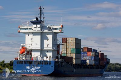
ELBWAVE
Container Ship
Current Trip
| Time Travelled | 23 h, 11 mins |
|---|---|
| Remaining Time | 17 h, 11 mins |
| Distance Travelled | 229.16 nm |
| Remaining Distance | 263.09 nm |
| AVG Speed | 9.9 Knots |
| MAX Speed | 17.1 Knots |
| AVG Wind | 8.4 knots |
| MAX Wind | 14.4 knots |
| MIN Temp | 7.4°C / 45.32°F |
| MAX Temp | 17.1°C / 62.78°F |
| Draught | 7.4 m |
| Position Received | Now |
Current Position
| Longitude | 13.73952° |
|---|---|
| Latitude | 54.94555° |
| Status | Under way using engine |
| Speed | 15.1 Knots |
| Course | 72.7° |
| Area | Baltic Sea |
| Station | T-AIS |
| Position Received | Now |
Info
Information
The current position of ELBWAVE is in Baltic Sea with coordinates 54.94555° / 13.73952° as reported on 2024-04-30 03:19 by AIS to our vessel tracker app. The vessel's current speed is 15.1 Knots and is heading at the port of KLAIPEDA. The estimated time of arrival as calculated by MyShipTracking vessel tracking app is 2024-04-30 20:31 LT
The vessel ELBWAVE (IMO: 9504035, MMSI: 209276000) is a Container Ship that was built in 2011 ( 13 years old ). It's sailing under the flag of [CY] Cyprus.
In this page you can find informations about the vessels current position, last detected port calls, and current voyage information. If the vessels is not in coverage by AIS you will find the latest position.
The current position of ELBWAVE is detected by our AIS receivers and we are not responsible for the reliability of the data. The last position was recorded while the vessel was in Coverage by the Ais receivers of our vessel tracking app.
The current draught of ELBWAVE as reported by AIS is 7.4 meters
Weather
| Temperature | 8.4°C / 47.12°F |
|---|---|
| Wind Speed | 12 knots |
| Direction | 86° E |
| Pressure | 1024.6 hPa |
| Humidity | 78.1 % |
| Cloud Coverage | 87 % |
Featured Company
Last Port Calls
| Port | Arrival | Departure | Time In Port |
|---|---|---|---|
| 2024-04-26 19:56 | 2024-04-29 04:09 | 2 d | |
| 2024-04-26 02:06 | 2024-04-26 10:13 | 8 h | |
| 2024-04-22 10:50 | 2024-04-23 16:08 | 1 d | |
| 2024-04-21 03:57 | 2024-04-21 16:06 | 12 h | |
| 2024-04-19 10:23 | 2024-04-19 23:36 | 13 h | |
| 2024-04-16 20:27 | 2024-04-17 21:17 | 1 d | |
| 2024-04-15 20:11 | 2024-04-16 12:28 | 16 h | |
| 2024-04-13 15:00 | 2024-04-14 00:48 | 9 h | |
| 2024-04-11 15:27 | 2024-04-12 11:07 | 19 h | |
| 2024-04-08 03:02 | 2024-04-09 08:30 | 1 d |
Most Visited Ports (Last year)
| Port | Arrivals | |
|---|---|---|
| 31 | ||
| 30 | ||
| 14 | ||
| 13 | ||
| 9 | ||
| 9 |
Last Trips
| Origin | Departure | Destination | Arrival | Distance | |
|---|---|---|---|---|---|
| 2024-04-26 12:13 | 2024-04-26 21:56 | 114.57 nm | |||
| 2024-04-23 18:08 | 2024-04-26 04:06 | 757.87 nm | |||
| 2024-04-21 18:06 | 2024-04-22 12:50 | 271.19 nm | |||
| 2024-04-20 01:36 | 2024-04-21 05:57 | 308.56 nm | |||
| 2024-04-17 23:17 | 2024-04-19 12:23 | 445.64 nm | |||
| 2024-04-16 14:28 | 2024-04-16 22:27 | 113.70 nm | |||
| 2024-04-14 02:48 | 2024-04-15 22:11 | 489.19 nm | |||
| 2024-04-12 13:07 | 2024-04-13 17:00 | 435.64 nm | |||
| 2024-04-09 10:30 | 2024-04-11 17:27 | 722.45 nm | |||
| 2024-04-07 16:28 | 2024-04-08 05:02 | 119.53 nm |
Events
| Time | Event | Details | Position / Dest | Info |
|---|---|---|---|---|
| 2024-04-29 22:56 | Change Sea Area | German part of the Baltic Sea Danish part of the Baltic Sea |
54.41501 / 12.13127
Baltic Sea
LTKLJ
|
Speed: 15.3 kn Course: 76.7° |
| 2024-04-29 22:11 | ETA Changed | 2024/04/30 22:00 2024/04/30 00:30 |
54.41156 / 11.80326
LTKLJ
|
Speed: 15 kn Course: 90.6° |
| 2024-04-29 22:04 | ETA Changed | 2024/04/30 00:30 2024/05/01 00:30 |
54.41245 / 11.75094
LTKLJ
|
Speed: 14.7 kn Course: 97.1° |
| 2024-04-29 21:16 | Change Sea Area | Danish part of the Baltic Sea German part of the Baltic Sea |
54.50339 / 11.44035
Baltic Sea
LTKLJ
|
Speed: 15.6 kn Course: 115.4° |
| 2024-04-29 19:38 | Detected in Sea | German part of the Baltic Sea |
54.56839 / 10.78106
Baltic Sea
LTKLJ
|
Speed: 14.8 kn Course: 83° |
| 2024-04-29 19:14 | Change Sea Area | Danish part of the Baltic Sea German part of the Baltic Sea |
54.55746 / 10.61291
Baltic Sea
LTKLJ
|
Speed: 15.1 kn Course: 77.3° |
| 2024-04-29 18:17 | Change Sea Area | German part of the Baltic Sea German part of the North Sea |
54.46356 / 10.27432
Baltic Sea
LTKLJ
|
Speed: 13 kn Course: 37.6° |
| 2024-04-29 17:32 | START Moving | 1.31 nm, South West of STICKENHΟRN SPORT |
54.36557 / 10.14532
LTKLJ
|
Speed: 3.1 kn Course: 102° |
| 2024-04-29 17:25 | Status Changed | Under way using engine Moored |
54.36623 / 10.14019
LTKLJ
|
Speed: Course: 103° |
| 2024-04-29 17:05 | STOP Moving | 1.4 nm, South West of STICKENHΟRN SPORT |
54.36625 / 10.14014
LTKLJ
|
Speed: 0.3 kn Course: 103° |