

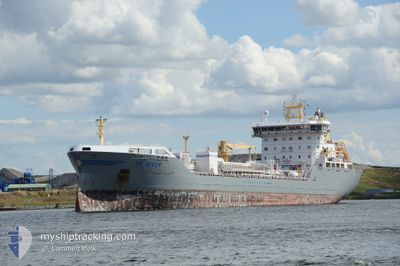
EK-RIVER
Tanker

Current Trip
| Time Travelled | 23 h, 19 mins |
|---|---|
| Remaining Time | 12 h, 22 mins |
| Distance Travelled | 233.48 nm |
| Remaining Distance | 131.60 nm |
| AVG Speed | 10.5 Knots |
| MAX Speed | 15.3 Knots |
| AVG Wind | 8.5 knots |
| MAX Wind | 15 knots |
| MIN Temp | -16.4°C / 2.48°F |
| MAX Temp | 1.3°C / 34.34°F |
| Draught | 7.5 m |
| Position Received | 5 h, 45 m ago |
Current Position
| Longitude | --- |
|---|---|
| Latitude | --- |
| Status | Under way using engine |
| Speed | 10.6 Knots |
| Course | 245.5° |
| Area | Gulf of Bothnia |
| Station | T-AIS |
| Position Received | 5 h, 45 m ago |
Information
The current position of EK-RIVER is in Gulf of Bothnia with coordinates 63.53562° / 20.72387° as reported on 2025-03-21 19:47 by AIS to our vessel tracker app. The vessel's current speed is 10.6 Knots and is heading at the port of KOKKOLA. The estimated time of arrival as calculated by MyShipTracking vessel tracking app is 2025-03-22 15:55 LT
The vessel EK-RIVER (IMO: 9808259, MMSI: 257037140) is a Tanker It's sailing under the flag of [NO] Norway.
In this page you can find informations about the vessels current position, last detected port calls, and current voyage information. If the vessels is not in coverage by AIS you will find the latest position.
The current position of EK-RIVER is detected by our AIS receivers and we are not responsible for the reliability of the data. The last position was recorded while the vessel was in Coverage by the Ais receivers of our vessel tracking app.
The current draught of EK-RIVER as reported by AIS is 7.5 meters
Weather
| Temperature | 1.3°C / 34.34°F |
|---|---|
| Wind Speed | 14 knots |
| Direction | 202° SSW |
| Pressure | 1031.6 hPa |
| Humidity | 73.3 % |
| Cloud Coverage | --- |


Featured Company
Last Port Calls
| Port | Arrival | Departure | Time In Port |
|---|---|---|---|
| 2025-03-20 16:50 | 2025-03-21 04:14 | 11 h | |
| 2025-03-19 10:45 | 2025-03-19 21:35 | 10 h | |
| 2025-03-17 12:01 | 2025-03-18 01:13 | 13 h | |
| 2025-03-15 19:18 | 2025-03-16 05:16 | 9 h | |
| 2025-03-09 14:25 | 2025-03-11 15:31 | 2 d | |
| 2025-03-05 18:55 | 2025-03-05 20:21 | 1 h | |
| 2025-03-05 02:42 | 2025-03-05 18:14 | 15 h | |
| 2025-03-03 17:51 | 2025-03-05 02:31 | 1 d | |
| 2025-03-01 20:33 | 2025-03-02 14:45 | 18 h | |
| 2025-03-01 00:14 | 2025-03-01 19:58 | 19 h |
Last Trips
| Origin | Departure | Destination | Arrival | Distance | |
|---|---|---|---|---|---|
| 2025-03-19 21:35 | 2025-03-20 16:50 | 136.82 nm | |||
| 2025-03-18 01:13 | 2025-03-19 10:45 | 227.24 nm | |||
| 2025-03-16 05:16 | 2025-03-17 12:01 | 345.58 nm | |||
| 2025-03-11 15:31 | 2025-03-15 19:18 | 1203.33 nm | |||
| 2025-03-05 20:21 | 2025-03-09 14:25 | 146.85 nm | |||
| 2025-03-05 18:14 | 2025-03-05 18:55 | 4.89 nm | |||
| 2025-03-05 02:31 | 2025-03-05 02:42 | 0.81 nm | |||
| 2025-03-02 14:45 | 2025-03-03 17:51 | 77.14 nm | |||
| 2025-03-01 19:58 | 2025-03-01 20:33 | 2.80 nm | |||
| 2025-02-28 23:27 | 2025-03-01 00:14 | 5.54 nm |
Events
| Time | Event | Details | Position / Dest | Info |
|---|---|---|---|---|
| 2025-03-21 19:54 | Status Changed | Default Under way using engine |
63.52381 / 20.69256
SESDL>FIKOK
|
Speed: 10.6 kn Course: 245.5° |
| 2025-03-21 19:47 | OUT of Coverage |
63.53562 / 20.72387
Gulf of Bothnia
|
Speed: 10.6 kn Course: 245.5° |
|
| 2025-03-21 19:46 | Change Sea Area | Swedish part of the Gulf of Bothnia Finnish part of the Gulf of Bothnia |
63.53684 / 20.72983
Gulf of Bothnia
|
Speed: 10.4 kn Course: 245.3° |
| 2025-03-21 19:46 | Status Changed | Under way using engine Default |
63.53684 / 20.72983
SESDL>FIKOK
|
Speed: 10.3 kn Course: 245° |
| 2025-03-21 19:42 | IN Coverage |
63.53684 / 20.72983
Gulf of Bothnia
|
Speed: 10.4 kn Course: 245.3° |
|
| 2025-03-21 04:10 | START Moving | 7.33 nm, South of AJOS |
65.54401 / 24.42517
SESDL>FIKOK
|
Speed: 6.4 kn Course: 213° |
| 2025-03-21 03:14 | STOP Moving | 7.2 nm, South of AJOS |
65.54590 / 24.42795
SESDL>FIKOK
|
Speed: Course: 215° |
| 2025-03-21 03:10 | START Moving | 7.15 nm, South of AJOS |
65.54668 / 24.42906
SESDL>FIKOK
|
Speed: 3.3 kn Course: 216° |
| 2025-03-21 03:02 | STOP Moving | 6.83 nm, South of AJOS |
65.55139 / 24.43686
SESDL>FIKOK
|
Speed: Course: 215° |
| 2025-03-21 02:14 | PORT DEPARTURE |
|
65.65209 / 24.50638
SESDL>FIKOK
|
Speed: 4.3 kn Course: 203° |