
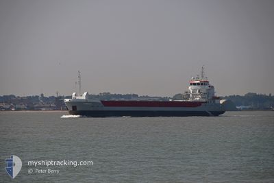
EEMS TJONGER
General Cargo
Current Trip
| Time Travelled | 2 days |
|---|---|
| Remaining Time | --- |
| Distance Travelled | 595.76 nm |
| Remaining Distance | --- |
| AVG Speed | 9.8 Knots |
| MAX Speed | 11.6 Knots |
| AVG Wind | 15.4 knots |
| MAX Wind | 29 knots |
| MIN Temp | 6.1°C / 42.98°F |
| MAX Temp | 13.8°C / 56.84°F |
| Draught | 4.9 m |
| Position Received | 1 h, 10 m ago |
Current Position
| Longitude | --- |
|---|---|
| Latitude | --- |
| Status | Under way using engine |
| Speed | 9.5 Knots |
| Course | 11.3° |
| Area | Irish Sea and St. George's Channel |
| Station | T-AIS |
| Position Received | 1 h, 10 m ago |
Info
Information
The current position of EEMS TJONGER is in Irish Sea and St. George's Channel with coordinates 52.83718° / -5.11291° as reported on 2025-02-18 11:24 by AIS to our vessel tracker app. The vessel's current speed is 9.5 Knots and is heading at the port of ELLESMERE. The estimated time of arrival as calculated by MyShipTracking vessel tracking app is 2025-02-18 23:00 LT
The vessel EEMS TJONGER (IMO: 9517240, MMSI: 246869000) is a General Cargo that was built in 2012 ( 13 years old ). It's sailing under the flag of [NL] Netherlands.
In this page you can find informations about the vessels current position, last detected port calls, and current voyage information. If the vessels is not in coverage by AIS you will find the latest position.
The current position of EEMS TJONGER is detected by our AIS receivers and we are not responsible for the reliability of the data. The last position was recorded while the vessel was in Coverage by the Ais receivers of our vessel tracking app.
The current draught of EEMS TJONGER as reported by AIS is 4.9 meters
Weather
| Temperature | 6.1°C / 42.98°F |
|---|---|
| Wind Speed | 21 knots |
| Direction | 142° SE |
| Pressure | 1016.5 hPa |
| Humidity | 73.8 % |
| Cloud Coverage | 100 % |
Featured Company
Last Port Calls
| Port | Arrival | Departure | Time In Port |
|---|---|---|---|
| 2025-02-12 07:20 | 2025-02-15 23:19 | 3 d | |
| 2025-02-06 19:48 | 2025-02-07 19:14 | 23 h | |
| 2025-02-03 07:40 | 2025-02-04 08:38 | 1 d | |
| 2025-01-24 03:41 | 2025-01-27 20:05 | 3 d | |
| 2025-01-23 19:07 | 2025-01-24 00:16 | 5 h | |
| 2025-01-23 17:31 | |||
| 2025-01-23 07:07 | |||
| 2025-01-23 02:28 | |||
| 2025-01-19 11:16 | |||
| 2025-01-16 19:09 | 2025-01-17 20:47 | 1 d |
Last Trips
| Origin | Departure | Destination | Arrival | Distance | |
|---|---|---|---|---|---|
| 2025-02-07 19:14 | 2025-02-12 07:20 | 95.96 nm | |||
| 2025-02-04 08:38 | 2025-02-06 19:48 | 519.95 nm | |||
| 2025-01-27 20:05 | 2025-02-03 07:40 | 1249.50 nm | |||
| 2025-01-24 00:16 | 2025-01-24 03:41 | 30.28 nm | |||
| 2025-01-17 20:47 | 2025-01-23 19:07 | 345.32 nm | |||
| 2025-01-17 20:47 | 2025-01-23 17:31 | 345.09 nm | |||
| 2025-01-17 20:47 | 2025-01-23 07:07 | 343.92 nm | |||
| 2025-01-17 20:47 | 2025-01-23 02:28 | 343.72 nm | |||
| 2025-01-17 20:47 | 2025-01-19 11:16 | 338.97 nm | |||
| 2025-01-13 13:25 | 2025-01-16 19:09 | 700.20 nm |
Events
| Time | Event | Details | Position / Dest | Info |
|---|---|---|---|---|
| 2025-02-18 11:31 | Status Changed | Default Under way using engine |
52.85537 / -5.10699
GBELL
|
Speed: 9.5 kn Course: 11.3° |
| 2025-02-18 11:24 | Change Sea Area | United Kingdom part of the Irish Sea and St. George's Channel United Kingdom part of the Celtic Sea |
52.83718 / -5.11291
Irish Sea and St. George's Channel
GBELL
|
Speed: 9.5 kn Course: 11.3° |
| 2025-02-18 11:24 | OUT of Coverage |
52.83718 / -5.11291
Irish Sea and St. George's Channel
GBELL
|
Speed: 9.5 kn Course: 11.3° |
|
| 2025-02-18 11:24 | Status Changed | Under way using engine Default |
52.83630 / -5.11326
GBELL
|
Speed: 8.9 kn Course: 16° |
| 2025-02-18 11:07 | IN Coverage |
52.83718 / -5.11291
Irish Sea and St. George's Channel
GBELL
|
Speed: 9.5 kn Course: 11.3° |
|
| 2025-02-17 22:35 | Status Changed | Default Under way using engine |
51.07364 / -5.82076
GBELL
|
Speed: 9.9 kn Course: 11° |
| 2025-02-17 22:29 | Status Changed | Under way using engine Default |
51.05620 / -5.82080
GBELL
|
Speed: 9.8 kn Course: 6° |
| 2025-02-17 22:29 | OUT of Coverage |
51.05620 / -5.82080
Celtic Sea
GBELL
|
Speed: 9.9 kn Course: 11° |
|
| 2025-02-17 22:19 | Status Changed | Default Under way using engine |
51.03042 / -5.82093
GBELL
|
Speed: 10 kn Course: 14.9° |
| 2025-02-17 21:58 | Status Changed | Under way using engine Default |
50.97451 / -5.82212
GBELL
|
Speed: 9.1 kn Course: 353° |