
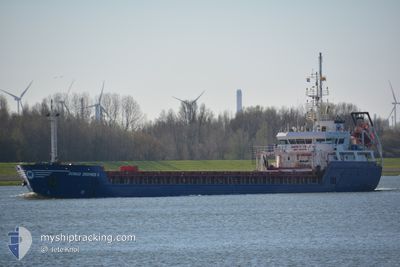
DONAU EKSPRES II
General Cargo
Current Trip
Current Position
| Longitude | --- |
|---|---|
| Latitude | --- |
| Status | Moored |
| Speed | |
| Course | 125° |
| Area | Sea of Marmara |
| Station | T-AIS |
| Position Received | 3 m ago |
Info
Information
The current position of DONAU EKSPRES II is in Sea of Marmara with coordinates 40.41654° / 29.08625° as reported on 2025-03-08 10:04 by AIS to our vessel tracker app. The vessel's current speed is 0 Knots and is currently inside the port of GEMLIK.
The vessel DONAU EKSPRES II (IMO: 9598804, MMSI: 271043190) is a General Cargo that was built in 2012 ( 13 years old ). It's sailing under the flag of [TR] Turkey.
In this page you can find informations about the vessels current position, last detected port calls, and current voyage information. If the vessels is not in coverage by AIS you will find the latest position.
The current position of DONAU EKSPRES II is detected by our AIS receivers and we are not responsible for the reliability of the data. The last position was recorded while the vessel was in Coverage by the Ais receivers of our vessel tracking app.
The current draught of DONAU EKSPRES II as reported by AIS is 5.8 meters
Weather
| Temperature | 11.3°C / 52.34°F |
|---|---|
| Wind Speed | 4 knots |
| Direction | 265° W |
| Pressure | 1015.1 hPa |
| Humidity | 62.1 % |
| Cloud Coverage | --- |
Featured Company
Last Trips
| Origin | Departure | Destination | Arrival | Distance | |
|---|---|---|---|---|---|
| 2025-03-04 14:24 | 2025-03-07 00:26 | 370.90 nm | |||
| 2025-02-13 16:10 | 2025-03-01 09:42 | 2857.62 nm | |||
| 2025-02-05 17:03 | 2025-02-09 17:32 | 659.23 nm | |||
| 2025-01-18 20:01 | 2025-01-19 22:41 | 109.99 nm | |||
| 2024-12-21 01:24 | 2025-01-16 02:17 | 4111.52 nm |
Events
| Time | Event | Details | Position / Dest | Info |
|---|---|---|---|---|
| 2025-03-08 09:10 | Status Changed | Moored Default |
40.41656 / 29.08625
[TR] GEMLIK
|
Speed: Course: 126° |
| 2025-03-08 09:01 | Status Changed | Default Moored |
40.41657 / 29.08623
[TR] GEMLIK
|
Speed: Course: 126° |
| 2025-03-07 23:52 | Status Changed | Moored Default |
40.41657 / 29.08623
[TR] GEMLIK
|
Speed: Course: 126° |
| 2025-03-07 23:52 | IN Coverage |
40.41657 / 29.08623
Sea of Marmara
[TR] GEMLIK
|
Speed: Course: 296.3° |
|
| 2025-03-07 22:04 | Status Changed | Default Moored |
40.41657 / 29.08622
[TR] GEMLIK
|
Speed: Course: 126° |
| 2025-03-07 21:58 | OUT of Coverage |
40.41657 / 29.08623
Sea of Marmara
[TR] GEMLIK
|
Speed: Course: 321.5° |
|
| 2025-03-07 20:04 | Status Changed | Moored Under way using engine |
40.41657 / 29.08623
[TR] GEMLIK
|
Speed: Course: 125° |
| 2025-03-06 21:39 | STOP Moving |
40.41655 / 29.08616
[TR] GEMLIK
|
Speed: 0.2 kn Course: 126° |
|
| 2025-03-06 21:26 | PORT ARRIVAL |
|
40.41896 / 29.08066
[TR] GEMLIK
|
Speed: 3.1 kn Course: 125° |
| 2025-03-06 20:35 | Status Changed | Under way using engine Default |
40.42788 / 28.94996
TRGEM
|
Speed: 8.1 kn Course: 96° |