
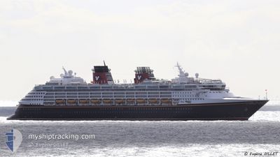
DISNEY WONDER
Passengers Ship
Current Trip
CAVAN>USISP
| Time Travelled | 1 day |
|---|---|
| Remaining Time | --- |
| Distance Travelled | 443.02 nm |
| Remaining Distance | --- |
| AVG Speed | 16.9 Knots |
| MAX Speed | 22.2 Knots |
| AVG Wind | 6.7 knots |
| MAX Wind | 15.9 knots |
| MIN Temp | 7.1°C / 44.78°F |
| MAX Temp | 14.7°C / 58.46°F |
| Draught | 8.3 m |
| Position Received | 1 m ago |
Current Position
| Longitude | -131.02844° |
|---|---|
| Latitude | 54.06953° |
| Status | Under way using engine |
| Speed | 18.5 Knots |
| Course | 352.6° |
| Area | The Coastal Waters of Southeast Alaska and British Columbia |
| Station | T-AIS |
| Position Received | 1 m ago |
Info
Information
The current position of DISNEY WONDER is in The Coastal Waters of Southeast Alaska and British Columbia with coordinates 54.06953° / -131.02844° as reported on 2024-05-29 00:28 by AIS to our vessel tracker app. The vessel's current speed is 18.5 Knots
The vessel DISNEY WONDER (IMO: 9126819, MMSI: 308457000) is a Passengers Ship that was built in 1999 ( 25 years old ). It's sailing under the flag of [BS] Bahamas.
In this page you can find informations about the vessels current position, last detected port calls, and current voyage information. If the vessels is not in coverage by AIS you will find the latest position.
The current position of DISNEY WONDER is detected by our AIS receivers and we are not responsible for the reliability of the data. The last position was recorded while the vessel was in Coverage by the Ais receivers of our vessel tracking app.
The current draught of DISNEY WONDER as reported by AIS is 8.3 meters
Weather
| Temperature | 8.6°C / 47.48°F |
|---|---|
| Wind Speed | 13 knots |
| Direction | 173° S |
| Pressure | 1016.3 hPa |
| Humidity | 86.9 % |
| Cloud Coverage | 100 % |
Featured Company
Last Port Calls
| Port | Arrival | Departure | Time In Port |
|---|---|---|---|
| 2024-05-27 13:12 | 2024-05-27 23:35 | 10 h | |
| 2024-05-25 17:54 | 2024-05-26 03:22 | 9 h | |
| 2024-05-24 13:42 | 2024-05-25 01:58 | 12 h | |
| 2024-05-23 14:18 | 2024-05-24 04:06 | 13 h | |
| 2024-05-20 13:12 | 2024-05-20 23:57 | 10 h | |
| 2024-05-18 18:22 | 2024-05-19 03:06 | 8 h | |
| 2024-05-17 13:30 | 2024-05-18 01:10 | 11 h | |
| 2024-05-13 13:12 | 2024-05-13 23:58 | 10 h | |
| 2024-05-12 17:16 | 2024-05-13 04:09 | 10 h | |
| 2024-05-09 13:23 | 2024-05-10 00:43 | 11 h |
Last Trips
| Origin | Departure | Destination | Arrival | Distance | |
|---|---|---|---|---|---|
| 2024-05-25 19:22 | 2024-05-27 06:12 | 532.77 nm | |||
| 2024-05-24 17:58 | 2024-05-25 09:54 | 279.78 nm | |||
| 2024-05-23 20:06 | 2024-05-24 05:42 | 100.35 nm | |||
| 2024-05-20 16:57 | 2024-05-23 06:18 | 948.02 nm | |||
| 2024-05-18 19:06 | 2024-05-20 06:12 | 536.31 nm | |||
| 2024-05-17 17:10 | 2024-05-18 10:22 | 285.10 nm | |||
| 2024-05-13 16:58 | 2024-05-17 05:30 | 1005.41 nm | |||
| 2024-05-12 21:09 | 2024-05-13 06:12 | 82.25 nm | |||
| 2024-05-09 17:43 | 2024-05-12 10:16 | 1228.69 nm | |||
| 2024-05-07 17:40 | 2024-05-09 06:23 | 322.91 nm |
Events
| Time | Event | Details | Position / Dest | Info |
|---|---|---|---|---|
| 2024-05-28 23:20 | Status Changed | Under way using engine Default |
53.72756 / -130.87456
CAVAN>USISP
|
Speed: 19 kn Course: 349° |
| 2024-05-28 23:12 | Status Changed | Default Under way using engine |
53.68634 / -130.86140
CAVAN>USISP
|
Speed: 19 kn Course: 348.4° |
| 2024-05-28 23:01 | Status Changed | Under way using engine Default |
53.62624 / -130.84136
CAVAN>USISP
|
Speed: 19.5 kn Course: 350° |
| 2024-05-28 22:55 | Status Changed | Default Under way using engine |
53.59691 / -130.83276
CAVAN>USISP
|
Speed: 19.4 kn Course: 350.3° |
| 2024-05-28 22:42 | Status Changed | Under way using engine Default |
53.52757 / -130.81205
CAVAN>USISP
|
Speed: 19.4 kn Course: 349° |
| 2024-05-28 22:38 | Status Changed | Default Under way using engine |
53.50806 / -130.80586
CAVAN>USISP
|
Speed: 19.5 kn Course: 350.5° |
| 2024-05-28 22:34 | Status Changed | Under way using engine Default |
53.48419 / -130.79874
CAVAN>USISP
|
Speed: 19.4 kn Course: 350° |
| 2024-05-28 22:30 | Status Changed | Default Under way using engine |
53.46117 / -130.79213
CAVAN>USISP
|
Speed: 19.3 kn Course: 348.3° |
| 2024-05-28 22:26 | Status Changed | Under way using engine Default |
53.44267 / -130.78628
CAVAN>USISP
|
Speed: 19.3 kn Course: 346° |
| 2024-05-28 22:26 | IN Coverage |
53.44267 / -130.78628
The Coastal Waters of Southeast Alaska and British Columbia
CAVAN>USISP
|
Speed: 19.3 kn Course: 348.3° |