
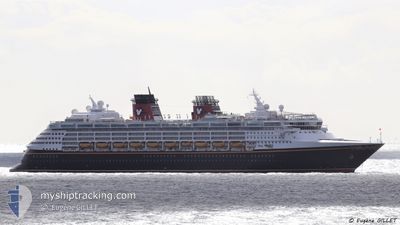
DISNEY WONDER
Passengers Ship
Current Trip
CAVAN>USSKG
| Time Travelled | 2 h, 25 mins |
|---|---|
| Remaining Time | --- |
| Distance Travelled | 39.19 nm |
| Remaining Distance | --- |
| AVG Speed | 18.5 Knopen |
| MAX Speed | 20.6 Knopen |
| AVG Wind | 8.4 knots |
| MAX Wind | 15 knots |
| MIN Temp | 10.9°C / 51.62°F |
| MAX Temp | 13.7°C / 56.66°F |
| Diepgang | 8.3 M |
| Positie ontvangen | Nu |
Current Position
| Lengtegraad | -131.45051° |
|---|---|
| Breedtegraat | 54.66004° |
| Status | Under way using engine |
| Snelheid | 20.3 Knopen |
| Koers | 141.5° |
| Gebied | The Coastal Waters of Southeast Alaska and British Columbia |
| Station | T-AIS |
| Positie ontvangen | Nu |
Info
Information
The current position of DISNEY WONDER is in The Coastal Waters of Southeast Alaska and British Columbia with coordinates 54.66004° / -131.45051° as reported on 2024-06-09 05:39 by AIS to our vessel tracker app. The vessel's current speed is 20.3 Knopen
The vessel DISNEY WONDER (IMO: 9126819, MMSI: 308457000) is a Passengers Ship that was built in 1999 ( 25 Jaar oud ). It's sailing under the flag of [BS] Bahamas.
In this page you can find informations about the vessels current position, last detected port calls, and current voyage information. If the vessels is not in coverage by AIS you will find the latest position.
The current position of DISNEY WONDER is detected by our AIS receivers and we are not responsible for the reliability of the data. The last position was recorded while the vessel was in Coverage by the Ais receivers of our vessel tracking app.
The current draught of DISNEY WONDER as reported by AIS is 8.3 meters
Weather
| Temperature | 11.2°C / 52.16°F |
|---|---|
| Wind Speed | 12 knots |
| Direction | 268° W |
| Pressure | 1017.1 hPa |
| Humidity | 82.3 % |
| Cloud Coverage | 100 % |
Featured Company
Last Port Calls
| Port | Arrival | Departure | Time In Port |
|---|---|---|---|
| 2024-06-08 09:35 | 2024-06-08 19:15 | 9 h | |
| 2024-06-07 05:51 | 2024-06-07 17:19 | 11 h | |
| 2024-06-06 20:15 | |||
| 2024-06-03 06:12 | 2024-06-03 16:22 | 10 h | |
| 2024-06-01 09:44 | 2024-06-01 19:16 | 9 h | |
| 2024-05-31 06:19 | 2024-05-31 17:16 | 10 h | |
| 2024-05-27 06:12 | 2024-05-27 16:35 | 10 h | |
| 2024-05-25 09:54 | 2024-05-25 19:22 | 9 h | |
| 2024-05-24 05:42 | 2024-05-24 17:58 | 12 h | |
| 2024-05-23 06:18 | 2024-05-23 20:06 | 13 h |
Last Trips
| Origin | Departure | Destination | Arrival | Distance | |
|---|---|---|---|---|---|
| 2024-06-07 17:19 | 2024-06-08 09:35 | 280.55 nm | |||
| 2024-06-06 20:15 | 2024-06-07 05:51 | 99.90 nm | |||
| 2024-06-01 19:16 | 2024-06-03 06:12 | 534.27 nm | |||
| 2024-05-31 17:16 | 2024-06-01 09:44 | 280.59 nm | |||
| 2024-05-27 16:35 | 2024-05-31 06:19 | 989.10 nm | |||
| 2024-05-25 19:22 | 2024-05-27 06:12 | 532.77 nm | |||
| 2024-05-24 17:58 | 2024-05-25 09:54 | 279.78 nm | |||
| 2024-05-23 20:06 | 2024-05-24 05:42 | 100.35 nm | |||
| 2024-05-20 16:57 | 2024-05-23 06:18 | 948.02 nm | |||
| 2024-05-18 19:06 | 2024-05-20 06:12 | 536.31 nm |
Events
| Tijd | Evenement | Details | Positie / Bestemming | Info |
|---|---|---|---|---|
| 2024-06-09 04:59 | Status Changed | Under way using engine Default |
54.84137 / -131.65624
CAVAN>USSKG
|
Snelheid: 19.1 kn Koers: 174° |
| 2024-06-09 04:47 | Status Changed | Default Under way using engine |
54.90574 / -131.66879
CAVAN>USSKG
|
Snelheid: 20.6 kn Koers: 173.6° |
| 2024-06-09 04:39 | Status Changed | Under way using engine Default |
54.95452 / -131.67823
CAVAN>USSKG
|
Snelheid: 20.1 kn Koers: 175° |
| 2024-06-09 04:35 | Status Changed | Default Under way using engine |
54.97367 / -131.68133
CAVAN>USSKG
|
Snelheid: 20.4 kn Koers: 175.6° |
| 2024-06-09 04:22 | Wijzig zee gebeid | United States (Alaska) part of the The Coastal Waters of Southeast Alaska and British Columbia Canadian part of the The Coastal Waters of Southeast Alaska and British Columbia |
55.05020 / -131.69120
The Coastal Waters of Southeast Alaska and British Columbia
|
Snelheid: 20.4 kn Koers: 179.2° |
| 2024-06-09 04:22 | Status Changed | Under way using engine Default |
55.05020 / -131.69120
CAVAN>USSKG
|
Snelheid: 20.6 kn Koers: 180° |
| 2024-06-09 04:22 | Binnenbereik |
55.05020 / -131.69120
The Coastal Waters of Southeast Alaska and British Columbia
|
Snelheid: 20.4 kn Koers: 179.2° |
|
| 2024-06-09 03:15 | Vertrekhaven |
|
55.31981 / -131.60959
CAVAN>USSKG
|
Snelheid: 7.3 kn Koers: 139° |
| 2024-06-09 03:03 | Start beweging |
55.33576 / -131.64000
[US] KETCHIKAN
|
Snelheid: 5.7 kn Koers: 123° |
|
| 2024-06-08 18:19 | Stop beweging |
55.33821 / -131.64424
[US] KETCHIKAN
|
Snelheid: 0.3 kn Koers: 131° |