
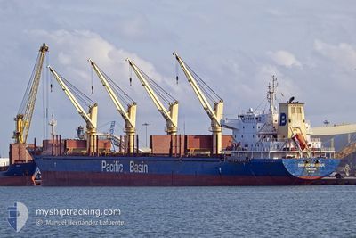
DIAMOND HARBOUR
Bulk Carrier
Current Trip
| Time Travelled | 1 day |
|---|---|
| Remaining Time | --- |
| Distance Travelled | 338.59 nm |
| Remaining Distance | --- |
| AVG Speed | 11.6 Knots |
| MAX Speed | 16.6 Knots |
| AVG Wind | 10.7 knots |
| MAX Wind | 20 knots |
| MIN Temp | 9.7°C / 49.46°F |
| MAX Temp | 13.8°C / 56.84°F |
| Draught | 10.6 m |
| Position Received | 6 h, 27 m ago |
Current Position
| Longitude | -128.54588° |
|---|---|
| Latitude | 44.67086° |
| Status | Under way using engine |
| Speed | 10.7 Knots |
| Course | 241.4° |
| Area | North Pacific Ocean |
| Station | T-AIS |
| Position Received | 6 h, 27 m ago |
Info
Information
The current position of DIAMOND HARBOUR is in North Pacific Ocean with coordinates 44.67086° / -128.54588° as reported on 2024-05-11 09:29 by AIS to our vessel tracker app. The vessel's current speed is 10.7 Knots and is heading at the port of GLADSTONE. The estimated time of arrival as calculated by MyShipTracking vessel tracking app is 2024-06-01 22:00 LT
The vessel DIAMOND HARBOUR (IMO: 9377987, MMSI: 477114300) is a Bulk Carrier that was built in 2008 ( 16 years old ). It's sailing under the flag of [HK] Hong Kong.
In this page you can find informations about the vessels current position, last detected port calls, and current voyage information. If the vessels is not in coverage by AIS you will find the latest position.
The current position of DIAMOND HARBOUR is detected by our AIS receivers and we are not responsible for the reliability of the data. The last position was recorded while the vessel was in Coverage by the Ais receivers of our vessel tracking app.
The current draught of DIAMOND HARBOUR as reported by AIS is 10.6 meters
Weather
| Temperature | 11.1°C / 51.98°F |
|---|---|
| Wind Speed | 17 knots |
| Direction | 360° N |
| Pressure | 1019.7 hPa |
| Humidity | 94.3 % |
| Cloud Coverage | 24 % |
Featured Company
Most Visited Ports (Last year)
| Port | Arrivals | |
|---|---|---|
| 1 | ||
| 1 | ||
| 1 | ||
| 1 | ||
| 1 | ||
| 1 |
Events
| Time | Event | Details | Position / Dest | Info |
|---|---|---|---|---|
| 2024-05-11 09:42 | Status Changed | Default Under way using engine |
44.65274 / -128.59424
AUGLT
|
Speed: 10.7 kn Course: 241.4° |
| 2024-05-11 09:29 | OUT of Coverage |
44.67086 / -128.54588
North Pacific Ocean
AUGLT
|
Speed: 10.7 kn Course: 241.4° |
|
| 2024-05-11 07:57 | Status Changed | Under way using engine Default |
44.79595 / -128.19781
AUGLT
|
Speed: 10.6 kn Course: 246° |
| 2024-05-11 07:26 | Status Changed | Default Under way using engine |
44.83331 / -128.07938
AUGLT
|
Speed: 10.7 kn Course: 245.2° |
| 2024-05-11 06:48 | Status Changed | Under way using engine Default |
44.87831 / -127.93293
AUGLT
|
Speed: 10 kn Course: 248° |
| 2024-05-11 06:28 | Status Changed | Default Under way using engine |
44.90167 / -127.85167
AUGLT
|
Speed: 11 kn Course: 244.4° |
| 2024-05-10 23:37 | Status Changed | Under way using engine Default |
45.46968 / -126.26696
AUGLT
|
Speed: 11 kn Course: 243° |
| 2024-05-10 23:25 | Status Changed | Default Under way using engine |
45.48465 / -126.22257
AUGLT
|
Speed: 10.7 kn Course: 243.9° |
| 2024-05-10 23:21 | Status Changed | Under way using engine Default |
45.49009 / -126.20622
AUGLT
|
Speed: 10.9 kn Course: 246° |
| 2024-05-10 22:18 | OUT of Coverage |
45.57794 / -125.96350
North Pacific Ocean
AUGLT
|
Speed: 11 kn Course: 242.2° |