

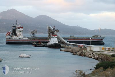
DELFBORG
General Cargo

Current Trip
| Time Travelled | 6 days |
|---|---|
| Remaining Time | --- |
| Distance Travelled | 1324.76 nm |
| Remaining Distance | --- |
| AVG Speed | 10 Knots |
| MAX Speed | 11.4 Knots |
| AVG Wind | 14.4 knots |
| MAX Wind | 27 knots |
| MIN Temp | 12.8°C / 55.04°F |
| MAX Temp | 20.7°C / 69.26°F |
| Draught | 6.6 m |
| Position Received | 2 d ago |
Current Position
| Longitude | --- |
|---|---|
| Latitude | --- |
| Status | Under way using engine |
| Speed | 10.7 Knots |
| Course | 295.4° |
| Area | Mediterranean Sea - Eastern Basin |
| Station | T-AIS |
| Position Received | 2 d ago |
Information
The current position of DELFBORG is in Mediterranean Sea - Eastern Basin with coordinates 36.30636° / 14.15242° as reported on 2025-03-19 19:48 by AIS to our vessel tracker app. The vessel's current speed is 10.7 Knots and is heading at the port of BIRKENHEAD. The estimated time of arrival as calculated by MyShipTracking vessel tracking app is 2025-03-29 08:00 LT
The vessel DELFBORG (IMO: 9393266, MMSI: 245091000) is a General Cargo that was built in 2007 ( 18 years old ). It's sailing under the flag of [NL] Netherlands.
In this page you can find informations about the vessels current position, last detected port calls, and current voyage information. If the vessels is not in coverage by AIS you will find the latest position.
The current position of DELFBORG is detected by our AIS receivers and we are not responsible for the reliability of the data. The last position was recorded while the vessel was in Coverage by the Ais receivers of our vessel tracking app.
The current draught of DELFBORG as reported by AIS is 6.6 meters
Weather
| Temperature | 16°C / 60.8°F |
|---|---|
| Wind Speed | 8 knots |
| Direction | 205° SSW |
| Pressure | 1014.4 hPa |
| Humidity | 77.7 % |
| Cloud Coverage | 78 % |


Featured Company
Last Port Calls
| Port | Arrival | Departure | Time In Port |
|---|---|---|---|
| 2025-03-14 02:53 | 2025-03-15 23:17 | 1 d | |
| 2025-03-01 16:02 | 2025-03-03 18:41 | 2 d | |
| 2025-02-22 16:18 | 2025-02-22 22:10 | 5 h | |
| 2025-02-18 05:35 | 2025-02-19 06:47 | 1 d | |
| 2025-02-12 08:49 | 2025-02-17 16:26 | 5 d | |
| 2025-02-08 07:56 | 2025-02-08 09:31 | 1 h | |
| 2025-02-05 05:17 | 2025-02-08 07:49 | 3 d | |
| 2025-02-03 12:47 | 2025-02-04 20:05 | 1 d | |
| 2025-02-02 23:45 | 2025-02-03 01:42 | 1 h | |
| 2025-01-21 11:39 | 2025-01-26 14:59 | 5 d |
Last Trips
| Origin | Departure | Destination | Arrival | Distance | |
|---|---|---|---|---|---|
| 2025-03-03 18:41 | 2025-03-14 02:53 | 1280.21 nm | |||
| 2025-02-22 22:10 | 2025-03-01 16:02 | 1646.89 nm | |||
| 2025-02-19 06:47 | 2025-02-22 16:18 | 803.82 nm | |||
| 2025-02-17 16:26 | 2025-02-18 05:35 | 116.13 nm | |||
| 2025-02-08 09:31 | 2025-02-12 08:49 | 1011.24 nm | |||
| 2025-02-08 07:49 | 2025-02-08 07:56 | 1.30 nm | |||
| 2025-02-04 20:05 | 2025-02-05 05:17 | 99.38 nm | |||
| 2025-02-03 01:42 | 2025-02-03 12:47 | 98.68 nm | |||
| 2025-01-26 14:59 | 2025-02-02 23:45 | 855.41 nm | |||
| 2025-01-17 19:50 | 2025-01-21 11:39 | 850.25 nm |
Events
| Time | Event | Details | Position / Dest | Info |
|---|---|---|---|---|
| 2025-03-19 20:01 | Status Changed | Default Under way using engine |
36.32251 / 14.11182
GBBRK
|
Speed: 10.7 kn Course: 295.4° |
| 2025-03-19 19:48 | Status Changed | Under way using engine Default |
36.30636 / 14.15242
GBBRK
|
Speed: 10.6 kn Course: 296° |
| 2025-03-19 19:48 | OUT of Coverage |
36.30636 / 14.15242
Mediterranean Sea - Eastern Basin
GBBRK
|
Speed: 10.7 kn Course: 295.4° |
|
| 2025-03-19 19:30 | Status Changed | Default Under way using engine |
36.28314 / 14.21255
GBBRK
|
Speed: 10.5 kn Course: 294.3° |
| 2025-03-19 18:29 | Draught Changed | 6.6 4.3 |
36.21732 / 14.42200
GBBRK
|
Speed: 10.6 kn Course: 287.4° |
| 2025-03-19 18:29 | Destination Changed | GBBRK EGDAM |
36.21732 / 14.42200
GBBRK
|
Speed: 10.6 kn Course: 287.4° |
| 2025-03-19 18:29 | ETA Changed | 2025/03/29 08:00 2025/03/13 14:00 |
36.21732 / 14.42200
GBBRK
|
Speed: 10.6 kn Course: 287.4° |
| 2025-03-19 18:14 | Detected in Sea | Maltese part of the Mediterranean Sea - Eastern Basin |
36.20551 / 14.47092
Mediterranean Sea - Eastern Basin
|
Speed: 10.4 kn Course: 287° |
| 2025-03-19 18:14 | Status Changed | Under way using engine Default |
36.20551 / 14.47092
EGDAM
|
Speed: 10.4 kn Course: 286° |
| 2025-03-19 18:10 | IN Coverage |
36.20551 / 14.47092
Mediterranean Sea - Eastern Basin
|
Speed: 10.4 kn Course: 287° |