
CRYSTALIA
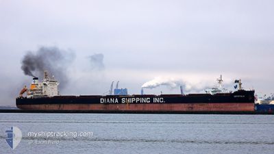
Bulk Carrier
Current Trip
| Time Travelled | 3 days |
|---|---|
| Remaining Time | --- |
| Distance Travelled | 808.72 nm |
| Remaining Distance | --- |
| AVG Speed | 9.6 Knots |
| MAX Speed | 12.4 Knots |
| AVG Wind | 6.9 knots |
| MAX Wind | 13.1 knots |
| MIN Temp | 24.2°C / 75.56°F |
| MAX Temp | 28°C / 82.4°F |
| Draught | 14.5 m |
| Position Received | 2 d ago |
Current Position
| Longitude | --- |
|---|---|
| Latitude | --- |
| Status | Under way using engine |
| Speed | 11.4 Knots |
| Course | 103.7° |
| Area | Gulf of Oman |
| Station | T-AIS |
| Position Received | 2 d ago |
Info
Information
The current position of CRYSTALIA is in Gulf of Oman with coordinates 25.16920° / 56.86532° as reported on 2024-11-25 11:18 by AIS to our vessel tracker app. The vessel's current speed is 11.4 Knots and is heading at the port of PARADIP. The estimated time of arrival as calculated by MyShipTracking vessel tracking app is 2024-12-06 09:30 LT
The vessel CRYSTALIA (IMO: 9658874, MMSI: 241300000) is a Bulk Carrier that was built in 2014 ( 10 years old ). It's sailing under the flag of [GR] Greece.
In this page you can find informations about the vessels current position, last detected port calls, and current voyage information. If the vessels is not in coverage by AIS you will find the latest position.
The current position of CRYSTALIA is detected by our AIS receivers and we are not responsible for the reliability of the data. The last position was recorded while the vessel was in Coverage by the Ais receivers of our vessel tracking app.
The current draught of CRYSTALIA as reported by AIS is 14.5 meters
Weather
| Temperature | 26.9°C / 80.42°F |
|---|---|
| Wind Speed | 15 knots |
| Direction | 49° NE |
| Pressure | 1011.6 hPa |
| Humidity | 54.8 % |
| Cloud Coverage | 1 % |
Featured Company
Last Trips
| Origin | Departure | Destination | Arrival | Distance | |
|---|---|---|---|---|---|
| 2024-11-16 17:39 | 2024-11-21 14:00 | 509.91 nm | |||
| 2024-11-10 07:46 | 2024-11-12 09:36 | 483.10 nm | |||
| 2024-10-08 21:51 | 2024-11-08 20:06 | 6670.56 nm | |||
| 2024-09-06 21:00 | 2024-10-02 01:03 | 5509.90 nm | |||
| 2024-08-29 05:58 | 2024-09-02 04:46 | 858.20 nm |
Events
| Time | Event | Details | Position / Dest | Info |
|---|---|---|---|---|
| 2024-11-25 11:20 | Status Changed | Default Under way using engine |
25.16832 / 56.86926
PARADIP
|
Speed: 11.4 kn Course: 103.7° |
| 2024-11-25 11:18 | OUT of Coverage |
25.16920 / 56.86532
Gulf of Oman
PARADIP
|
Speed: 11.4 kn Course: 103.7° |
|
| 2024-11-25 11:11 | Status Changed | Under way using engine Default |
25.17498 / 56.83975
PARADIP
|
Speed: 11.4 kn Course: 105° |
| 2024-11-25 10:55 | Status Changed | Default Under way using engine |
25.18730 / 56.78632
PARADIP
|
Speed: 11.4 kn Course: 104.3° |
| 2024-11-25 08:55 | START Moving | 7.36 nm, South East of KHORFAKKAN |
25.27292 / 56.45982
PARADIP
|
Speed: 3.1 kn Course: 162° |
| 2024-11-25 08:54 | Status Changed | Under way using engine At anchor |
25.27344 / 56.45960
PARADIP
|
Speed: 1.5 kn Course: 162° |
| 2024-11-25 08:14 | ETA Changed | 2024/12/06 04:00 2024/11/24 12:00 |
25.27802 / 56.45887
PARADIP
|
Speed: Course: 172° |
| 2024-11-25 08:07 | Destination Changed | PARADIP AE FJR |
25.27803 / 56.45892
PARADIP
|
Speed: Course: 176° |
| 2024-11-25 07:22 | STOP Moving | 7.12 nm, South East of KHORFAKKAN |
25.27801 / 56.45917
AE FJR
|
Speed: Course: 184° |
| 2024-11-25 07:18 | START Moving | 7.13 nm, South East of KHORFAKKAN |
25.27784 / 56.45909
AE FJR
|
Speed: 5.8 kn Course: 201.2° |