
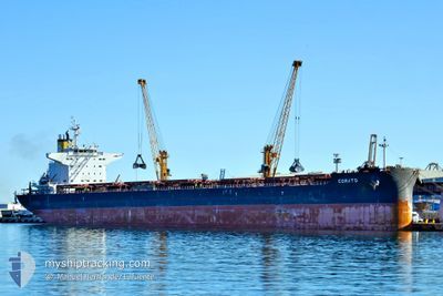
CORATO
Cargo
Current Trip
| Time Travelled | 8 days |
|---|---|
| Remaining Time | --- |
| Distance Travelled | 2476.52 nm |
| Remaining Distance | --- |
| AVG Speed | 12.5 Knots |
| MAX Speed | 14.1 Knots |
| AVG Wind | 15.4 knots |
| MAX Wind | 24.8 knots |
| MIN Temp | 10.5°C / 50.9°F |
| MAX Temp | 27.3°C / 81.14°F |
| Draught | 12.3 m |
| Position Received | 7 d ago |
Current Position
| Longitude | -56.84847° |
|---|---|
| Latitude | -37.92823° |
| Status | Under way using engine |
| Speed | 11.8 Knots |
| Course | 47.8° |
| Area | South Atlantic Ocean |
| Station | T-AIS |
| Position Received | 7 d ago |
Info
Information
The current position of CORATO is in South Atlantic Ocean with coordinates -37.92823° / -56.84847° as reported on 2024-06-01 00:09 by AIS to our vessel tracker app. The vessel's current speed is 11.8 Knots and is heading at the port of ROTTERDAM. The estimated time of arrival as calculated by MyShipTracking vessel tracking app is 2024-06-21 17:00 LT
The vessel CORATO (IMO: 9749829, MMSI: 249431000) is a Cargo It's sailing under the flag of [MT] Malta.
In this page you can find informations about the vessels current position, last detected port calls, and current voyage information. If the vessels is not in coverage by AIS you will find the latest position.
The current position of CORATO is detected by our AIS receivers and we are not responsible for the reliability of the data. The last position was recorded while the vessel was in Coverage by the Ais receivers of our vessel tracking app.
The current draught of CORATO as reported by AIS is 12.3 meters
Weather
| Temperature | 27.2°C / 80.96°F |
|---|---|
| Wind Speed | 13 knots |
| Direction | 113° ESE |
| Pressure | 1015.6 hPa |
| Humidity | 79.2 % |
| Cloud Coverage | 100 % |
Featured Company
Last Port Calls
| Port | Arrival | Departure | Time In Port |
|---|---|---|---|
| 2024-05-28 19:30 | 2024-05-30 20:11 | 2 d | |
| 2024-05-21 12:17 | 2024-05-25 03:17 | 3 d | |
| 2024-05-18 18:21 | 2024-05-20 08:34 | 1 d | |
| 2024-04-26 09:43 | 2024-05-02 00:42 | 5 d | |
| 2024-04-01 16:14 |
Most Visited Ports (Last year)
| Port | Arrivals | |
|---|---|---|
| 1 | ||
| 1 | ||
| 1 | ||
| 1 | ||
| 1 | ||
| 1 |
Last Trips
| Origin | Departure | Destination | Arrival | Distance | |
|---|---|---|---|---|---|
| 2024-05-25 03:17 | 2024-05-28 19:30 | 853.80 nm | |||
| 2024-05-20 08:34 | 2024-05-21 12:17 | 164.92 nm | |||
| 2024-05-02 00:42 | 2024-05-18 18:21 | 3643.64 nm | |||
| 2024-04-01 16:14 | 2024-04-26 09:43 | 6881.38 nm |
Events
| Time | Event | Details | Position / Dest | Info |
|---|---|---|---|---|
| 2024-06-01 00:11 | Status Changed | Default Under way using engine |
-37.92535 / -56.84438
NL RTM
|
Speed: 11.8 kn Course: 47.8° |
| 2024-06-01 00:09 | Status Changed | Under way using engine Default |
-37.92823 / -56.84847
NL RTM
|
Speed: 11.9 kn Course: 49° |
| 2024-06-01 00:09 | OUT of Coverage |
-37.92823 / -56.84847
South Atlantic Ocean
NL RTM
|
Speed: 11.8 kn Course: 47.8° |
|
| 2024-05-31 23:52 | Status Changed | Default Under way using engine |
-37.96596 / -56.90286
NL RTM
|
Speed: 11.8 kn Course: 49.9° |
| 2024-05-31 18:43 | Draught Changed | 12.3 10.5 |
-38.62622 / -57.91758
NL RTM
|
Speed: 12.4 kn Course: 62° |
| 2024-05-31 18:43 | Destination Changed | NL RTM AR BHI |
-38.62622 / -57.91758
NL RTM
|
Speed: 12.4 kn Course: 62° |
| 2024-05-31 18:43 | ETA Changed | 2024/06/21 15:00 2024/05/28 18:00 |
-38.62622 / -57.91758
NL RTM
|
Speed: 12.4 kn Course: 62° |
| 2024-05-31 18:03 | Status Changed | Under way using engine Default |
-38.69417 / -58.06896
AR BHI
|
Speed: 12.4 kn Course: 60° |
| 2024-05-31 17:50 | IN Coverage |
-38.69358 / -58.06770
South Atlantic Ocean
|
Speed: 12.3 kn Course: 59.3° |
|
| 2024-05-30 23:11 | PORT DEPARTURE |
|
-38.80193 / -62.25244
AR BHI
|
Speed: 4.8 kn Course: 125° |