
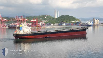
CMB POMEROL
Bulk Carrier
Current Trip
IN GGV
| Time Travelled | 2 h, 49 mins |
|---|---|
| Remaining Time | --- |
| Distance Travelled | --- |
| Remaining Distance | --- |
| AVG Speed | --- |
| MAX Speed | --- |
| AVG Wind | --- |
| MAX Wind | --- |
| MIN Temp | --- |
| MAX Temp | --- |
| Draught | 13.4 m |
| Position Received | 8 d ago |
Current Position
| Longitude | 99.31624° |
|---|---|
| Latitude | 4.30716° |
| Status | Under way using engine |
| Speed | 11.8 Knots |
| Course | 323.8° |
| Area | Malacca Strait |
| Station | T-AIS |
| Position Received | 8 d ago |
Info
Information
The current position of CMB POMEROL is in Malacca Strait with coordinates 4.30716° / 99.31624° as reported on 2024-05-27 19:06 by AIS to our vessel tracker app. The vessel's current speed is 11.8 Knots
The vessel CMB POMEROL (IMO: 9598335, MMSI: 563143300) is a Bulk Carrier that was built in 2012 ( 12 years old ). It's sailing under the flag of [SG] Singapore.
In this page you can find informations about the vessels current position, last detected port calls, and current voyage information. If the vessels is not in coverage by AIS you will find the latest position.
The current position of CMB POMEROL is detected by our AIS receivers and we are not responsible for the reliability of the data. The last position was recorded while the vessel was in Coverage by the Ais receivers of our vessel tracking app.
The current draught of CMB POMEROL as reported by AIS is 13.4 meters
Weather
| Temperature | 29.6°C / 85.28°F |
|---|---|
| Wind Speed | 12 knots |
| Direction | 230° SW |
| Pressure | 1006.1 hPa |
| Humidity | 86.2 % |
| Cloud Coverage | 41 % |
Featured Company
Last Port Calls
| Port | Arrival | Departure | Time In Port |
|---|---|---|---|
| 2024-06-02 20:20 | 2024-06-04 22:53 | 2 d | |
| 2024-05-10 17:11 | 2024-05-11 16:04 | 22 h |
Last Trips
| Origin | Departure | Destination | Arrival | Distance | |
|---|---|---|---|---|---|
| 2024-05-12 02:04 | 2024-06-03 01:50 | 5627.79 nm |
Events
| Time | Event | Details | Position / Dest | Info |
|---|---|---|---|---|
| 2024-06-04 22:53 | PORT DEPARTURE |
|
17.62571 / 83.25713
IN GGV
|
Speed: 7.5 kn Course: 88° |
| 2024-06-04 22:49 | START Moving |
17.62671 / 83.24875
[IN] GANGAVARAM
|
Speed: 7.5 kn Course: 88° |
|
| 2024-06-02 20:27 | STOP Moving |
17.62363 / 83.24149
[IN] GANGAVARAM
|
Speed: 0.3 kn Course: 11° |
|
| 2024-06-02 20:20 | PORT ARRIVAL |
|
17.62440 / 83.24291
[IN] GANGAVARAM
|
Speed: 6.5 kn Course: 264° |
| 2024-06-02 19:20 | START Moving | 3.5 nm, South East of GANGAVARAM |
17.57906 / 83.27883
IN GGV
|
Speed: 6.5 kn Course: 56° |
| 2024-06-01 07:28 | STOP Moving | 3.75 nm, South East of GANGAVARAM |
17.57486 / 83.28046
IN GGV
|
Speed: 0.2 kn Course: 226° |
| 2024-05-27 19:09 | Status Changed | Default Under way using engine |
4.31471 / 99.31086
IN GGV
|
Speed: 11.8 kn Course: 323.8° |
| 2024-05-27 19:06 | Change Sea Area | Indonesian part of the Malacca Strait Malaysian part of the Singapore Strait |
4.30716 / 99.31624
Malacca Strait
IN GGV
|
Speed: 11.8 kn Course: 323.8° |
| 2024-05-27 19:06 | Status Changed | Under way using engine Default |
4.30716 / 99.31624
IN GGV
|
Speed: 11.8 kn Course: 323° |
| 2024-05-27 19:06 | OUT of Coverage |
4.30716 / 99.31624
Malacca Strait
IN GGV
|
Speed: 11.8 kn Course: 323.8° |