
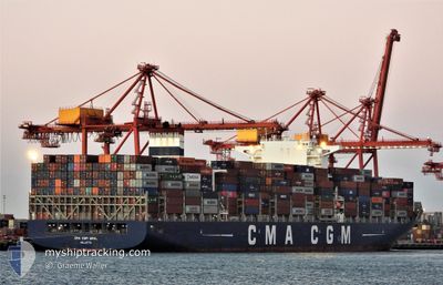
CMA CGM URAL
Cargo
Current Trip
| Time Travelled | 1 day |
|---|---|
| Remaining Time | --- |
| Distance Travelled | 247.86 nm |
| Remaining Distance | 5.70 nm |
| AVG Speed | 13.6 Knots |
| MAX Speed | 22 Knots |
| AVG Wind | 4.4 knots |
| MAX Wind | 11.9 knots |
| MIN Temp | 2.3°C / 36.14°F |
| MAX Temp | 7.6°C / 45.68°F |
| Draught | 13.6 m |
| Position Received | Now |
Current Position
| Longitude | --- |
|---|---|
| Latitude | --- |
| Status | Under way using engine |
| Speed | 7.7 Knots |
| Course | 40.4° |
| Area | The Coastal Waters of Southeast Alaska and British Columbia |
| Station | T-AIS |
| Position Received | Now |
Info
Information
The current position of CMA CGM URAL is in The Coastal Waters of Southeast Alaska and British Columbia with coordinates 49.30406° / -123.25423° as reported on 2024-12-05 04:11 by AIS to our vessel tracker app. The vessel's current speed is 7.7 Knots and is heading at the port of VANCOUVER. The estimated time of arrival as calculated by MyShipTracking vessel tracking app is 2024-12-04 08:00 LT
The vessel CMA CGM URAL (IMO: 9705079, MMSI: 256163000) is a Cargo It's sailing under the flag of [MT] Malta.
In this page you can find informations about the vessels current position, last detected port calls, and current voyage information. If the vessels is not in coverage by AIS you will find the latest position.
The current position of CMA CGM URAL is detected by our AIS receivers and we are not responsible for the reliability of the data. The last position was recorded while the vessel was in Coverage by the Ais receivers of our vessel tracking app.
The current draught of CMA CGM URAL as reported by AIS is 13.6 meters
Weather
| Temperature | 6.9°C / 44.42°F |
|---|---|
| Wind Speed | 1 knots |
| Direction | 315° NW |
| Pressure | 1023.4 hPa |
| Humidity | 84.8 % |
| Cloud Coverage | 25 % |
Featured Company
Last Port Calls
| Port | Arrival | Departure | Time In Port |
|---|---|---|---|
| 2024-11-27 03:05 | 2024-12-03 17:44 | 6 d | |
| 2024-11-12 16:01 | 2024-11-14 02:51 | 1 d | |
| 2024-11-10 22:20 | 2024-11-11 11:24 | 13 h | |
| 2024-11-02 18:12 | 2024-11-03 19:12 | 1 d | |
| 2024-10-22 03:18 | 2024-10-23 13:10 | 1 d |
Most Visited Ports (Last year)
| Port | Arrivals | |
|---|---|---|
| 4 | ||
| 4 | ||
| 4 | ||
| 4 | ||
| 4 | ||
| 3 |
Last Trips
| Origin | Departure | Destination | Arrival | Distance | |
|---|---|---|---|---|---|
| 2024-11-14 02:51 | 2024-11-27 03:05 | 4689.81 nm | |||
| 2024-11-11 11:24 | 2024-11-12 16:01 | 501.06 nm | |||
| 2024-11-03 19:12 | 2024-11-10 22:20 | 984.48 nm | |||
| 2024-10-23 13:10 | 2024-11-02 18:12 | 2094.61 nm | |||
| 2024-09-17 12:59 | 2024-10-22 03:18 | 11909.71 nm |
Events
| Time | Event | Details | Position / Dest | Info |
|---|---|---|---|---|
| 2024-12-05 04:06 | START Moving | 5.66 nm, South East of BOWEN ISLAND |
49.29780 / -123.25606
CAVAN
|
Speed: 3.7 kn Course: 324° |
| 2024-12-05 03:58 | Status Changed | Under way using engine At anchor |
49.29707 / -123.25290
CAVAN
|
Speed: 0.3 kn Course: 257° |
| 2024-12-04 20:34 | STOP Moving | 5.76 nm, South East of BOWEN ISLAND |
49.29601 / -123.25578
CAVAN
|
Speed: 0.1 kn Course: 70° |
| 2024-12-04 20:31 | Status Changed | At anchor Under way using engine |
49.29599 / -123.25622
CAVAN
|
Speed: 0.5 kn Course: 74° |
| 2024-12-04 18:52 | Change Sea Area | Canadian part of the The Coastal Waters of Southeast Alaska and British Columbia United States part of the The Coastal Waters of Southeast Alaska and British Columbia |
49.00542 / -123.24862
The Coastal Waters of Southeast Alaska and British Columbia
CAVAN
|
Speed: 18 kn Course: 316.5° |
| 2024-12-04 17:55 | Change Sea Area | United States part of the The Coastal Waters of Southeast Alaska and British Columbia Canadian part of the The Coastal Waters of Southeast Alaska and British Columbia |
48.78960 / -123.00816
The Coastal Waters of Southeast Alaska and British Columbia
CAVAN
|
Speed: 16.6 kn Course: 34.8° |
| 2024-12-04 17:37 | Change Sea Area | Canadian part of the The Coastal Waters of Southeast Alaska and British Columbia United States part of the The Coastal Waters of Southeast Alaska and British Columbia |
48.73709 / -123.11401
The Coastal Waters of Southeast Alaska and British Columbia
CAVAN
|
Speed: 18.5 kn Course: 63.4° |
| 2024-12-04 16:31 | Change Sea Area | United States part of the The Coastal Waters of Southeast Alaska and British Columbia Canadian part of the The Coastal Waters of Southeast Alaska and British Columbia |
48.46057 / -123.15859
The Coastal Waters of Southeast Alaska and British Columbia
CAVAN
|
Speed: 16.8 kn Course: 349.1° |
| 2024-12-04 14:43 | Change Sea Area | Canadian part of the The Coastal Waters of Southeast Alaska and British Columbia United States part of the The Coastal Waters of Southeast Alaska and British Columbia |
48.24276 / -123.44526
The Coastal Waters of Southeast Alaska and British Columbia
CAVAN
|
Speed: 6.2 kn Course: 17.6° |
| 2024-12-04 10:36 | Status Changed | Under way using engine Default |
48.34615 / -124.32274
CAVAN
|
Speed: 11.9 kn Course: 121° |