
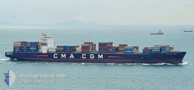
CMA CGM TARPON
Container Ship
Current Trip
| Trip Time | 7 days |
|---|---|
| Trip Distance | 2118.45 nm |
| AVG Speed | 12.7 Knots |
| MAX Speed | 19.1 Knots |
| Draught | 10.2 m |
| AVG Wind | 16.3 knots |
| MAX Wind | 34 knots |
| MIN Temp | 2.2°C / 35.96°F |
| MAX Temp | 12.5°C / 54.5°F |
| Position Received | 9 d ago |
Current Position
| Longitude | -124.98422° |
|---|---|
| Latitude | 38.55877° |
| Status | Under way using engine |
| Speed | 12.1 Knots |
| Course | 287.1° |
| Area | North Pacific Ocean |
| Station | T-AIS |
| Position Received | 9 d ago |
Info
Information
The current position of CMA CGM TARPON is in North Pacific Ocean with coordinates 38.55877° / -124.98422° as reported on 2024-04-21 21:17 by AIS to our vessel tracker app. The vessel's current speed is 12.1 Knots and is currently inside the port of DUTCH HARBOR.
The vessel CMA CGM TARPON (IMO: 9331012, MMSI: 215187000) is a Container Ship that was built in 2007 ( 17 years old ). It's sailing under the flag of [MT] Malta.
In this page you can find informations about the vessels current position, last detected port calls, and current voyage information. If the vessels is not in coverage by AIS you will find the latest position.
The current position of CMA CGM TARPON is detected by our AIS receivers and we are not responsible for the reliability of the data. The last position was recorded while the vessel was in Coverage by the Ais receivers of our vessel tracking app.
The current draught of CMA CGM TARPON as reported by AIS is 10.2 meters
Weather
| Temperature | 2.4°C / 36.32°F |
|---|---|
| Wind Speed | 4 knots |
| Direction | 228° SW |
| Pressure | 998.1 hPa |
| Humidity | 84.7 % |
| Cloud Coverage | 100 % |
Featured Company
Last Port Calls
| Port | Arrival | Departure | Time In Port |
|---|---|---|---|
| 2024-04-28 16:22 | |||
| 2024-04-20 11:25 | 2024-04-21 10:20 | 22 h | |
| 2024-04-16 03:59 | 2024-04-18 23:41 | 2 d | |
| 2024-04-04 00:31 | 2024-04-04 12:45 | 12 h | |
| 2024-04-01 22:29 | 2024-04-02 22:45 | 1 d | |
| 2024-03-15 11:11 | 2024-03-18 02:33 | 2 d | |
| 2024-03-10 15:44 | 2024-03-11 21:03 | 1 d | |
| 2024-03-08 08:49 |
Last Trips
| Origin | Departure | Destination | Arrival | Distance | |
|---|---|---|---|---|---|
| 2024-04-21 03:20 | 2024-04-28 08:22 | 2118.45 nm | |||
| 2024-04-18 16:41 | 2024-04-20 04:25 | 387.41 nm | |||
| 2024-04-04 20:45 | 2024-04-15 20:59 | 5762.25 nm | |||
| 2024-04-03 06:45 | 2024-04-04 08:31 | 242.44 nm | |||
| 2024-03-17 19:33 | 2024-04-02 06:29 | 5897.62 nm | |||
| 2024-03-11 15:03 | 2024-03-15 04:11 | 1251.84 nm | |||
| 2024-03-08 02:49 | 2024-03-10 09:44 | 199.43 nm |
Events
| Time | Event | Details | Position / Dest | Info |
|---|---|---|---|---|
| 2024-04-28 16:54 | STOP Moving |
53.88307 / -166.53130
[US] DUTCH HARBOR
|
Speed: Course: 48° |
|
| 2024-04-28 16:22 | PORT ARRIVAL |
|
53.89422 / -166.50812
[US] DUTCH HARBOR
|
Speed: 6.7 kn Course: 204° |
| 2024-04-28 14:42 | START Moving | 13.85 nm, North of DUTCH HARBOR |
54.11045 / -166.51866
USOAK>>USDUT
|
Speed: 3.5 kn Course: 127° |
| 2024-04-28 10:50 | STOP Moving | 15.43 nm, North of DUTCH HARBOR |
54.13705 / -166.55679
USOAK>>USDUT
|
Speed: 0.2 kn Course: 349° |
| 2024-04-28 09:55 | START Moving | 13.35 nm, North of DUTCH HARBOR |
54.10258 / -166.54274
USOAK>>USDUT
|
Speed: 5.2 kn Course: 294° |
| 2024-04-28 05:21 | STOP Moving | 18.45 nm, North of DUTCH HARBOR |
54.18700 / -166.57149
USOAK>>USDUT
|
Speed: 0.3 kn Course: 319° |
| 2024-04-21 21:25 | Status Changed | Default Under way using engine |
38.56667 / -125.01833
USOAK>>USDUT
|
Speed: 12.1 kn Course: 287.1° |
| 2024-04-21 21:17 | Status Changed | Under way using engine Default |
38.55877 / -124.98422
USOAK>>USDUT
|
Speed: 12 kn Course: 290° |
| 2024-04-21 21:17 | OUT of Coverage |
38.55877 / -124.98422
North Pacific Ocean
USOAK>>USDUT
|
Speed: 12.1 kn Course: 287.1° |
|
| 2024-04-21 21:02 | Status Changed | Default Under way using engine |
38.54252 / -124.91898
USOAK>>USDUT
|
Speed: 11.3 kn Course: 288.2° |