
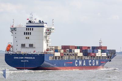
CMA CGM PREGOLIA
Cargo
Current Trip
| Time Travelled | 5 days |
|---|---|
| Remaining Time | --- |
| Distance Travelled | 1282.84 nm |
| Remaining Distance | 2566.83 nm |
| AVG Speed | 15 Knots |
| MAX Speed | 21.4 Knots |
| AVG Wind | 18.8 knots |
| MAX Wind | 33 knots |
| MIN Temp | 7.7°C / 45.86°F |
| MAX Temp | 17.2°C / 62.96°F |
| Draught | 10.5 m |
| Position Received | 3 d ago |
Current Position
| Longitude | --- |
|---|---|
| Latitude | --- |
| Status | Under way using engine |
| Speed | 21 Knots |
| Course | 273.4° |
| Area | English Channel |
| Station | T-AIS |
| Position Received | 3 d ago |
Info
Information
The current position of CMA CGM PREGOLIA is in English Channel with coordinates 50.21466° / -1.64150° as reported on 2025-12-20 13:50 by AIS to our vessel tracker app. The vessel's current speed is 21 Knots and is heading at the port of NEW YORK. The estimated time of arrival as calculated by MyShipTracking vessel tracking app is 2025-12-30 11:00 LT
The vessel CMA CGM PREGOLIA (IMO: 9745500, MMSI: 248659000) is a Cargo It's sailing under the flag of [MT] Malta.
In this page you can find informations about the vessels current position, last detected port calls, and current voyage information. If the vessels is not in coverage by AIS you will find the latest position.
The current position of CMA CGM PREGOLIA is detected by our AIS receivers and we are not responsible for the reliability of the data. The last position was recorded while the vessel was in Coverage by the Ais receivers of our vessel tracking app.
The current draught of CMA CGM PREGOLIA as reported by AIS is 10.5 meters
Weather
| Temperature | 16.2°C / 61.16°F |
|---|---|
| Wind Speed | 17 knots |
| Direction | 354° N |
| Pressure | 1022.2 hPa |
| Humidity | 75 % |
| Cloud Coverage | 14 % |
Featured Company
Last Port Calls
| Port | Arrival | Departure | Time In Port |
|---|---|---|---|
| 2025-12-15 08:13 | 2025-12-17 18:53 | 2 d | |
| 2025-12-14 00:11 | 2025-12-14 17:44 | 17 h | |
| 2025-12-12 10:15 | 2025-12-13 09:01 | 22 h | |
| 2025-11-30 17:28 | 2025-12-01 04:11 | 10 h | |
| 2025-11-28 00:11 | 2025-11-28 17:26 | 17 h | |
| 2025-11-22 09:12 | 2025-11-22 19:36 | 10 h | |
| 2025-11-16 15:35 | 2025-11-17 02:45 | 11 h | |
| 2025-11-01 02:49 | 2025-11-02 10:03 | 1 d | |
| 2025-10-26 02:25 | 2025-10-27 03:29 | 1 d | |
| 2025-10-21 05:04 | 2025-10-21 21:28 | 16 h |
Last Trips
| Origin | Departure | Destination | Arrival | Distance | |
|---|---|---|---|---|---|
| 2025-12-14 17:44 | 2025-12-15 08:13 | 192.45 nm | |||
| 2025-12-13 09:01 | 2025-12-14 00:11 | 147.99 nm | |||
| 2025-12-01 04:11 | 2025-12-12 10:15 | 4433.18 nm | |||
| 2025-11-28 17:26 | 2025-11-30 17:28 | 706.77 nm | |||
| 2025-11-22 19:36 | 2025-11-28 00:11 | 1473.95 nm | |||
| 2025-11-17 02:45 | 2025-11-22 09:12 | 1221.44 nm | |||
| 2025-11-02 10:03 | 2025-11-16 15:35 | 6021.46 nm | |||
| 2025-10-27 03:29 | 2025-11-01 02:49 | 1828.83 nm | |||
| 2025-10-21 21:28 | 2025-10-26 02:25 | 1616.64 nm | |||
| 2025-09-27 04:42 | 2025-10-21 05:04 | 7820.73 nm |
Events
| Time | Event | Details | Position / Dest | Info |
|---|---|---|---|---|
| 2025-12-20 13:56 | Status Changed | Default Under way using engine |
50.20909 / -1.68856
USNYC
|
Speed: 21 kn Course: 273.4° |
| 2025-12-20 13:50 | Change Sea Area | United Kingdom part of the English Channel French part of the English Channel |
50.21466 / -1.64151
English Channel
USNYC
|
Speed: 21 kn Course: 273.4° |
| 2025-12-20 13:50 | OUT of Coverage |
50.21466 / -1.64151
English Channel
USNYC
|
Speed: 21 kn Course: 273.4° |
|
| 2025-12-20 13:50 | Status Changed | Under way using engine Default |
50.21444 / -1.63629
USNYC
|
Speed: 20.9 kn Course: 287° |
| 2025-12-20 13:40 | IN Coverage |
50.21466 / -1.64151
English Channel
USNYC
|
Speed: 21 kn Course: 273.4° |
|
| 2025-12-20 12:28 | Status Changed | Default Under way using engine |
49.93690 / -1.13672
USNYC
|
Speed: 13.5 kn Course: 308.8° |
| 2025-12-20 12:21 | OUT of Coverage |
49.91780 / -1.10165
English Channel
USNYC
|
Speed: 13.5 kn Course: 308.8° |
|
| 2025-12-20 12:20 | Status Changed | Under way using engine Default |
49.91630 / -1.09862
USNYC
|
Speed: 8.4 kn Course: 210° |
| 2025-12-20 11:55 | Status Changed | Default Not under command |
49.92065 / -1.04741
USNYC
|
Speed: 8.5 kn Course: 311.1° |
| 2025-12-20 11:48 | Status Changed | Not under command Under way using engine |
49.91070 / -1.02860
USNYC
|
Speed: 10 kn Course: 309.2° |