

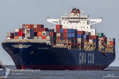
CMA CGM NERVAL
Container Ship

Current Trip
| Time Travelled | 12 days |
|---|---|
| Remaining Time | 5 days |
| Distance Travelled | 5719.60 nm |
| Remaining Distance | 2566.12 nm |
| AVG Speed | 18.7 Knots |
| MAX Speed | 22 Knots |
| AVG Wind | 10.6 knots |
| MAX Wind | 27.1 knots |
| MIN Temp | 16°C / 60.8°F |
| MAX Temp | 28.2°C / 82.76°F |
| Draught | 12.6 m |
| Position Received | 7 d ago |
Current Position
| Longitude | --- |
|---|---|
| Latitude | --- |
| Status | Under way using engine |
| Speed | 19.2 Knots |
| Course | 295.9° |
| Area | North Pacific Ocean |
| Station | T-AIS |
| Position Received | 7 d ago |
Information
The current position of CMA CGM NERVAL is in North Pacific Ocean with coordinates 20.55028° / -109.51938° as reported on 2025-02-09 21:49 by AIS to our vessel tracker app. The vessel's current speed is 19.2 Knots and is heading at the port of YOKOHAMA. The estimated time of arrival as calculated by MyShipTracking vessel tracking app is 2025-02-24 00:21 LT
The vessel CMA CGM NERVAL (IMO: 9406623, MMSI: 248432000) is a Container Ship that was built in 2010 ( 15 years old ). It's sailing under the flag of [MT] Malta.
In this page you can find informations about the vessels current position, last detected port calls, and current voyage information. If the vessels is not in coverage by AIS you will find the latest position.
The current position of CMA CGM NERVAL is detected by our AIS receivers and we are not responsible for the reliability of the data. The last position was recorded while the vessel was in Coverage by the Ais receivers of our vessel tracking app.
The current draught of CMA CGM NERVAL as reported by AIS is 12.6 meters
Weather
| Temperature | 18.9°C / 66.02°F |
|---|---|
| Wind Speed | 5 knots |
| Direction | 349° N |
| Pressure | 1017.3 hPa |
| Humidity | 56.2 % |
| Cloud Coverage | 78 % |


Featured Company
Last Port Calls
| Port | Arrival | Departure | Time In Port |
|---|---|---|---|
| 2025-02-04 07:35 | 2025-02-04 19:49 | 12 h | |
| 2025-01-27 17:34 | 2025-01-29 11:22 | 1 d | |
| 2025-01-22 21:49 | 2025-01-22 22:09 | 19 m | |
| 2025-01-10 07:01 | 2025-01-10 21:36 | 14 h | |
| 2024-12-20 16:53 | 2024-12-21 16:41 | 23 h | |
| 2024-12-16 05:31 | 2024-12-16 16:57 | 11 h |
Last Trips
| Origin | Departure | Destination | Arrival | Distance | |
|---|---|---|---|---|---|
| 2025-01-29 11:22 | 2025-02-04 07:35 | 1276.50 nm | |||
| 2025-01-22 22:09 | 2025-01-27 17:34 | 1162.80 nm | |||
| 2025-01-10 21:36 | 2025-01-22 21:49 | 2967.11 nm | |||
| 2024-12-21 16:41 | 2025-01-10 07:01 | 6146.58 nm | |||
| 2024-12-16 16:57 | 2024-12-20 16:53 | 631.34 nm | |||
| 2024-11-20 17:50 | 2024-12-16 05:31 | 7597.58 nm |
Events
| Time | Event | Details | Position / Dest | Info |
|---|---|---|---|---|
| 2025-02-09 21:53 | Status Changed | Default Under way using engine |
20.56108 / -109.54308
JPYOK
|
Speed: 19.2 kn Course: 295.9° |
| 2025-02-09 21:49 | OUT of Coverage |
20.55028 / -109.51938
North Pacific Ocean
JPYOK
|
Speed: 19.2 kn Course: 295.9° |
|
| 2025-02-09 21:48 | Status Changed | Under way using engine Default |
20.55008 / -109.51896
JPYOK
|
Speed: 19.2 kn Course: 295° |
| 2025-02-09 21:35 | IN Coverage |
20.55028 / -109.51938
North Pacific Ocean
JPYOK
|
Speed: 19.2 kn Course: 295.9° |
|
| 2025-02-09 20:50 | Status Changed | Default Under way using engine |
20.41062 / -109.21563
JPYOK
|
Speed: 19.6 kn Course: 295.9° |
| 2025-02-09 20:45 | Status Changed | Under way using engine Default |
20.40005 / -109.19267
JPYOK
|
Speed: 19.6 kn Course: 295° |
| 2025-02-09 20:45 | OUT of Coverage |
20.40005 / -109.19267
North Pacific Ocean
JPYOK
|
Speed: 19.6 kn Course: 295.9° |
|
| 2025-02-09 20:24 | Status Changed | Default Under way using engine |
20.35077 / -109.08559
JPYOK
|
Speed: 19.4 kn Course: 295.9° |
| 2025-02-09 20:05 | Status Changed | Under way using engine Default |
20.30148 / -108.98471
JPYOK
|
Speed: 19.8 kn Course: 298° |
| 2025-02-09 19:48 | Status Changed | Default Under way using engine |
20.25797 / -108.89792
JPYOK
|
Speed: 19.7 kn Course: 295.9° |