

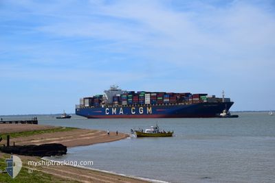
CMA CGM FIDELIO
Container Ship

Current Trip
| Time Travelled | 2 days |
|---|---|
| Remaining Time | 5 days |
| Distance Travelled | 1131.31 nm |
| Remaining Distance | 2834.83 nm |
| AVG Speed | 17.2 Knots |
| MAX Speed | 20.7 Knots |
| AVG Wind | 17.1 knots |
| MAX Wind | 22 knots |
| MIN Temp | 2.4°C / 36.32°F |
| MAX Temp | 10.6°C / 51.08°F |
| Draught | 13.9 m |
| Position Received | 1 d ago |
Current Position
| Longitude | --- |
|---|---|
| Latitude | --- |
| Status | Under way using engine |
| Speed | 16.2 Knots |
| Course | 275.1° |
| Area | Celtic Sea |
| Station | T-AIS |
| Position Received | 1 d ago |
Information
The current position of CMA CGM FIDELIO is in Celtic Sea with coordinates 49.77000° / -7.36155° as reported on 2025-03-16 05:15 by AIS to our vessel tracker app. The vessel's current speed is 16.2 Knots and is heading at the port of NEW YORK. The estimated time of arrival as calculated by MyShipTracking vessel tracking app is 2025-03-23 01:23 LT
The vessel CMA CGM FIDELIO (IMO: 9299642, MMSI: 229808000) is a Container Ship that was built in 2006 ( 19 years old ). It's sailing under the flag of [MT] Malta.
In this page you can find informations about the vessels current position, last detected port calls, and current voyage information. If the vessels is not in coverage by AIS you will find the latest position.
The current position of CMA CGM FIDELIO is detected by our AIS receivers and we are not responsible for the reliability of the data. The last position was recorded while the vessel was in Coverage by the Ais receivers of our vessel tracking app.
The current draught of CMA CGM FIDELIO as reported by AIS is 13.9 meters
Weather
| Temperature | 10.9°C / 51.62°F |
|---|---|
| Wind Speed | 19 knots |
| Direction | 164° SSE |
| Pressure | 1015.2 hPa |
| Humidity | 68.2 % |
| Cloud Coverage | 99 % |


Featured Company
Last Port Calls
| Port | Arrival | Departure | Time In Port |
|---|---|---|---|
| 2025-03-12 15:36 | 2025-03-14 13:19 | 1 d | |
| 2025-03-09 18:57 | 2025-03-11 12:09 | 1 d | |
| 2025-03-07 05:14 | 2025-03-09 05:08 | 1 d | |
| 2025-03-02 18:29 | 2025-03-03 22:37 | 1 d | |
| 2025-02-16 13:21 | 2025-02-17 18:58 | 1 d | |
| 2025-02-13 07:56 | 2025-02-14 23:15 | 1 d | |
| 2025-02-09 23:45 | 2025-02-10 22:49 | 23 h | |
| 2025-02-02 09:18 | 2025-02-03 17:07 | 1 d | |
| 2025-01-07 17:08 | 2025-01-08 15:58 | 22 h | |
| 2025-01-04 18:49 | 2025-01-05 15:17 | 20 h |
Most Visited Ports (Last year)
| Port | Arrivals | |
|---|---|---|
| 5 | ||
| 5 | ||
| 4 | ||
| 4 | ||
| 4 | ||
| 4 |
Last Trips
| Origin | Departure | Destination | Arrival | Distance | |
|---|---|---|---|---|---|
| 2025-03-11 12:09 | 2025-03-12 15:36 | 349.63 nm | |||
| 2025-03-09 05:08 | 2025-03-09 18:57 | 133.54 nm | |||
| 2025-03-03 22:37 | 2025-03-07 05:14 | 285.06 nm | |||
| 2025-02-17 18:58 | 2025-03-02 18:29 | 4287.41 nm | |||
| 2025-02-14 23:15 | 2025-02-16 13:21 | 432.61 nm | |||
| 2025-02-10 22:49 | 2025-02-13 07:56 | 133.41 nm | |||
| 2025-02-03 17:07 | 2025-02-09 23:45 | 459.38 nm | |||
| 2025-01-08 15:58 | 2025-02-02 09:18 | 10062.55 nm | |||
| 2025-01-05 15:17 | 2025-01-07 17:08 | 863.99 nm | |||
| 2024-12-25 06:17 | 2025-01-04 18:49 | 1659.99 nm |
Events
| Time | Event | Details | Position / Dest | Info |
|---|---|---|---|---|
| 2025-03-16 05:20 | Status Changed | Default Under way using engine |
49.77191 / -7.39628
USNYC
|
Speed: 16.2 kn Course: 275.1° |
| 2025-03-16 05:15 | OUT of Coverage |
49.77000 / -7.36155
Celtic Sea
USNYC
|
Speed: 16.2 kn Course: 275.1° |
|
| 2025-03-16 04:53 | Change Sea Area | United Kingdom part of the Celtic Sea United Kingdom part of the English Channel |
49.76073 / -7.20825
Celtic Sea
USNYC
|
Speed: 16.4 kn Course: 276.3° |
| 2025-03-16 04:52 | Status Changed | Under way using engine Default |
49.76050 / -7.20477
USNYC
|
Speed: 16.4 kn Course: 275° |
| 2025-03-16 04:40 | IN Coverage |
49.76073 / -7.20825
Celtic Sea
USNYC
|
Speed: 16.4 kn Course: 276.3° |
|
| 2025-03-16 00:12 | Status Changed | Default Under way using engine |
49.71267 / -5.13413
USNYC
|
Speed: 18.7 kn Course: 268.3° |
| 2025-03-16 00:06 | OUT of Coverage |
49.71365 / -5.08605
English Channel
USNYC
|
Speed: 18.7 kn Course: 268.3° |
|
| 2025-03-15 23:35 | Status Changed | Under way using engine Default |
49.73485 / -4.84403
USNYC
|
Speed: 18.6 kn Course: 259° |
| 2025-03-15 23:28 | Status Changed | Default Under way using engine |
49.74230 / -4.78625
USNYC
|
Speed: 18.6 kn Course: 259.5° |
| 2025-03-15 23:11 | Status Changed | Under way using engine Default |
49.75850 / -4.65930
USNYC
|
Speed: 18.4 kn Course: 259° |