
CLEAN HORIZON
Tanker D
Current Trip
FOR ORDERS
| Time Travelled | --- |
|---|---|
| Remaining Time | --- |
| Distance Travelled | 19407.60 nm |
| Remaining Distance | --- |
| AVG Speed | 16.1 Knots |
| MAX Speed | 20.3 Knots |
| AVG Wind | 14.8 knots |
| MAX Wind | 35.7 knots |
| MIN Temp | -2.1°C / 28.22°F |
| MAX Temp | 29.7°C / 85.46°F |
| Draught | 11.5 m |
| Position Received | 6 d ago |
Current Position
| Longitude | -15.59136° |
|---|---|
| Latitude | 6.35745° |
| Status | Under way using engine |
| Speed | 16.1 Knots |
| Course | 137.8° |
| Area | North Atlantic Ocean |
| Station | T-AIS |
| Position Received | 6 d ago |
Info
Information
The current position of CLEAN HORIZON is in North Atlantic Ocean with coordinates 6.35745° / -15.59136° as reported on 2024-04-28 11:15 by AIS to our vessel tracker app. The vessel's current speed is 16.1 Knots
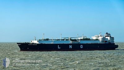
The vessel CLEAN HORIZON (IMO: 9655444, MMSI: 256083000) is a Tanker D It's sailing under the flag of [MT] Malta.
In this page you can find informations about the vessels current position, last detected port calls, and current voyage information. If the vessels is not in coverage by AIS you will find the latest position.
The current position of CLEAN HORIZON is detected by our AIS receivers and we are not responsible for the reliability of the data. The last position was recorded while the vessel was in Coverage by the Ais receivers of our vessel tracking app.
The current draught of CLEAN HORIZON as reported by AIS is 11.5 meters
Weather
| Temperature | 18.9°C / 66.02°F |
|---|---|
| Wind Speed | 11 knots |
| Direction | 152° SSE |
| Pressure | 1020.5 hPa |
| Humidity | 65.3 % |
| Cloud Coverage | --- |
Featured Company
Last Port Calls
Most Visited Ports (Last year)
| Port | Arrivals | |
|---|---|---|
| 4 | ||
| 3 | ||
| 2 | ||
| 1 | ||
| 1 | ||
| 1 |
Last Trips
| Origin | Departure | Destination | Arrival | Distance |
|---|
Events
| Time | Event | Details | Position / Dest | Info |
|---|---|---|---|---|
| 2024-04-28 11:22 | Status Changed | Default Under way using engine |
6.33354 / -15.57174
FOR ORDERS
|
Speed: 16.1 kn Course: 137.8° |
| 2024-04-28 11:15 | OUT of Coverage |
6.35745 / -15.59136
North Atlantic Ocean
|
Speed: 16.1 kn Course: 137.8° |
|
| 2024-04-28 11:12 | Status Changed | Under way using engine Default |
6.36970 / -15.60121
FOR ORDERS
|
Speed: 16 kn Course: 144° |
| 2024-04-28 10:37 | Status Changed | Default Under way using engine |
6.49551 / -15.69354
FOR ORDERS
|
Speed: 16.1 kn Course: 143° |
| 2024-04-28 10:31 | Status Changed | Under way using engine Default |
6.51816 / -15.71118
FOR ORDERS
|
Speed: 16.1 kn Course: 142° |
| 2024-04-28 10:30 | Status Changed | Default Under way using engine |
6.52170 / -15.71396
FOR ORDERS
|
Speed: 16 kn Course: 142.2° |
| 2024-04-28 10:19 | Status Changed | Under way using engine Default |
6.56037 / -15.74410
FOR ORDERS
|
Speed: 16 kn Course: 140° |
| 2024-04-28 10:17 | Status Changed | Default Under way using engine |
6.56842 / -15.75052
FOR ORDERS
|
Speed: 16 kn Course: 141.5° |
| 2024-04-28 10:08 | Status Changed | Under way using engine Default |
6.59908 / -15.77481
FOR ORDERS
|
Speed: 16 kn Course: 141° |
| 2024-04-28 09:57 | Status Changed | Default Under way using engine |
6.63717 / -15.80292
FOR ORDERS
|
Speed: 16.4 kn Course: 141° |