
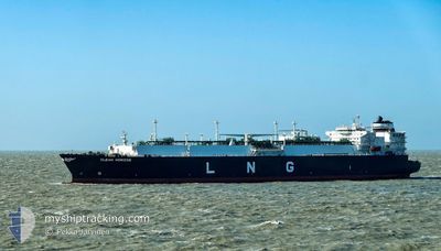
CLEAN HORIZON
Tanker D
Current Trip
FOR ORDERS
| Time Travelled | --- |
|---|---|
| Remaining Time | --- |
| Distance Travelled | 19407.60 nm |
| Remaining Distance | --- |
| AVG Speed | 16.1 Knop |
| MAX Speed | 20.3 Knop |
| AVG Wind | 14.8 knots |
| MAX Wind | 35.7 knots |
| MIN Temp | -2.1°C / 28.22°F |
| MAX Temp | 29.7°C / 85.46°F |
| Djupgående | 11.5 m |
| Position mottagen | 1 m sen |
Current Position
| Longitud | -16.83859° |
|---|---|
| Latitude | 24.54108° |
| Status | Under way using engine |
| Fart | 16.1 Knop |
| Kurs | 210.5° |
| Område | North Atlantic Ocean |
| Station | T-AIS |
| Position mottagen | 1 m sen |
Info
Information
The current position of CLEAN HORIZON is in North Atlantic Ocean with coordinates 24.54108° / -16.83859° as reported on 2024-04-25 11:31 by AIS to our vessel tracker app. The vessel's current speed is 16.1 Knop
The vessel CLEAN HORIZON (IMO: 9655444, MMSI: 256083000) is a Tanker D It's sailing under the flag of [MT] Malta.
In this page you can find informations about the vessels current position, last detected port calls, and current voyage information. If the vessels is not in coverage by AIS you will find the latest position.
The current position of CLEAN HORIZON is detected by our AIS receivers and we are not responsible for the reliability of the data. The last position was recorded while the vessel was in Coverage by the Ais receivers of our vessel tracking app.
The current draught of CLEAN HORIZON as reported by AIS is 11.5 meters
Weather
| Temperature | 20°C / 68°F |
|---|---|
| Wind Speed | 16 knots |
| Direction | 49° NE |
| Pressure | 1015.2 hPa |
| Humidity | 80.8 % |
| Cloud Coverage | 24 % |
Featured Company
Last Port Calls
Most Visited Ports (Last year)
| Port | Arrivals | |
|---|---|---|
| 4 | ||
| 3 | ||
| 2 | ||
| 1 | ||
| 1 | ||
| 1 |
Last Trips
| Origin | Departure | Destination | Arrival | Distance |
|---|
Events
| Tid | Event | Detaljer | Position / Dest | Information |
|---|---|---|---|---|
| 2024-04-25 11:30 | ETA ändrat | 2024/05/28 15:01 2024/05/28 16:01 |
24.54264 / -16.83759
FOR ORDERS
|
Fart: 16 kn Kurs: 210.3° |
| 2024-04-25 11:04 | Status ändrad | Under way using engine Default |
24.64088 / -16.77011
FOR ORDERS
|
Fart: 16.3 kn Kurs: 214° |
| 2024-04-25 11:01 | Status ändrad | Default Under way using engine |
24.65243 / -16.76215
FOR ORDERS
|
Fart: 16.4 kn Kurs: 215.1° |
| 2024-04-25 10:45 | Status ändrad | Under way using engine Default |
24.71518 / -16.71659
FOR ORDERS
|
Fart: 16.7 kn Kurs: 214° |
| 2024-04-25 10:30 | I täckningsområde |
24.70820 / -16.72156
North Atlantic Ocean
|
Fart: 16.5 kn Kurs: 212.6° |
|
| 2024-04-25 07:34 | Status ändrad | Default Under way using engine |
25.45018 / -16.19291
FOR ORDERS
|
Fart: 16.1 kn Kurs: 212.3° |
| 2024-04-25 07:30 | Status ändrad | Under way using engine Default |
25.46427 / -16.18300
FOR ORDERS
|
Fart: 16.1 kn Kurs: 211° |
| 2024-04-25 07:30 | UTANFÖR täckningsområde |
25.46427 / -16.18300
North Atlantic Ocean
|
Fart: 16.1 kn Kurs: 212.3° |
|
| 2024-04-25 07:25 | Status ändrad | Default Under way using engine |
25.48579 / -16.16816
FOR ORDERS
|
Fart: 16 kn Kurs: 212.2° |
| 2024-04-25 07:16 | Byter havsområde | Western Saharan part of the North Atlantic Ocean Spanish (Canary Islands) part of the North Atlantic Ocean |
25.52010 / -16.14679
North Atlantic Ocean
|
Fart: 16 kn Kurs: 207° |