
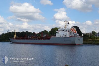
CLAUS
Oil/Chemical Tanker
Current Trip
| Time Travelled | 7 days |
|---|---|
| Remaining Time | 4 h, 18 mins |
| Distance Travelled | 122.73 nm |
| Remaining Distance | 47.98 nm |
| AVG Speed | 11.3 Knots |
| MAX Speed | 14.8 Knots |
| AVG Wind | 12.6 knots |
| MAX Wind | 22 knots |
| MIN Temp | 14.4°C / 57.92°F |
| MAX Temp | 19.4°C / 66.92°F |
| Draught | 5 m |
| Position Received | 4 m ago |
Current Position
| Longitude | 2.94177° |
|---|---|
| Latitude | 51.82123° |
| Status | Under way using engine |
| Speed | 11.2 Knots |
| Course | 72.2° |
| Area | North Sea |
| Station | T-AIS |
| Position Received | 4 m ago |
Info
Information
The current position of CLAUS is in North Sea with coordinates 51.82123° / 2.94177° as reported on 2024-09-21 13:39 by AIS to our vessel tracker app. The vessel's current speed is 11.2 Knots and is heading at the port of ROTTERDAM. The estimated time of arrival as calculated by MyShipTracking vessel tracking app is 2024-09-21 18:02 LT
The vessel CLAUS (IMO: 9268253, MMSI: 236263000) is a Oil/Chemical Tanker that was built in 2004 ( 20 years old ). It's sailing under the flag of [GI] Gibraltar.
In this page you can find informations about the vessels current position, last detected port calls, and current voyage information. If the vessels is not in coverage by AIS you will find the latest position.
The current position of CLAUS is detected by our AIS receivers and we are not responsible for the reliability of the data. The last position was recorded while the vessel was in Coverage by the Ais receivers of our vessel tracking app.
The current draught of CLAUS as reported by AIS is 5 meters
Weather
| Temperature | 19.3°C / 66.74°F |
|---|---|
| Wind Speed | 8 knots |
| Direction | 83° E |
| Pressure | 1018.2 hPa |
| Humidity | 76.9 % |
| Cloud Coverage | 7 % |
Featured Company
Last Port Calls
| Port | Arrival | Departure | Time In Port |
|---|---|---|---|
| 2024-09-13 08:10 | 2024-09-14 09:19 | 1 d | |
| 2024-09-03 09:27 | 2024-09-06 05:39 | 2 d | |
| 2024-08-30 09:14 | 2024-08-31 08:16 | 23 h | |
| 2024-08-30 01:33 | 2024-08-30 06:59 | 5 h | |
| 2024-08-28 13:00 | 2024-08-29 02:58 | 13 h | |
| 2024-08-23 21:54 | 2024-08-25 02:11 | 1 d | |
| 2024-08-20 01:17 | 2024-08-20 23:04 | 21 h | |
| 2024-08-17 23:34 | 2024-08-19 00:41 | 1 d | |
| 2024-08-10 12:01 | 2024-08-10 13:06 | 1 h | |
| 2024-08-05 13:35 | 2024-08-10 11:41 | 4 d |
Last Trips
| Origin | Departure | Destination | Arrival | Distance | |
|---|---|---|---|---|---|
| 2024-09-06 06:39 | 2024-09-13 09:10 | 446.19 nm | |||
| 2024-08-31 09:16 | 2024-09-03 10:27 | 782.22 nm | |||
| 2024-08-29 03:58 | 2024-08-30 10:14 | 285.88 nm | |||
| 2024-08-29 03:58 | 2024-08-30 02:33 | 259.02 nm | |||
| 2024-08-25 04:11 | 2024-08-28 14:00 | 617.29 nm | |||
| 2024-08-21 01:04 | 2024-08-23 23:54 | 319.01 nm | |||
| 2024-08-19 02:41 | 2024-08-20 03:17 | 309.83 nm | |||
| 2024-08-10 14:06 | 2024-08-18 01:34 | 760.54 nm | |||
| 2024-08-10 12:41 | 2024-08-10 13:01 | 1.94 nm | |||
| 2024-08-05 14:10 | 2024-08-05 14:35 | 1.84 nm |
Events
| Time | Event | Details | Position / Dest | Info |
|---|---|---|---|---|
| 2024-09-21 12:40 | Change Sea Area | Dutch part of the North Sea Belgian part of the North Sea |
51.80481 / 2.65984
North Sea
NLRTM
|
Speed: 10.5 kn Course: 104.5° |
| 2024-09-21 12:12 | Change Sea Area | Belgian part of the North Sea United Kingdom part of the North Sea |
51.82627 / 2.53252
North Sea
NLRTM
|
Speed: 10.3 kn Course: 106.1° |
| 2024-09-21 09:02 | Status Changed | Under way using engine Default |
51.61593 / 1.88768
NLRTM
|
Speed: 11 kn Course: 55° |
| 2024-09-21 09:01 | Status Changed | Default Under way using engine |
51.61477 / 1.88499
NLRTM
|
Speed: 11 kn Course: 54.9° |
| 2024-09-21 07:12 | Draught Changed | 5 5.1 |
51.41915 / 1.46431
NLRTM
|
Speed: 9.5 kn Course: 74.3° |
| 2024-09-21 07:09 | START Moving | 5.69 nm, North of RAMSGATE |
51.41776 / 1.45666
NLRTM
|
Speed: 5.6 kn Course: 57.2° |
| 2024-09-21 07:05 | Status Changed | Under way using engine At anchor |
51.41601 / 1.45562
NLRTM
|
Speed: 0.6 kn Course: 320° |
| 2024-09-21 07:01 | ETA Changed | 2024/09/21 17:00 2024/09/21 16:00 |
51.41521 / 1.45576
NLRTM
|
Speed: 0.3 kn Course: 313° |
| 2024-09-21 06:52 | Destination Changed | NLRTM WEST THURROCK |
51.41574 / 1.45654
NLRTM
|
Speed: Course: 317° |
| 2024-09-21 06:52 | ETA Changed | 2024/09/21 16:00 2024/09/07 15:00 |
51.41574 / 1.45654
NLRTM
|
Speed: Course: 317° |