
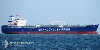
CL EMILY BRONTE
Tanker
Current Trip
| Trip Time | 50 days |
|---|---|
| Trip Distance | 11569.16 nm |
| AVG Speed | 11.2 Knots |
| MAX Speed | 13.8 Knots |
| Draught | 12.9 m |
| AVG Wind | 13.7 knots |
| MAX Wind | 30 knots |
| MIN Temp | 15.1°C / 59.18°F |
| MAX Temp | 28.7°C / 83.66°F |
| Position Received | 2 h, 46 m ago |
Current Position
| Longitude | --- |
|---|---|
| Latitude | --- |
| Status | Moored |
| Speed | |
| Course | 13° |
| Area | Indian Ocean |
| Station | T-AIS |
| Position Received | 2 h, 46 m ago |
Info
Information
The current position of CL EMILY BRONTE is in Indian Ocean with coordinates -32.24074° / 115.75508° as reported on 2025-01-12 09:51 by AIS to our vessel tracker app. The vessel's current speed is 0 Knots and is currently inside the port of KWINANA.
The vessel CL EMILY BRONTE (IMO: 9943322, MMSI: 636022160) is a Tanker It's sailing under the flag of [LR] Liberia.
In this page you can find informations about the vessels current position, last detected port calls, and current voyage information. If the vessels is not in coverage by AIS you will find the latest position.
The current position of CL EMILY BRONTE is detected by our AIS receivers and we are not responsible for the reliability of the data. The last position was recorded while the vessel was in Coverage by the Ais receivers of our vessel tracking app.
The current draught of CL EMILY BRONTE as reported by AIS is 12.9 meters
Weather
| Temperature | 20.6°C / 69.08°F |
|---|---|
| Wind Speed | 8 knots |
| Direction | 209° SSW |
| Pressure | 1011.2 hPa |
| Humidity | 82.8 % |
| Cloud Coverage | --- |
Featured Company
Last Port Calls
| Port | Arrival | Departure | Time In Port |
|---|---|---|---|
| 2025-01-12 16:24 | |||
| 2024-11-21 18:28 | 2024-11-23 02:22 | 1 d | |
| 2024-11-01 19:59 | 2024-11-03 06:44 | 1 d |
Most Visited Ports (Last year)
| Port | Arrivals | |
|---|---|---|
| 3 | ||
| 2 | ||
| 2 | ||
| 2 | ||
| 1 | ||
| 1 |
Last Trips
| Origin | Departure | Destination | Arrival | Distance | |
|---|---|---|---|---|---|
| 2024-11-23 02:22 | 2025-01-12 16:24 | 11569.16 nm | |||
| 2024-11-03 06:44 | 2024-11-21 18:28 | 5096.91 nm | |||
| 2024-10-31 20:07 | 2024-11-01 19:59 | 217.54 nm |
Events
| Time | Event | Details | Position / Dest | Info |
|---|---|---|---|---|
| 2025-01-12 09:54 | Status Changed | Default Moored |
-32.24073 / 115.75509
[AU] KWINANA
|
Speed: Course: 13° |
| 2025-01-12 09:51 | Status Changed | Moored Default |
-32.24074 / 115.75508
[AU] KWINANA
|
Speed: Course: 13° |
| 2025-01-12 09:51 | OUT of Coverage |
-32.24074 / 115.75508
Indian Ocean
[AU] KWINANA
|
Speed: Course: 308.9° |
|
| 2025-01-12 09:36 | Status Changed | Default Moored |
-32.24075 / 115.75511
[AU] KWINANA
|
Speed: Course: 13° |
| 2025-01-12 09:27 | Status Changed | Moored Under way using engine |
-32.24075 / 115.75511
[AU] KWINANA
|
Speed: Course: 13° |
| 2025-01-12 08:26 | ETA Changed | 2025/01/12 04:30 2025/01/11 23:00 |
-32.24072 / 115.75481
[AU] KWINANA
|
Speed: 0.3 kn Course: 15° |
| 2025-01-12 08:25 | STOP Moving |
-32.24064 / 115.75465
[AU] KWINANA
|
Speed: 0.3 kn Course: 21° |
|
| 2025-01-12 08:24 | PORT ARRIVAL |
|
-32.24063 / 115.75461
[AU] KWINANA
|
Speed: 0.8 kn Course: 24° |
| 2025-01-12 03:29 | Status Changed | Under way using engine Default |
-31.84903 / 115.42516
AU KWI
|
Speed: 4.8 kn Course: 117° |
| 2025-01-12 03:28 | Status Changed | Default Under way using engine |
-31.84826 / 115.42297
AU KWI
|
Speed: 5.1 kn Course: 112.5° |