
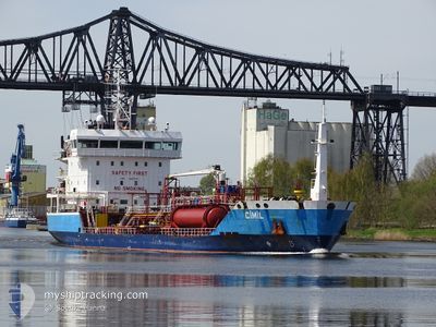
CIMIL
Oil/Chemical Tanker
Current Trip
| Time Travelled | 3 days |
|---|---|
| Remaining Time | 2 days |
| Distance Travelled | 866.93 nm |
| Remaining Distance | 528.06 nm |
| AVG Speed | 9.2 Knots |
| MAX Speed | 12.9 Knots |
| AVG Wind | 12 knots |
| MAX Wind | 23.8 knots |
| MIN Temp | 4.1°C / 39.38°F |
| MAX Temp | 11.9°C / 53.42°F |
| Draught | 6.2 m |
| Position Received | 1 d ago |
Current Position
| Longitude | -6.20840° |
|---|---|
| Latitude | 48.41927° |
| Status | Under way using engine |
| Speed | 8.6 Knots |
| Course | 208° |
| Area | Celtic Sea |
| Station | T-AIS |
| Position Received | 1 d ago |
Info
Information
The current position of CIMIL is in Celtic Sea with coordinates 48.41927° / -6.20840° as reported on 2024-04-25 13:20 by AIS to our vessel tracker app. The vessel's current speed is 8.6 Knots and is heading at the port of HUELVA. The estimated time of arrival as calculated by MyShipTracking vessel tracking app is 2024-04-29 11:53 LT
The vessel CIMIL (IMO: 9487378, MMSI: 215909000) is a Oil/Chemical Tanker that was built in 2010 ( 14 years old ). It's sailing under the flag of [MT] Malta.
In this page you can find informations about the vessels current position, last detected port calls, and current voyage information. If the vessels is not in coverage by AIS you will find the latest position.
The current position of CIMIL is detected by our AIS receivers and we are not responsible for the reliability of the data. The last position was recorded while the vessel was in Coverage by the Ais receivers of our vessel tracking app.
The current draught of CIMIL as reported by AIS is 6.2 meters
Weather
| Temperature | 11.8°C / 53.24°F |
|---|---|
| Wind Speed | 20 knots |
| Direction | 10° N |
| Pressure | 999.9 hPa |
| Humidity | 73.7 % |
| Cloud Coverage | 100 % |
Featured Company
Last Port Calls
| Port | Arrival | Departure | Time In Port |
|---|---|---|---|
| 2024-04-22 04:39 | 2024-04-23 06:53 | 1 d | |
| 2024-04-19 11:23 | 2024-04-20 06:04 | 18 h | |
| 2024-04-18 15:30 | 2024-04-19 10:33 | 19 h | |
| 2024-04-17 06:12 | 2024-04-18 13:37 | 1 d | |
| 2024-04-09 16:51 | 2024-04-13 12:11 | 3 d | |
| 2024-04-06 11:53 | 2024-04-06 16:59 | 5 h | |
| 2024-04-05 06:08 | 2024-04-06 10:40 | 1 d | |
| 2024-04-02 07:06 | 2024-04-03 04:55 | 21 h | |
| 2024-03-31 19:45 | 2024-04-01 18:25 | 22 h | |
| 2024-03-26 17:42 | 2024-03-27 08:58 | 15 h |
Most Visited Ports (Last year)
| Port | Arrivals | |
|---|---|---|
| 8 | ||
| 7 | ||
| 5 | ||
| 4 | ||
| 4 | ||
| 4 |
Last Trips
| Origin | Departure | Destination | Arrival | Distance | |
|---|---|---|---|---|---|
| 2024-04-20 08:04 | 2024-04-22 06:39 | 79.15 nm | |||
| 2024-04-19 12:33 | 2024-04-19 13:23 | 4.16 nm | |||
| 2024-04-18 15:37 | 2024-04-18 17:30 | 14.22 nm | |||
| 2024-04-13 14:11 | 2024-04-17 08:12 | 703.00 nm | |||
| 2024-04-06 18:59 | 2024-04-09 18:51 | 681.11 nm | |||
| 2024-04-06 12:40 | 2024-04-06 13:53 | 10.13 nm | |||
| 2024-04-03 06:55 | 2024-04-05 08:08 | 450.35 nm | |||
| 2024-04-01 20:25 | 2024-04-02 09:06 | 104.47 nm | |||
| 2024-03-27 09:58 | 2024-03-31 21:45 | 110.60 nm | |||
| 2024-03-25 13:17 | 2024-03-26 18:42 | 236.95 nm |
Events
| Time | Event | Details | Position / Dest | Info |
|---|---|---|---|---|
| 2024-04-25 13:22 | Status Changed | Default Under way using engine |
48.41608 / -6.21100
ESHUV
|
Speed: 8.6 kn Course: 208° |
| 2024-04-25 13:20 | OUT of Coverage |
48.41927 / -6.20840
Celtic Sea
ESHUV
|
Speed: 8.6 kn Course: 208° |
|
| 2024-04-25 12:28 | Detected in Sea | French part of the Celtic Sea |
48.53375 / -6.11323
Celtic Sea
ESHUV
|
Speed: 9.3 kn Course: 209° |
| 2024-04-25 12:28 | Status Changed | Under way using engine Default |
48.53375 / -6.11323
ESHUV
|
Speed: 9.4 kn Course: 209° |
| 2024-04-25 12:16 | IN Coverage |
48.53375 / -6.11323
Celtic Sea
ESHUV
|
Speed: 9.3 kn Course: 209° |
|
| 2024-04-25 03:06 | Status Changed | Default Under way using engine |
49.42185 / -4.43135
ESHUV
|
Speed: 9.1 kn Course: 239° |
| 2024-04-25 02:59 | OUT of Coverage |
49.43137 / -4.40725
English Channel
ESHUV
|
Speed: 9.1 kn Course: 239° |
|
| 2024-04-25 02:58 | Status Changed | Under way using engine Default |
49.43292 / -4.40330
ESHUV
|
Speed: 9.2 kn Course: 238° |
| 2024-04-25 02:42 | Status Changed | Default Under way using engine |
49.45379 / -4.34950
ESHUV
|
Speed: 9.3 kn Course: 236° |
| 2024-04-25 02:36 | Status Changed | Under way using engine Default |
49.46075 / -4.33108
ESHUV
|
Speed: 9.4 kn Course: 235° |