
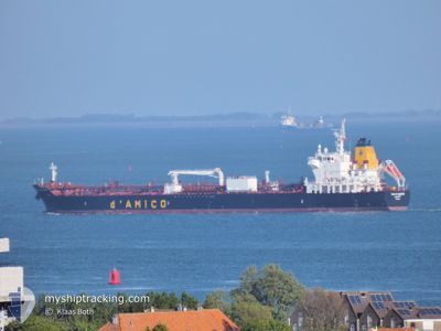
CIELO DI SALERNO
Tanker
Current Trip
| Time Travelled | 10 h, 30 mins |
|---|---|
| Remaining Time | --- |
| Distance Travelled | 2.11 nm |
| Remaining Distance | 5.25 nm |
| AVG Speed | 4.4 Knots |
| MAX Speed | 5 Knots |
| AVG Wind | 16.8 knots |
| MAX Wind | 21 knots |
| MIN Temp | 18.2°C / 64.76°F |
| MAX Temp | 19.3°C / 66.74°F |
| Draught | 11.7 m |
| Position Received | 5 d ago |
Current Position
| Longitude | --- |
|---|---|
| Latitude | --- |
| Status | Under way using engine |
| Speed | 12.3 Knots |
| Course | 207.7° |
| Area | North Atlantic Ocean |
| Station | T-AIS |
| Position Received | 5 d ago |
Information
The current position of CIELO DI SALERNO is in North Atlantic Ocean with coordinates 27.56682° / -15.23534° as reported on 2025-02-19 04:16 by AIS to our vessel tracker app. The vessel's current speed is 12.3 Knots and is heading at the port of NOUADHIBOU. The estimated time of arrival as calculated by MyShipTracking vessel tracking app is 2025-02-20 19:00 LT
The vessel CIELO DI SALERNO (IMO: 9717292, MMSI: 249775000) is a Tanker It's sailing under the flag of [MT] Malta.
In this page you can find informations about the vessels current position, last detected port calls, and current voyage information. If the vessels is not in coverage by AIS you will find the latest position.
The current position of CIELO DI SALERNO is detected by our AIS receivers and we are not responsible for the reliability of the data. The last position was recorded while the vessel was in Coverage by the Ais receivers of our vessel tracking app.
The current draught of CIELO DI SALERNO as reported by AIS is 11.7 meters
Weather
| Temperature | 19°C / 66.2°F |
|---|---|
| Wind Speed | 13 knots |
| Direction | 34° NE |
| Pressure | 1019.8 hPa |
| Humidity | 65.9 % |
| Cloud Coverage | --- |
Featured Company
Last Port Calls
| Port | Arrival | Departure | Time In Port |
|---|---|---|---|
| 2025-02-21 09:38 | 2025-02-24 15:05 | 3 d | |
| 2025-02-10 00:23 | 2025-02-12 14:54 | 2 d | |
| 2025-01-27 12:49 | 2025-01-29 14:34 | 2 d | |
| 2025-01-19 16:23 | 2025-01-21 14:51 | 1 d | |
| 2025-01-08 21:15 | 2025-01-11 00:57 | 2 d | |
| 2024-12-27 15:25 | 2024-12-28 14:45 | 23 h | |
| 2024-12-22 12:00 | 2024-12-24 19:21 | 2 d | |
| 2024-12-17 17:45 | 2024-12-21 09:42 | 3 d | |
| 2024-12-05 13:28 | 2024-12-09 09:50 | 3 d |
Most Visited Ports (Last year)
| Port | Arrivals | |
|---|---|---|
| 19 | ||
| 10 | ||
| 3 | ||
| 1 |
Last Trips
| Origin | Departure | Destination | Arrival | Distance | |
|---|---|---|---|---|---|
| 2025-02-12 15:54 | 2025-02-21 09:38 | 2269.42 nm | |||
| 2025-01-29 14:34 | 2025-02-10 01:23 | 2317.16 nm | |||
| 2025-01-21 14:51 | 2025-01-27 12:49 | 8.88 nm | |||
| 2025-01-11 01:57 | 2025-01-19 16:23 | 2272.99 nm | |||
| 2024-12-28 14:45 | 2025-01-08 22:15 | 3189.88 nm | |||
| 2024-12-24 19:21 | 2024-12-27 15:25 | 788.56 nm | |||
| 2024-12-21 09:42 | 2024-12-22 12:00 | 231.47 nm | |||
| 2024-12-09 10:50 | 2024-12-17 17:45 | 2315.89 nm | |||
| 2024-11-27 09:57 | 2024-12-05 14:28 | 2315.82 nm |
Events
| Time | Event | Details | Position / Dest | Info |
|---|---|---|---|---|
| 2025-02-24 15:54 | STOP Moving | 1.01 nm, South East of CASADO |
20.80633 / -17.02167
NOUADHIBOU
|
Speed: 0.2 kn Course: 335° |
| 2025-02-24 15:14 | START Moving | 0.58 nm, East of CASADO |
20.81896 / -17.02495
NOUADHIBOU
|
Speed: 5.1 kn Course: 190° |
| 2025-02-24 15:05 | PORT DEPARTURE |
|
20.82694 / -17.02640
NOUADHIBOU
|
Speed: 1.8 kn Course: 101° |
| 2025-02-21 09:40 | STOP Moving |
20.82799 / -17.02821
[MR] CASADO
|
Speed: 0.1 kn Course: 357° |
|
| 2025-02-21 09:38 | PORT ARRIVAL |
|
20.82800 / -17.02813
[MR] CASADO
|
Speed: 1.9 kn Course: 7° |
| 2025-02-21 08:09 | START Moving | 4.6 nm, South of CASADO |
20.74098 / -17.02608
NOUADHIBOU
|
Speed: 4.2 kn Course: 232° |
| 2025-02-20 20:04 | STOP Moving | 4.87 nm, South of CASADO |
20.73687 / -17.02316
NOUADHIBOU
|
Speed: Course: 13° |
| 2025-02-19 04:23 | Status Changed | Default Under way using engine |
27.54332 / -15.24914
NOUADHIBOU
|
Speed: 12.3 kn Course: 207.7° |
| 2025-02-19 04:16 | Status Changed | Under way using engine Default |
27.56682 / -15.23534
NOUADHIBOU
|
Speed: 12.2 kn Course: 208° |
| 2025-02-19 04:16 | OUT of Coverage |
27.56682 / -15.23534
North Atlantic Ocean
NOUADHIBOU
|
Speed: 12.3 kn Course: 207.7° |