

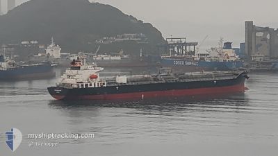
CHEMROAD WING
Oil/Chemical Tanker

Current Trip
| Time Travelled | 56 days |
|---|---|
| Remaining Time | 3 days |
| Distance Travelled | 4364.90 nm |
| Remaining Distance | 1087.36 nm |
| AVG Speed | 11.8 Knots |
| MAX Speed | 15.9 Knots |
| AVG Wind | 12.5 knots |
| MAX Wind | 36.7 knots |
| MIN Temp | 0.7°C / 33.26°F |
| MAX Temp | 29.9°C / 85.82°F |
| Draught | 9.7 m |
| Position Received | 2 d ago |
Current Position
| Longitude | --- |
|---|---|
| Latitude | --- |
| Status | Under way using engine |
| Speed | 12.2 Knots |
| Course | 285.7° |
| Area | Singapore Strait |
| Station | T-AIS |
| Position Received | 2 d ago |
Information
The current position of CHEMROAD WING is in Singapore Strait with coordinates 1.18438° / 103.65647° as reported on 2025-03-25 06:18 by AIS to our vessel tracker app. The vessel's current speed is 12.2 Knots and is heading at the port of TUTICORIN. The estimated time of arrival as calculated by MyShipTracking vessel tracking app is 2025-03-31 02:48 LT
The vessel CHEMROAD WING (IMO: 9309502, MMSI: 357740000) is a Oil/Chemical Tanker that was built in 2005 ( 20 years old ). It's sailing under the flag of [PA] Panama.
In this page you can find informations about the vessels current position, last detected port calls, and current voyage information. If the vessels is not in coverage by AIS you will find the latest position.
The current position of CHEMROAD WING is detected by our AIS receivers and we are not responsible for the reliability of the data. The last position was recorded while the vessel was in Coverage by the Ais receivers of our vessel tracking app.
The current draught of CHEMROAD WING as reported by AIS is 9.7 meters
Weather
| Temperature | 28.5°C / 83.3°F |
|---|---|
| Wind Speed | 9 knots |
| Direction | 304° NW |
| Pressure | 1006.4 hPa |
| Humidity | 71.6 % |
| Cloud Coverage | 80 % |


Featured Company
Events
| Time | Event | Details | Position / Dest | Info |
|---|---|---|---|---|
| 2025-03-25 06:26 | Status Changed | Default Under way using engine |
1.19132 / 103.62962
IN TUT
|
Speed: 12.2 kn Course: 285.7° |
| 2025-03-25 06:18 | OUT of Coverage |
1.18438 / 103.65647
Singapore Strait
IN TUT
|
Speed: 12.2 kn Course: 285.7° |
|
| 2025-03-25 06:17 | Change Sea Area | Indonesian part of the Singapore Strait Singaporean part of the Singapore Strait |
1.18348 / 103.65972
Singapore Strait
IN TUT
|
Speed: 12.1 kn Course: 286.2° |
| 2025-03-25 05:30 | START Moving | 3.74 nm, South of BUKOM ISLAND |
1.17401 / 103.75333
IN TUT
|
Speed: 3.5 kn Course: 155° |
| 2025-03-25 05:24 | Status Changed | Under way using engine At anchor |
1.17604 / 103.75316
IN TUT
|
Speed: 0.1 kn Course: 168° |
| 2025-03-25 04:20 | Destination Changed | IN TUT SG SIN PGBG |
1.17380 / 103.75448
IN TUT
|
Speed: 0.2 kn Course: 314° |
| 2025-03-25 04:20 | ETA Changed | 2025/03/30 20:00 2025/03/24 07:00 |
1.17380 / 103.75448
IN TUT
|
Speed: 0.2 kn Course: 314° |
| 2025-03-25 03:22 | Status Changed | At anchor Default |
1.17507 / 103.75491
SG SIN PGBG
|
Speed: 0.1 kn Course: 272° |
| 2025-03-25 03:16 | Status Changed | Default At anchor |
1.17522 / 103.75478
SG SIN PGBG
|
Speed: 0.2 kn Course: 279° |
| 2025-03-25 01:10 | Status Changed | At anchor Default |
1.17533 / 103.75474
SG SIN PGBG
|
Speed: Course: 258° |