
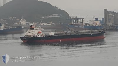
CHEMROAD WING
Oil/Chemical Tanker
Current Trip
MU PLU
| Time Travelled | 6 days |
|---|---|
| Remaining Time | --- |
| Distance Travelled | 1253.48 морская миля |
| Remaining Distance | --- |
| AVG Speed | 12.8 Узлы |
| MAX Speed | 14 Узлы |
| AVG Wind | 8.6 knots |
| MAX Wind | 17 knots |
| MIN Temp | 15°C / 59°F |
| MAX Temp | 28.7°C / 83.66°F |
| Осадка | 11.8 м |
| Позиция Получена | 1 d тому назад |
Current Position
| Долгота | -38.61573° |
|---|---|
| Широта | -13.07570° |
| Статус | Under way using engine |
| Скорость | 5.1 Узлы |
| Курс | 301° |
| Район | South Atlantic Ocean |
| Станция | T-AIS |
| Позиция Получена | 1 d тому назад |
Info
Information
The current position of CHEMROAD WING is in South Atlantic Ocean with coordinates -13.07570° / -38.61573° as reported on 2024-04-23 15:00 by AIS to our vessel tracker app. The vessel's current speed is 5.1 Узлы
The vessel CHEMROAD WING (IMO: 9309502, MMSI: 357740000) is a Oil/Chemical Tanker that was built in 2005 ( 19 лет ). It's sailing under the flag of [PA] Panama.
In this page you can find informations about the vessels current position, last detected port calls, and current voyage information. If the vessels is not in coverage by AIS you will find the latest position.
The current position of CHEMROAD WING is detected by our AIS receivers and we are not responsible for the reliability of the data. The last position was recorded while the vessel was in Coverage by the Ais receivers of our vessel tracking app.
The current draught of CHEMROAD WING as reported by AIS is 11.8 meters
Weather
| Temperature | 28.2°C / 82.76°F |
|---|---|
| Wind Speed | 8 knots |
| Direction | 159° SSE |
| Pressure | 1014.1 hPa |
| Humidity | 75.9 % |
| Cloud Coverage | 1 % |
Featured Company
Events
| Время | Событие | Детали | Позиция / Направление | Информация |
|---|---|---|---|---|
| 2024-04-23 15:52 | Окончание движения | 8.04 nm, South West of SALVADOR |
-13.05290 / -38.62042
MU PLU
|
Скорость: 0.1 kn Курс: 182° |
| 2024-04-23 15:05 | Статус изменился | Default Under way using engine |
-13.07218 / -38.62143
MU PLU
|
Скорость: 5.1 kn Курс: 301° |
| 2024-04-23 15:00 | Вне покрытия |
-13.07570 / -38.61573
South Atlantic Ocean
|
Скорость: 5.1 kn Курс: 301° |
|
| 2024-04-23 15:00 | Статус изменился | Under way using engine Default |
-13.07610 / -38.61513
MU PLU
|
Скорость: 6.2 kn Курс: 298° |
| 2024-04-23 14:45 | В покрытии |
-13.07570 / -38.61573
South Atlantic Ocean
|
Скорость: 5.1 kn Курс: 301° |
|
| 2024-04-19 04:06 | ПОРТ ОТПРАВЛЕНИЯ |
|
-25.49368 / -48.53105
MU PLU
|
Скорость: Курс: 106° |
| 2024-04-17 14:18 | Окончание движения |
-25.50037 / -48.53818
[BR] PARANAGUA
|
Скорость: Курс: 106° |
|
| 2024-04-17 14:13 | Порт |
|
-25.50035 / -48.53833
[BR] PARANAGUA
|
Скорость: 1.1 kn Курс: 109° |
| 2024-04-17 13:30 | Начало движения | 1.66 nm, East of PARANAGUA |
-25.49403 / -48.48790
MU PLU
|
Скорость: 8.3 kn Курс: 255° |
| 2024-04-16 19:13 | Вне покрытия |
-25.48922 / -48.47745
South Atlantic Ocean
|
Скорость: 0.1 kn Курс: 341° |