
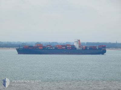
CHACABUCO
Container Ship
Current Trip
| Time Travelled | 6 days |
|---|---|
| Remaining Time | --- |
| Distance Travelled | 2589.65 nm |
| Remaining Distance | --- |
| AVG Speed | 15.7 Knots |
| MAX Speed | 19.5 Knots |
| AVG Wind | 18.6 knots |
| MAX Wind | 31 knots |
| MIN Temp | 2.7°C / 36.86°F |
| MAX Temp | 21.6°C / 70.88°F |
| Draught | 13.2 m |
| Position Received | 1 d ago |
Current Position
| Longitude | --- |
|---|---|
| Latitude | --- |
| Status | Under way using engine |
| Speed | 18.5 Knots |
| Course | 242.2° |
| Area | North Atlantic Ocean |
| Station | T-AIS |
| Position Received | 1 d ago |
Info
Information
The current position of CHACABUCO is in North Atlantic Ocean with coordinates 35.63511° / -26.31484° as reported on 2025-01-12 14:11 by AIS to our vessel tracker app. The vessel's current speed is 18.5 Knots and is heading at the port of VERACRUZ. The estimated time of arrival as calculated by MyShipTracking vessel tracking app is 2025-01-20 23:30 LT
The vessel CHACABUCO (IMO: 9295957, MMSI: 636092679) is a Container Ship that was built in 2006 ( 19 years old ). It's sailing under the flag of [LR] Liberia.
In this page you can find informations about the vessels current position, last detected port calls, and current voyage information. If the vessels is not in coverage by AIS you will find the latest position.
The current position of CHACABUCO is detected by our AIS receivers and we are not responsible for the reliability of the data. The last position was recorded while the vessel was in Coverage by the Ais receivers of our vessel tracking app.
The current draught of CHACABUCO as reported by AIS is 13.2 meters
Weather
| Temperature | 21.6°C / 70.88°F |
|---|---|
| Wind Speed | 18 knots |
| Direction | 215° SW |
| Pressure | 1015.4 hPa |
| Humidity | 86.2 % |
| Cloud Coverage | 100 % |
Featured Company
Last Port Calls
| Port | Arrival | Departure | Time In Port |
|---|---|---|---|
| 2025-01-06 18:01 | 2025-01-08 00:02 | 1 d | |
| 2025-01-04 20:09 | 2025-01-06 03:53 | 1 d | |
| 2025-01-02 10:37 | 2025-01-03 15:48 | 1 d | |
| 2024-12-26 03:41 | 2024-12-27 01:59 | 22 h | |
| 2024-12-11 10:05 | 2024-12-13 09:00 | 1 d | |
| 2024-12-08 17:25 | 2024-12-09 21:36 | 1 d | |
| 2024-11-20 21:24 | 2024-11-22 01:51 | 1 d | |
| 2024-11-15 18:30 | 2024-11-16 20:55 | 1 d | |
| 2024-11-13 05:59 | 2024-11-14 17:41 | 1 d | |
| 2024-11-09 09:00 | 2024-11-10 01:16 | 16 h |
Last Trips
| Origin | Departure | Destination | Arrival | Distance | |
|---|---|---|---|---|---|
| 2025-01-06 04:53 | 2025-01-06 19:01 | 130.02 nm | |||
| 2025-01-03 16:48 | 2025-01-04 21:09 | 399.15 nm | |||
| 2024-12-27 02:59 | 2025-01-02 11:37 | 358.80 nm | |||
| 2024-12-13 03:00 | 2024-12-26 04:41 | 5079.46 nm | |||
| 2024-12-09 15:36 | 2024-12-11 04:05 | 507.94 nm | |||
| 2024-11-22 02:51 | 2024-12-08 11:25 | 6094.35 nm | |||
| 2024-11-16 21:55 | 2024-11-20 22:24 | 216.95 nm | |||
| 2024-11-14 18:41 | 2024-11-15 19:30 | 332.26 nm | |||
| 2024-11-10 01:16 | 2024-11-13 06:59 | 209.58 nm | |||
| 2024-11-08 13:28 | 2024-11-09 09:00 | 251.05 nm |
Events
| Time | Event | Details | Position / Dest | Info |
|---|---|---|---|---|
| 2025-01-12 14:16 | Status Changed | Default Under way using engine |
35.62275 / -26.34286
MXVER
|
Speed: 18.5 kn Course: 242.2° |
| 2025-01-12 14:11 | OUT of Coverage |
35.63511 / -26.31484
North Atlantic Ocean
MXVER
|
Speed: 18.5 kn Course: 242.2° |
|
| 2025-01-12 06:20 | Status Changed | Under way using engine Default |
36.71805 / -23.81294
MXVER
|
Speed: 18.5 kn Course: 226° |
| 2025-01-12 06:12 | Status Changed | Default Under way using engine |
36.74912 / -23.77296
MXVER
|
Speed: 18.6 kn Course: 226.6° |
| 2025-01-12 05:49 | Status Changed | Under way using engine Default |
36.82828 / -23.66999
MXVER
|
Speed: 18.2 kn Course: 226° |
| 2025-01-12 05:25 | Status Changed | Default Under way using engine |
36.91501 / -23.55547
MXVER
|
Speed: 18.1 kn Course: 226.9° |
| 2025-01-12 05:19 | Status Changed | Under way using engine Default |
36.93350 / -23.53092
MXVER
|
Speed: 18.2 kn Course: 227° |
| 2025-01-12 04:57 | Status Changed | Default Under way using engine |
37.00820 / -23.43160
MXVER
|
Speed: 18.2 kn Course: 227.3° |
| 2025-01-12 04:47 | Status Changed | Under way using engine Default |
37.04448 / -23.38346
MXVER
|
Speed: 18 kn Course: 227° |
| 2025-01-12 04:47 | IN Coverage |
37.04448 / -23.38346
North Atlantic Ocean
MXVER
|
Speed: 18.2 kn Course: 227.3° |