

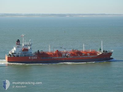
CGAS MAUD
Lpg Tanker

Current Trip
GB PEM FOR ORDER
| Time Travelled | 3 days |
|---|---|
| Remaining Time | --- |
| Distance Travelled | 512.76 nm |
| Remaining Distance | --- |
| AVG Speed | 11.5 Knots |
| MAX Speed | 15.9 Knots |
| AVG Wind | 12.6 knots |
| MAX Wind | 31.4 knots |
| MIN Temp | 11.1°C / 51.98°F |
| MAX Temp | 15.5°C / 59.9°F |
| Draught | 5.2 m |
| Position Received | 11 h, 56 m ago |
Current Position
| Longitude | --- |
|---|---|
| Latitude | --- |
| Status | At anchor |
| Speed | 0.2 Knots |
| Course | 217° |
| Area | Celtic Sea |
| Station | T-AIS |
| Position Received | 11 h, 56 m ago |
Information
The current position of CGAS MAUD is in Celtic Sea with coordinates 51.79563° / -5.17540° as reported on 2025-06-03 01:54 by AIS to our vessel tracker app. The vessel's current speed is 0.2 Knots
The vessel CGAS MAUD (IMO: 9363522, MMSI: 248102000) is a Lpg Tanker that was built in 2006 ( 19 years old ). It's sailing under the flag of [MT] Malta.
In this page you can find informations about the vessels current position, last detected port calls, and current voyage information. If the vessels is not in coverage by AIS you will find the latest position.
The current position of CGAS MAUD is detected by our AIS receivers and we are not responsible for the reliability of the data. The last position was recorded while the vessel was in Coverage by the Ais receivers of our vessel tracking app.
The current draught of CGAS MAUD as reported by AIS is 5.2 meters
Weather
| Temperature | 13°C / 55.4°F |
|---|---|
| Wind Speed | 18 knots |
| Direction | 247° WSW |
| Pressure | 1004.8 hPa |
| Humidity | 82.7 % |
| Cloud Coverage | 94 % |

Featured Company
Last Port Calls
| Port | Arrival | Departure | Time In Port |
|---|---|---|---|
| 2025-05-30 03:42 | 2025-05-31 03:46 | 1 d | |
| 2025-05-26 09:29 | 2025-05-28 09:40 | 2 d | |
| 2025-05-23 10:55 | 2025-05-24 15:00 | 1 d | |
| 2025-05-19 23:21 | 2025-05-21 03:22 | 1 d | |
| 2025-05-14 10:28 | 2025-05-17 12:22 | 3 d | |
| 2025-05-12 06:44 | 2025-05-13 08:09 | 1 d | |
| 2025-05-08 10:24 | 2025-05-09 11:24 | 1 d | |
| 2025-05-03 08:36 | 2025-05-04 16:02 | 1 d | |
| 2025-04-29 07:03 | 2025-04-29 23:18 | 16 h | |
| 2025-04-24 18:57 | 2025-04-25 23:17 | 1 d |
Most Visited Ports (Last year)
| Port | Arrivals | |
|---|---|---|
| 13 | ||
| 6 | ||
| 5 | ||
| 4 | ||
| 4 | ||
| 4 |
Last Trips
| Origin | Departure | Destination | Arrival | Distance | |
|---|---|---|---|---|---|
| 2025-05-28 09:40 | 2025-05-30 03:42 | 519.39 nm | |||
| 2025-05-24 15:00 | 2025-05-26 09:29 | 506.52 nm | |||
| 2025-05-21 03:22 | 2025-05-23 10:55 | 288.46 nm | |||
| 2025-05-17 12:22 | 2025-05-19 23:21 | 321.42 nm | |||
| 2025-05-13 08:09 | 2025-05-14 10:28 | 304.13 nm | |||
| 2025-05-09 11:24 | 2025-05-12 06:44 | 883.88 nm | |||
| 2025-05-04 16:02 | 2025-05-08 10:24 | 879.77 nm | |||
| 2025-04-29 23:18 | 2025-05-03 08:36 | 960.06 nm | |||
| 2025-04-25 23:17 | 2025-04-29 07:03 | 1088.44 nm | |||
| 2025-04-21 07:29 | 2025-04-24 18:57 | 325.36 nm |
Events
| Time | Event | Details | Position / Dest | Info |
|---|---|---|---|---|
| 2025-06-03 02:00 | Status Changed | Default At anchor |
51.79578 / -5.17532
GB PEM FOR ORDER
|
Speed: 0.2 kn Course: 217° |
| 2025-06-03 01:54 | Status Changed | At anchor Default |
51.79563 / -5.17540
GB PEM FOR ORDER
|
Speed: 0.1 kn Course: 208° |
| 2025-06-03 01:54 | OUT of Coverage |
51.79563 / -5.17540
Celtic Sea
|
Speed: 0.2 kn Course: 70° |
|
| 2025-06-03 01:45 | IN Coverage |
51.79563 / -5.17540
Celtic Sea
|
Speed: 0.2 kn Course: 70° |
|
| 2025-06-01 20:51 | STOP Moving | 9.81 nm, North West of PEMBROKE |
51.79481 / -5.17705
GB PEM FOR ORDER
|
Speed: 0.3 kn Course: 191° |
| 2025-06-01 20:40 | Status Changed | Default Under way using engine |
51.79443 / -5.17867
GB PEM FOR ORDER
|
Speed: 5.7 kn Course: 75° |
| 2025-06-01 20:32 | OUT of Coverage |
51.79433 / -5.19573
Celtic Sea
GB PEM FOR ORDER
|
Speed: 5.7 kn Course: 75° |
|
| 2025-06-01 12:56 | Status Changed | Under way using engine Default |
50.44692 / -5.83328
GB PEM FOR ORDER
|
Speed: 11.5 kn Course: 27° |
| 2025-06-01 12:52 | Status Changed | Default Under way using engine |
50.43552 / -5.84050
GB PEM FOR ORDER
|
Speed: 11.5 kn Course: 23° |
| 2025-06-01 12:46 | Status Changed | Under way using engine Default |
50.41713 / -5.85430
GB PEM FOR ORDER
|
Speed: 11.6 kn Course: 24° |