
CEMENT TRADER
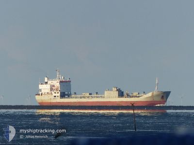
Cement Carrier
Current Trip
| Time Travelled | 18 days |
|---|---|
| Remaining Time | 13 h, 19 mins |
| Distance Travelled | 1652.20 nm |
| Remaining Distance | 402.31 nm |
| AVG Speed | 8.5 Knots |
| MAX Speed | 12.5 Knots |
| AVG Wind | 18.5 knots |
| MAX Wind | 28.3 knots |
| MIN Temp | 5.3°C / 41.54°F |
| MAX Temp | 17.1°C / 62.78°F |
| Draught | 7.2 m |
| Position Received | 5 h, 18 m ago |
Current Position
| Longitude | --- |
|---|---|
| Latitude | --- |
| Status | Under way using engine |
| Speed | 10.6 Knots |
| Course | 227.7° |
| Area | North Atlantic Ocean |
| Station | T-AIS |
| Position Received | 5 h, 18 m ago |
Information
The current position of CEMENT TRADER is in North Atlantic Ocean with coordinates 34.92509° / -13.61341° as reported on 2025-03-28 23:40 by AIS to our vessel tracker app. The vessel's current speed is 10.6 Knots and is heading at the port of FUNCHAL. The estimated time of arrival as calculated by MyShipTracking vessel tracking app is 2025-03-29 18:17 LT
The vessel CEMENT TRADER (IMO: 7716763, MMSI: 304048000) is a Cement Carrier that was built in 1980 ( 45 years old ). It's sailing under the flag of [AG] Antigua Barbuda.
In this page you can find informations about the vessels current position, last detected port calls, and current voyage information. If the vessels is not in coverage by AIS you will find the latest position.
The current position of CEMENT TRADER is detected by our AIS receivers and we are not responsible for the reliability of the data. The last position was recorded while the vessel was in Coverage by the Ais receivers of our vessel tracking app.
The current draught of CEMENT TRADER as reported by AIS is 7.2 meters
Weather
| Temperature | 16.9°C / 62.42°F |
|---|---|
| Wind Speed | 25 knots |
| Direction | 63° ENE |
| Pressure | 1016.5 hPa |
| Humidity | 82.8 % |
| Cloud Coverage | 100 % |
Featured Company
Last Port Calls
| Port | Arrival | Departure | Time In Port |
|---|---|---|---|
| 2025-03-06 07:10 | 2025-03-10 11:21 | 4 d | |
| 2025-02-14 06:05 | 2025-02-16 10:49 | 2 d | |
| 2025-02-14 05:41 | 2025-02-14 05:57 | 15 m | |
| 2025-02-05 20:41 | 2025-02-06 17:16 | 20 h | |
| 2025-02-04 09:09 | 2025-02-05 13:49 | 1 d | |
| 2025-01-28 01:07 | 2025-01-28 01:54 | 47 m | |
| 2025-01-25 22:26 | 2025-01-28 00:31 | 2 d | |
| 2025-01-25 22:06 | 2025-01-25 22:19 | 13 m | |
| 2025-01-17 07:28 | 2025-01-19 07:10 | 1 d | |
| 2025-01-08 22:00 | 2025-01-11 02:12 | 2 d |
Last Trips
| Origin | Departure | Destination | Arrival | Distance | |
|---|---|---|---|---|---|
| 2025-02-16 11:49 | 2025-03-06 07:10 | 2411.55 nm | |||
| 2025-02-14 06:57 | 2025-02-14 07:05 | 1.12 nm | |||
| 2025-02-06 18:16 | 2025-02-14 06:41 | 1389.84 nm | |||
| 2025-02-05 13:49 | 2025-02-05 21:41 | 75.06 nm | |||
| 2025-01-28 02:54 | 2025-02-04 09:09 | 1347.03 nm | |||
| 2025-01-28 01:31 | 2025-01-28 02:07 | 2.26 nm | |||
| 2025-01-25 23:19 | 2025-01-25 23:26 | 1.02 nm | |||
| 2025-01-19 07:10 | 2025-01-25 23:06 | 1319.78 nm | |||
| 2025-01-11 03:12 | 2025-01-17 07:28 | 1347.52 nm | |||
| 2025-01-08 22:37 | 2025-01-08 23:00 | 1.49 nm |
Events
| Time | Event | Details | Position / Dest | Info |
|---|---|---|---|---|
| 2025-03-28 23:42 | Status Changed | Default Under way using engine |
34.92034 / -13.62023
PTFNC
|
Speed: 10.6 kn Course: 227.7° |
| 2025-03-28 23:40 | Detected in Sea | Portuguese (Madeira) part of the North Atlantic Ocean |
34.92509 / -13.61341
North Atlantic Ocean
PTFNC
|
Speed: 10.6 kn Course: 227.7° |
| 2025-03-28 23:40 | Status Changed | Under way using engine Default |
34.92509 / -13.61341
PTFNC
|
Speed: 10.7 kn Course: 230° |
| 2025-03-28 23:40 | OUT of Coverage |
34.92509 / -13.61341
North Atlantic Ocean
PTFNC
|
Speed: 10.6 kn Course: 227.7° |
|
| 2025-03-28 23:27 | IN Coverage |
34.92509 / -13.61341
North Atlantic Ocean
PTFNC
|
Speed: 10.6 kn Course: 227.7° |
|
| 2025-03-28 00:47 | Status Changed | Default Under way using engine |
37.83022 / -9.75055
PTFNC
|
Speed: 11.3 kn Course: 225.1° |
| 2025-03-28 00:43 | OUT of Coverage |
37.84003 / -9.73755
North Atlantic Ocean
PTFNC
|
Speed: 11.3 kn Course: 225.1° |
|
| 2025-03-28 00:38 | Status Changed | Under way using engine Default |
37.85067 / -9.72376
PTFNC
|
Speed: 11.3 kn Course: 227° |
| 2025-03-28 00:35 | Status Changed | Default Under way using engine |
37.85651 / -9.71628
PTFNC
|
Speed: 11.3 kn Course: 224.8° |
| 2025-03-28 00:30 | Status Changed | Under way using engine Default |
37.86865 / -9.70068
PTFNC
|
Speed: 11.2 kn Course: 227° |