
CEMENT FERRY
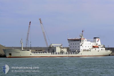
Cement Carrier
Current Trip
| Time Travelled | 19 h, 14 mins |
|---|---|
| Remaining Time | --- |
| Distance Travelled | 137.46 nm |
| Remaining Distance | --- |
| AVG Speed | 7.2 Knots |
| MAX Speed | 7.9 Knots |
| AVG Wind | 4.6 knots |
| MAX Wind | 6.8 knots |
| MIN Temp | 9.3°C / 48.74°F |
| MAX Temp | 15.2°C / 59.36°F |
| Draught | 7.1 m |
| Position Received | 1 m ago |
Current Position
| Longitude | --- |
|---|---|
| Latitude | --- |
| Status | Under way using engine |
| Speed | 6.9 Knots |
| Course | 226.7° |
| Area | Aegean Sea |
| Station | T-AIS |
| Position Received | 1 m ago |
Info
Information
The current position of CEMENT FERRY is in Aegean Sea with coordinates 37.51925° / 24.74772° as reported on 2024-11-27 16:08 by AIS to our vessel tracker app. The vessel's current speed is 6.9 Knots and is heading at the port of RINIA. The estimated time of arrival as calculated by MyShipTracking vessel tracking app is 2024-11-30 13:00 LT
The vessel CEMENT FERRY (IMO: 8404264, MMSI: 305963000) is a Cement Carrier that was built in 1985 ( 39 years old ). It's sailing under the flag of [AG] Antigua Barbuda.
In this page you can find informations about the vessels current position, last detected port calls, and current voyage information. If the vessels is not in coverage by AIS you will find the latest position.
The current position of CEMENT FERRY is detected by our AIS receivers and we are not responsible for the reliability of the data. The last position was recorded while the vessel was in Coverage by the Ais receivers of our vessel tracking app.
The current draught of CEMENT FERRY as reported by AIS is 7.1 meters
Weather
| Temperature | 15.2°C / 59.36°F |
|---|---|
| Wind Speed | 1 knots |
| Direction | 13° NNE |
| Pressure | 1023.6 hPa |
| Humidity | 58.3 % |
| Cloud Coverage | 5 % |
Featured Company
Last Port Calls
| Port | Arrival | Departure | Time In Port |
|---|---|---|---|
| 2024-11-25 04:26 | 2024-11-26 20:56 | 1 d | |
| 2024-11-20 15:20 | |||
| 2024-11-11 06:14 | 2024-11-14 02:13 | 2 d | |
| 2024-11-04 21:55 | 2024-11-07 07:50 | 2 d | |
| 2024-10-29 14:08 | 2024-11-01 08:23 | 2 d | |
| 2024-10-22 07:15 | 2024-10-24 10:43 | 2 d | |
| 2024-10-15 15:02 | 2024-10-18 10:46 | 2 d | |
| 2024-10-08 14:30 | 2024-10-11 20:00 | 3 d | |
| 2024-10-02 08:11 | 2024-10-04 19:58 | 2 d | |
| 2024-09-26 18:41 | 2024-09-29 01:18 | 2 d |
Last Trips
| Origin | Departure | Destination | Arrival | Distance | |
|---|---|---|---|---|---|
| 2024-11-20 16:20 | 2024-11-25 07:26 | 635.66 nm | |||
| 2024-11-07 08:50 | 2024-11-11 09:14 | 634.41 nm | |||
| 2024-11-01 11:23 | 2024-11-04 22:55 | 631.27 nm | |||
| 2024-10-24 12:43 | 2024-10-29 17:08 | 636.28 nm | |||
| 2024-10-18 13:46 | 2024-10-22 09:15 | 642.36 nm | |||
| 2024-10-11 22:00 | 2024-10-15 18:02 | 633.26 nm | |||
| 2024-10-04 22:58 | 2024-10-08 16:30 | 631.47 nm | |||
| 2024-09-29 03:18 | 2024-10-02 11:11 | 632.59 nm | |||
| 2024-09-23 08:22 | 2024-09-26 20:41 | 633.73 nm | |||
| 2024-09-16 21:31 | 2024-09-20 17:59 | 632.63 nm |
Events
| Time | Event | Details | Position / Dest | Info |
|---|---|---|---|---|
| 2024-11-27 13:33 | IN Coverage |
37.73508 / 25.02045
Aegean Sea
ALROM
|
Speed: 6.6 kn Course: 214° |
|
| 2024-11-27 07:41 | Status Changed | Default Under way using engine |
38.31202 / 25.53204
ALROM
|
Speed: 7.2 kn Course: 215.4° |
| 2024-11-27 07:30 | Status Changed | Under way using engine Default |
38.33109 / 25.54980
ALROM
|
Speed: 7.3 kn Course: 215° |
| 2024-11-27 07:30 | OUT of Coverage |
38.33109 / 25.54980
Aegean Sea
ALROM
|
Speed: 7.2 kn Course: 215.4° |
|
| 2024-11-27 07:25 | Status Changed | Default Under way using engine |
38.33831 / 25.55625
ALROM
|
Speed: 7.6 kn Course: 217.6° |
| 2024-11-27 07:10 | Status Changed | Under way using engine Default |
38.36423 / 25.58074
ALROM
|
Speed: 7.6 kn Course: 217° |
| 2024-11-27 07:04 | Status Changed | Default Under way using engine |
38.37434 / 25.59049
ALROM
|
Speed: 7.6 kn Course: 217.7° |
| 2024-11-27 06:53 | Status Changed | Under way using engine Default |
38.39231 / 25.60797
ALROM
|
Speed: 7.6 kn Course: 218° |
| 2024-11-27 06:45 | Status Changed | Default Under way using engine |
38.40538 / 25.62087
ALROM
|
Speed: 7.5 kn Course: 217.9° |
| 2024-11-27 05:34 | Status Changed | Under way using engine Default |
38.52046 / 25.73704
ALROM
|
Speed: 7.3 kn Course: 218° |