
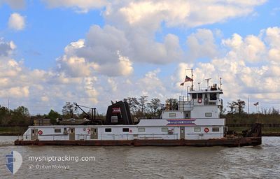
CAPT RICKIE JOHNSON
Spare - Local Vessel
Current Trip
USCEN>USMYG>USCEN
| Time Travelled | 1 day |
|---|---|
| Remaining Time | --- |
| Distance Travelled | 32.37 nm |
| Remaining Distance | --- |
| AVG Speed | 5.2 Knots |
| MAX Speed | 8.3 Knots |
| AVG Wind | 5.6 knots |
| MAX Wind | 10 knots |
| MIN Temp | 23.8°C / 74.84°F |
| MAX Temp | 35.4°C / 95.72°F |
| Draught | 3 m |
| Position Received | 1 d ago |
Current Position
| Longitude | -90.82356° |
|---|---|
| Latitude | 29.98419° |
| Status | Pushing Ahead - Towing |
| Speed | 7.2 Knots |
| Course | 133.9° |
| Area | --- |
| Station | T-AIS |
| Position Received | 1 d ago |
Info
Information
The current position of CAPT RICKIE JOHNSON is in --- with coordinates 29.98419° / -90.82356° as reported on 2024-05-09 06:16 by AIS to our vessel tracker app. The vessel's current speed is 7.2 Knots
The vessel CAPT RICKIE JOHNSON (MMSI: 367057460) is a Spare - Local Vessel It's sailing under the flag of [US] USA.
In this page you can find informations about the vessels current position, last detected port calls, and current voyage information. If the vessels is not in coverage by AIS you will find the latest position.
The current position of CAPT RICKIE JOHNSON is detected by our AIS receivers and we are not responsible for the reliability of the data. The last position was recorded while the vessel was in Coverage by the Ais receivers of our vessel tracking app.
The current draught of CAPT RICKIE JOHNSON as reported by AIS is 3 meters
Weather
| Temperature | 31°C / 87.8°F |
|---|---|
| Wind Speed | 5 knots |
| Direction | 18° NNE |
| Pressure | 1010.1 hPa |
| Humidity | 58.8 % |
| Cloud Coverage | 73 % |
Featured Company
Last Port Calls
| Port | Arrival | Departure | Time In Port |
|---|---|---|---|
| 2024-05-09 10:38 | 2024-05-09 11:26 | 47 m | |
| 2024-05-09 05:46 | 2024-05-09 06:14 | 27 m | |
| 2024-05-07 17:22 | 2024-05-08 16:10 | 22 h | |
| 2024-05-05 22:44 | 2024-05-06 21:22 | 22 h | |
| 2024-05-05 18:34 | 2024-05-05 19:53 | 1 h | |
| 2024-05-05 07:34 | 2024-05-05 16:18 | 8 h | |
| 2024-05-04 21:54 | 2024-05-04 22:18 | 24 m | |
| 2024-05-03 01:53 | 2024-05-04 01:54 | 1 d | |
| 2024-04-29 09:26 | 2024-04-30 17:26 | 1 d | |
| 2024-04-29 01:14 | 2024-04-29 01:50 | 36 m |
Most Visited Ports (Last year)
| Port | Arrivals | |
|---|---|---|
| 190 | ||
| 84 | ||
| 25 | ||
| 7 |
Last Trips
| Origin | Departure | Destination | Arrival | Distance | |
|---|---|---|---|---|---|
| 2024-05-09 01:14 | 2024-05-09 05:38 | 6.60 nm | |||
| 2024-05-08 11:10 | 2024-05-09 00:46 | 32.42 nm | |||
| 2024-05-06 16:22 | 2024-05-07 12:22 | 56.53 nm | |||
| 2024-05-05 14:53 | 2024-05-05 17:44 | 14.08 nm | |||
| 2024-05-05 11:18 | 2024-05-05 13:34 | 9.92 nm | |||
| 2024-05-04 17:18 | 2024-05-05 02:34 | 33.55 nm | |||
| 2024-05-03 20:54 | 2024-05-04 16:54 | 31.65 nm | |||
| 2024-04-30 12:26 | 2024-05-02 20:53 | 67.44 nm | |||
| 2024-04-28 20:50 | 2024-04-29 04:26 | 42.89 nm | |||
| 2024-04-26 21:02 | 2024-04-28 20:14 | 121.89 nm |
Events
| Time | Event | Details | Position / Dest | Info |
|---|---|---|---|---|
| 2024-05-10 15:30 | STOP Moving | 2.51 nm, South East of CONVENT |
29.99952 / -90.78909
USCEN>USMYG>USCEN
|
Speed: Course: 44° |
| 2024-05-10 13:18 | START Moving | 0.98 nm, South of BURNSIDE |
30.11581 / -90.91486
USCEN>USMYG>USCEN
|
Speed: 5 kn Course: 173° |
| 2024-05-10 08:39 | STOP Moving | 0.7 nm, South East of BURNSIDE |
30.12113 / -90.91434
USCEN>USMYG>USCEN
|
Speed: 0.2 kn Course: 173° |
| 2024-05-10 06:54 | START Moving | 2.8 nm, South West of BURNSIDE |
30.11178 / -90.97014
USCEN>USMYG>USCEN
|
Speed: 3.1 kn Course: 110° |
| 2024-05-09 22:27 | STOP Moving | 2.94 nm, West of BURNSIDE |
30.11425 / -90.97414
USCEN>USMYG>USCEN
|
Speed: Course: 289° |
| 2024-05-09 22:02 | START Moving | 3.34 nm, West of BURNSIDE |
30.11260 / -90.98158
USCEN>USMYG>USCEN
|
Speed: 3.9 kn Course: 270° |
| 2024-05-09 15:50 | STOP Moving | 3.64 nm, West of BURNSIDE |
30.11639 / -90.98890
USCEN>USMYG>USCEN
|
Speed: 0.1 kn Course: 285° |
| 2024-05-09 15:31 | START Moving | 3.46 nm, West of BURNSIDE |
30.11351 / -90.98440
USCEN>USMYG>USCEN
|
Speed: 4 kn Course: 278° |
| 2024-05-09 15:22 | STOP Moving | 3.29 nm, West of BURNSIDE |
30.11481 / -90.98144
USCEN>USMYG>USCEN
|
Speed: 0.1 kn Course: 281° |
| 2024-05-09 14:11 | START Moving | 1.81 nm, South of BURNSIDE |
30.10136 / -90.91492
USCEN>USMYG>USCEN
|
Speed: 6.1 kn Course: 349° |