
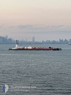
CAPE HENRY
Spare - Local Vessel
Current Trip
| Trip Time | 1 h, 18 mins |
|---|---|
| Trip Distance | 8.90 nm |
| AVG Speed | 8.1 Knots |
| MAX Speed | 10.7 Knots |
| Draught | 5 m |
| AVG Wind | 5.6 knots |
| MAX Wind | 6 knots |
| MIN Temp | 4.9°C / 40.82°F |
| MAX Temp | 5.9°C / 42.62°F |
| Position Received | Now |
Current Position
| Longitude | --- |
|---|---|
| Latitude | --- |
| Status | Pushing Ahead - Towing |
| Speed | |
| Course | 347° |
| Area | North Atlantic Ocean |
| Station | T-AIS |
| Position Received | Now |
Info
Information
The current position of CAPE HENRY is in North Atlantic Ocean with coordinates 40.54081° / -74.25342° as reported on 2025-02-27 15:46 by AIS to our vessel tracker app. The vessel's current speed is 0 Knots and is currently inside the port of PERTH AMBOY.
The vessel CAPE HENRY (IMO: 9865439, MMSI: 366876000) is a Spare - Local Vessel It's sailing under the flag of [US] USA.
In this page you can find informations about the vessels current position, last detected port calls, and current voyage information. If the vessels is not in coverage by AIS you will find the latest position.
The current position of CAPE HENRY is detected by our AIS receivers and we are not responsible for the reliability of the data. The last position was recorded while the vessel was in Coverage by the Ais receivers of our vessel tracking app.
The current draught of CAPE HENRY as reported by AIS is 5 meters
Weather
| Temperature | 8.3°C / 46.94°F |
|---|---|
| Wind Speed | 5 knots |
| Direction | 239° WSW |
| Pressure | 1006.5 hPa |
| Humidity | 80.5 % |
| Cloud Coverage | 100 % |
Featured Company
Last Port Calls
| Port | Arrival | Departure | Time In Port |
|---|---|---|---|
| 2025-02-27 07:08 | |||
| 2025-02-23 23:29 | 2025-02-27 05:50 | 3 d | |
| 2025-02-22 17:19 | 2025-02-23 17:10 | 23 h | |
| 2025-02-20 20:10 | 2025-02-22 03:32 | 1 d | |
| 2025-02-19 10:36 | 2025-02-20 00:24 | 13 h | |
| 2025-02-16 07:23 | 2025-02-17 01:01 | 17 h | |
| 2025-02-15 08:51 | 2025-02-15 10:57 | 2 h | |
| 2025-02-15 05:40 | 2025-02-15 06:58 | 1 h | |
| 2025-02-15 04:27 | 2025-02-15 04:42 | 14 m | |
| 2025-02-14 12:57 | 2025-02-15 03:14 | 14 h |
Most Visited Ports (Last year)
| Port | Arrivals | |
|---|---|---|
| 87 | ||
| 30 | ||
| 30 | ||
| 18 | ||
| 2 | ||
| 2 |
Last Trips
| Origin | Departure | Destination | Arrival | Distance | |
|---|---|---|---|---|---|
| 2025-02-27 00:50 | 2025-02-27 02:08 | 8.90 nm | |||
| 2025-02-23 12:10 | 2025-02-23 18:29 | 59.95 nm | |||
| 2025-02-21 22:32 | 2025-02-22 12:19 | 62.94 nm | |||
| 2025-02-19 19:24 | 2025-02-20 15:10 | 152.24 nm | |||
| 2025-02-16 20:01 | 2025-02-19 05:36 | 109.04 nm | |||
| 2025-02-15 05:57 | 2025-02-16 02:23 | 63.18 nm | |||
| 2025-02-15 01:58 | 2025-02-15 03:51 | 13.91 nm | |||
| 2025-02-14 23:42 | 2025-02-15 00:40 | 0.37 nm | |||
| 2025-02-14 22:14 | 2025-02-14 23:27 | 8.09 nm | |||
| 2025-02-14 07:11 | 2025-02-14 07:57 | 8.55 nm |
Events
| Time | Event | Details | Position / Dest | Info |
|---|---|---|---|---|
| 2025-02-27 07:08 | PORT ARRIVAL |
|
40.54054 / -74.25327
[US] PERTH AMBOY
|
Speed: 0.7 kn Course: 6° |
| 2025-02-27 06:54 | STOP Moving | 0.11 nm, North of PERTH AMBOY |
40.53685 / -74.25133
US NYC
|
Speed: 0.3 kn Course: 163° |
| 2025-02-27 05:50 | PORT DEPARTURE |
|
40.64686 / -74.17623
US NYC
|
Speed: 10.1 kn Course: 265° |
| 2025-02-27 05:14 | START Moving |
40.70393 / -74.11800
[US] NEW YORK
|
Speed: 3.3 kn Course: 174° |
|
| 2025-02-27 04:34 | Status Changed | Pushing Ahead - Towing Moored |
40.70657 / -74.12055
[US] NEW YORK
|
Speed: Course: 341° |
| 2025-02-27 01:51 | ETA Changed | 2025/02/27 12:00 2025/02/24 01:00 |
40.70654 / -74.12057
[US] NEW YORK
|
Speed: Course: 341° |
| 2025-02-27 01:33 | Status Changed | Moored Under way using engine |
40.70652 / -74.12056
[US] NEW YORK
|
Speed: Course: 341° |
| 2025-02-26 22:39 | STOP Moving |
40.70540 / -74.11939
[US] NEW YORK
|
Speed: 0.3 kn Course: 211° |
|
| 2025-02-26 22:06 | START Moving |
40.64148 / -74.16210
[US] NEW YORK
|
Speed: 5.5 kn Course: 120° |
|
| 2025-02-26 21:49 | Status Changed | Under way using engine Moored |
40.64106 / -74.16469
[US] NEW YORK
|
Speed: Course: 186° |