
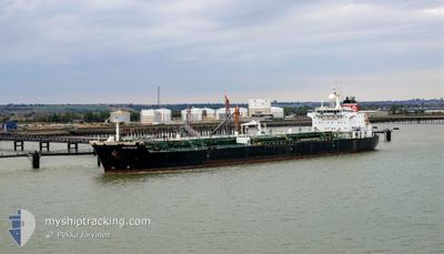
CAN KA
Oil Products Tanker
Current Trip
| Trip Time | 10 h, 22 mins |
|---|---|
| Trip Distance | 95.76 nm |
| AVG Speed | 9.1 Knots |
| MAX Speed | 14.5 Knots |
| Draught | 7 m |
| AVG Wind | 6.9 knots |
| MAX Wind | 14.3 knots |
| MIN Temp | 11.3°C / 52.34°F |
| MAX Temp | 15°C / 59°F |
| Position Received | 1 d ago |
Current Position
| Longitude | --- |
|---|---|
| Latitude | --- |
| Status | Moored |
| Speed | |
| Course | 32° |
| Area | Sea of Marmara |
| Station | T-AIS |
| Position Received | 1 d ago |
Information
The current position of CAN KA is in Sea of Marmara with coordinates 40.98035° / 27.97820° as reported on 2025-03-24 23:21 by AIS to our vessel tracker app. The vessel's current speed is 0 Knots and is currently inside the port of EREGLI.
The vessel CAN KA (IMO: 9312925, MMSI: 271049994) is a Oil Products Tanker that was built in 2006 ( 19 years old ). It's sailing under the flag of [TR] Turkey.
In this page you can find informations about the vessels current position, last detected port calls, and current voyage information. If the vessels is not in coverage by AIS you will find the latest position.
The current position of CAN KA is detected by our AIS receivers and we are not responsible for the reliability of the data. The last position was recorded while the vessel was in Coverage by the Ais receivers of our vessel tracking app.
The current draught of CAN KA as reported by AIS is 7 meters
Weather
| Temperature | 12.3°C / 54.14°F |
|---|---|
| Wind Speed | 6 knots |
| Direction | 259° W |
| Pressure | 1022.6 hPa |
| Humidity | 67.1 % |
| Cloud Coverage | 100 % |
Featured Company
Last Port Calls
| Port | Arrival | Departure | Time In Port |
|---|---|---|---|
| 2025-03-24 14:10 | |||
| 2025-03-22 06:45 | 2025-03-24 03:48 | 1 d | |
| 2025-03-14 06:20 | 2025-03-20 16:55 | 6 d | |
| 2025-03-12 05:25 | 2025-03-13 18:16 | 1 d | |
| 2025-03-05 21:15 | 2025-03-10 18:00 | 4 d | |
| 2025-02-27 10:41 | 2025-03-03 04:05 | 3 d | |
| 2025-02-07 19:19 | 2025-02-10 02:02 | 2 d | |
| 2025-02-02 06:22 | 2025-02-03 14:00 | 1 d | |
| 2025-01-29 05:21 | 2025-02-02 04:34 | 3 d | |
| 2025-01-24 12:44 | 2025-01-28 10:18 | 3 d |
Most Visited Ports (Last year)
| Port | Arrivals | |
|---|---|---|
| 15 | ||
| 13 | ||
| 8 | ||
| 7 | ||
| 4 | ||
| 4 |
Last Trips
| Origin | Departure | Destination | Arrival | Distance | |
|---|---|---|---|---|---|
| 2025-03-24 06:48 | 2025-03-24 17:10 | 95.76 nm | |||
| 2025-03-20 19:55 | 2025-03-22 09:45 | 21.65 nm | |||
| 2025-03-13 21:16 | 2025-03-14 09:20 | 16.06 nm | |||
| 2025-03-10 21:00 | 2025-03-12 08:25 | 97.22 nm | |||
| 2025-03-03 08:05 | 2025-03-06 00:15 | 661.61 nm | |||
| 2025-02-10 05:02 | 2025-02-27 14:41 | 2509.93 nm | |||
| 2025-02-03 17:00 | 2025-02-07 22:19 | 119.82 nm | |||
| 2025-02-02 07:34 | 2025-02-02 09:22 | 16.62 nm | |||
| 2025-01-28 13:18 | 2025-01-29 08:21 | 96.83 nm | |||
| 2025-01-12 21:24 | 2025-01-24 15:44 | 196.68 nm |
Events
| Time | Event | Details | Position / Dest | Info |
|---|---|---|---|---|
| 2025-03-24 23:45 | Status Changed | Default Moored |
40.98037 / 27.97822
[TR] EREGLI
|
Speed: Course: 32° |
| 2025-03-24 23:21 | Status Changed | Moored Default |
40.98035 / 27.97820
[TR] EREGLI
|
Speed: Course: 32° |
| 2025-03-24 23:21 | IN Coverage |
40.98035 / 27.97820
Sea of Marmara
[TR] EREGLI
|
Speed: Course: 97.2° |
|
| 2025-03-24 23:21 | OUT of Coverage |
40.98035 / 27.97820
Sea of Marmara
[TR] EREGLI
|
Speed: Course: 97.2° |
|
| 2025-03-24 14:45 | Status Changed | Default Under way using engine |
40.98038 / 27.97821
[TR] EREGLI
|
Speed: Course: 31° |
| 2025-03-24 14:44 | OUT of Coverage |
40.98038 / 27.97820
Sea of Marmara
[TR] EREGLI
|
Speed: Course: 97.2° |
|
| 2025-03-24 14:24 | STOP Moving |
40.98033 / 27.97806
[TR] EREGLI
|
Speed: 0.2 kn Course: 31° |
|
| 2025-03-24 14:10 | PORT ARRIVAL |
|
40.97527 / 27.97460
[TR] EREGLI
|
Speed: 2.3 kn Course: 16° |
| 2025-03-24 13:45 | START Moving | 1.96 nm, South East of EREGLI |
40.95459 / 28.00241
TRMAR
|
Speed: 3.9 kn Course: 300° |
| 2025-03-24 13:35 | STOP Moving | 2.05 nm, South East of EREGLI |
40.95439 / 28.00606
TRMAR
|
Speed: 0.3 kn Course: 265° |